 geo.be Metadata Catalog
2026
Type of resources
Available actions
Topics
INSPIRE themes
federalThemes
Keywords
Contact for the resource
Provided by
Years
Formats
Representation types
Update frequencies
status
Service types
Scale
Resolution
-
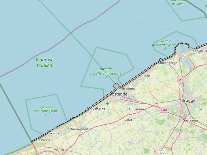
The Royal Decree of 20 March 2026 establishing the marine spatial plan for the period 2026 to 2034 in the Belgian marine areas defines 1 coastal protection experiments zone: Coastal protection belt (Art. 20§2). It replaces the 2020 Marine Spatial Plan. Please refer to the Belgian official gazette ("Moniteur belgeBelgisch Staatsblad") for official reference information.
-
The Royal Decree of 20 March 2026 establishing the marine spatial plan for the period 2026 to 2034 in the Belgian marine areas defines 13 dredging zones: Dredge spoil disposal zone S1 (Art. 15§1.1°), Dredge spoil disposal zone S2 (Art. 15§1.2°), Dredge spoil disposal zone "Public Works Ostend" (Art. 15§1.3°), Dredge spoil disposal zone "Public Works Zeebrugge East" (Art. 15§1.4°), Dredge spoil disposal zone "Public Works Zeebrugge West" (Art. 15§1.5°), Dredge spoil disposal site "Public Works Nieuwpoort" (Art. 15§1.6°), Dredge spoil disposal zone "Zeebrugge Erosion Pit" (Art. 15§1.7°), Zone 1 for future replacement of dredge spoil zone S1 (Art. 15§4.1°), Zone 2 for future replacement of dredge spoil zone S1 (Art. 15§4.2°), Search zone 1 for future replacement of Zeebrugge East and West (Art. 15§6), Search zone 2 for future replacement of Zeebrugge East and West (Art. 15§6), Search zone 3 for future replacement of Zeebrugge East and West (Art. 15§6), Dredge spoil disposal zone for future replacement "Public Works Nieuwpoort" (Art. 15§8). It replaces the 2020 Marine Spatial Plan. Please refer to the Belgian official gazette ("Moniteur belgeBelgisch Staatsblad") for official reference information.
-
The Royal Decree of 20 March 2026 establishing the marine spatial plan for the period 2026 to 2034 in the Belgian marine areas defines 5 fishery management zones: Zone with prohibition of active bottom-disturbing commercial fishing (Art. 10§2), Zone with prohibition of bottom-disturbing commercial fishing (Art. 10§2), Fisheries research zone (Art. 17§2), Zone accessible to aquaculture and passive fisheries (Art. 18), Zone with prohibition of bottom-disturbing recreational fishing (Art. 24§2). It replaces the 2020 Marine Spatial Plan. Please refer to the Belgian official gazette ("Moniteur belgeBelgisch Staatsblad") for official reference information.
-
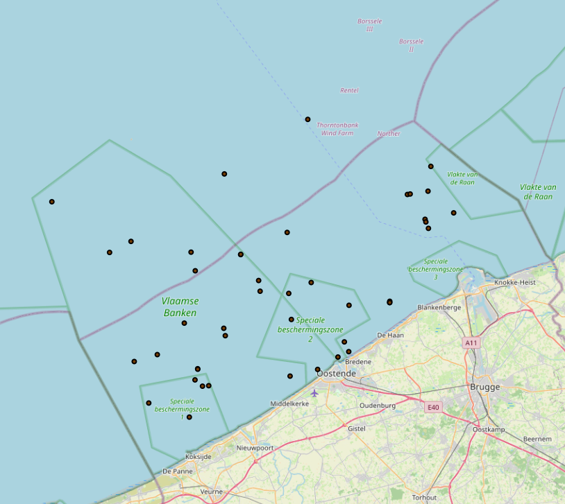
The Royal Decree of 20 March 2026 establishing the marine spatial plan for the period 2026 to 2034 in the Belgian marine areas defines 1 cultural heritage (wrecks) zones: Protected shipwrecks (Art. 26§1). It replaces the 2020 Marine Spatial Plan. Please refer to the Belgian official gazette ("Moniteur belgeBelgisch Staatsblad") for official reference information.
-
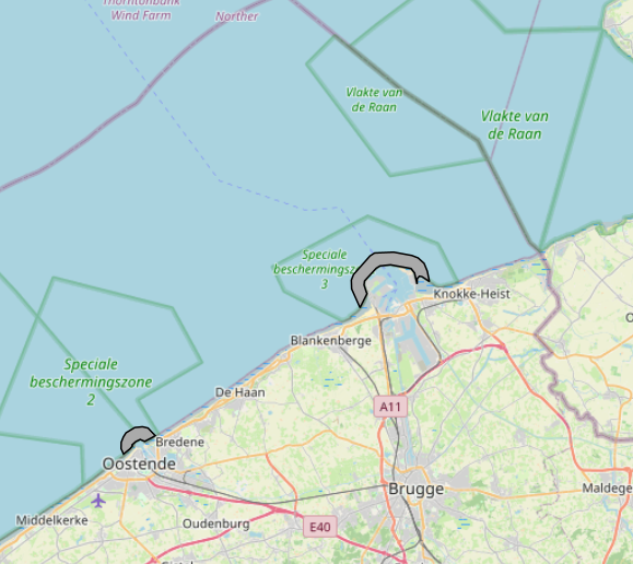
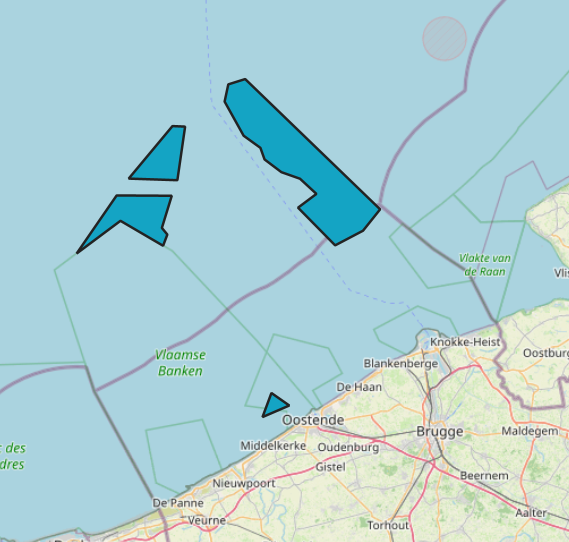
The Royal Decree of 20 March 2026 establishing the marine spatial plan for the period 2026 to 2034 in the Belgian marine areas defines 2 potential seaport expansion zones: Potential expansion of the Port of Ostend (Art. 16§2), Potential expansion of the Port of Zeebrugge (Art. 16§3). It replaces the 2020 Marine Spatial Plan. Please refer to the Belgian official gazette ("Moniteur belgeBelgisch Staatsblad") for official reference information.
-
The Royal Decree of 20 March 2026 establishing the marine spatial plan for the period 2026 to 2034 in the Belgian marine areas defines 8 scientific research and recreation zones: Thorntonbank monitoring area (Art. 23§10.1°), Gootebank monitoring area (Art. 23§10.2°), Scientific research zone (Art. 23§3), Search area for scientific research reserve (Art. 23§6), Zone with prohibition of additional fixed structures (Art. 23§7.4°), Zone accessible for scientific research 1 (Art. 23§8.1°), Zone accessible for scientific research 2 (Art. 23§8.1°), Reference area for calibration and quality assessment of measuring instruments (Art. 23§9). It replaces the 2020 Marine Spatial Plan. Please refer to the Belgian official gazette ("Moniteur belgeBelgisch Staatsblad") for official reference information.
-
UNDER EMBARGO - This dataset contains the data on porewater nutrients, sediment granulometry, and pigment concentrations that were collected in the C-power offshore wind farm in spring, summer, and autumn of 2022 for the OUTFLOW project. Data were gathered at increasing distances from the scour protection layer (SPL) of a wind turbine, 7, 15, 25, and 75 m away from the edge. Cores were collected by divers, and a boxcore was used for samples 75 m away. From these cores, porewater nutrients were collected with rhizon samplers, and cores were slices in 0.5 to 2 cm slices, and each slice was analyzed for total organic carbon, total nitrogen, granulometry, and algal pigment concentrations.
-
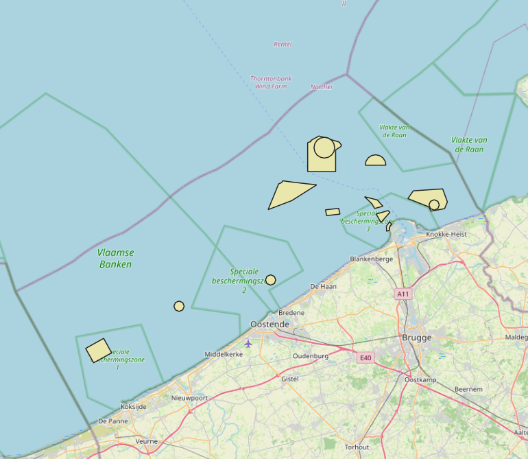
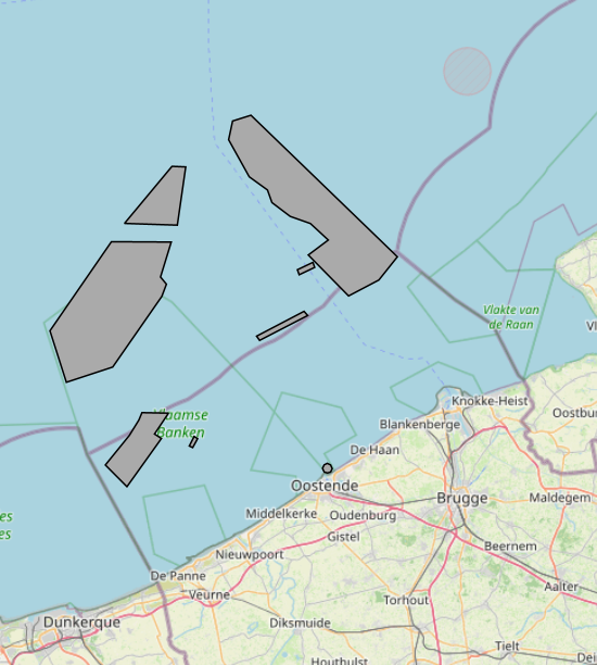
The Royal Decree of 20 March 2026 establishing the marine spatial plan for the period 2026 to 2034 in the Belgian marine areas defines 7 energy, cable and pipeline zones: Renewable energy zone: Zone 1, Eastern Zone (Art. 12§1), Princess Elisabeth renewable energy zone: Zone 2a, Noordhinder North (Art. 12§2.2a°), Princess Elisabeth renewable energy zone: Zone 2b, Noordhinder South (Art. 12§2.2b°), Princess Elisabeth renewable energy zone: Zone 2c, Fairybank (Art. 12§2.3°), Modular offshore grid for electricity transmission (Art. 12§4), Safeguard zone of the Eastern Zone (Art. 12§5), Pipeline and cable corridor (Art. 13§1). It replaces the 2020 Marine Spatial Plan. Please refer to the Belgian official gazette ("Moniteur belgeBelgisch Staatsblad") for official reference information.
-
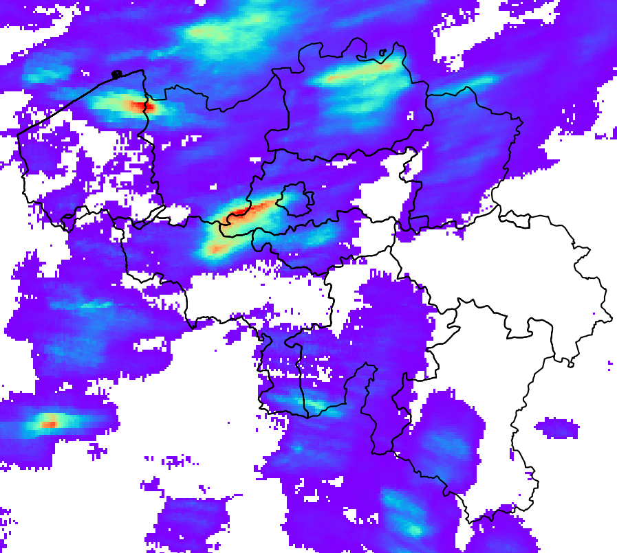
RADQPE provides high resolution radar-based quantitative precipitation estimation in realtime for Belgium and its surroundings. This product is not publically available yet.
-
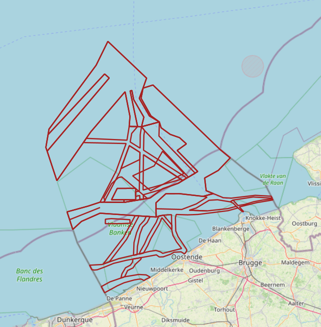
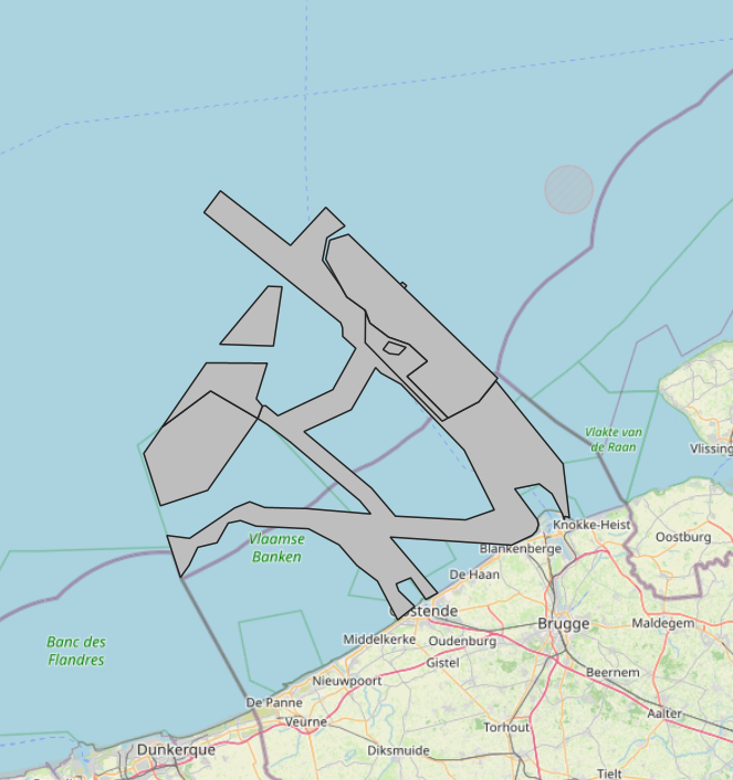
The Royal Decree of 20 March 2026 establishing the marine spatial plan for the period 2026 to 2034 in the Belgian marine areas defines 20 shipping and ports zones: IMO shipping zones (Art. 14§2), Traffic separation schemes (Art. 14§2), IMO traffic separation scheme "Noordhinder South" (Art. 14§2.1°), IMO precautionary area "in the vicinity of Thornton and Blighbank" (Art. 14§2.10°), Other routes and traffic flows (Royal Decree) (Art. 14§2.11°-19°), IMO traffic separation scheme "Off Noordhinder" (Art. 14§2.2°), IMO precautionary area "Noordhinder Junction" (Art. 14§2.3°), IMO traffic separation scheme "At Westhinder" (Art. 14§2.4°), Separation line "At West Hinder" (Art. 14§2.4°), IMO precautionary area "At Westhinder" (Art. 14§2.5°), IMO area to be avoided "At Westhinder" (Art. 14§2.6°), IMO deep-water route "Approach to the Scheldt" (Art. 14§2.7°), IMO two-way route "Westpit" (Art. 14§2.8°), IMO precautionary area "At Gootebank" (Art. 14§2.9°), Anchorage area "Oostdyck" (Art. 14§3.1°), IMO anchorage area "At Westhinder" (Art. 14§3.2°), Maritime safety research zone: Zone 1 (Art. 14§5.1°), Maritime safety research zone: Zone 2 (Art. 14§5.2°), Maritime safety research zone: Zone 3 (Art. 14§5.3°). It replaces the 2020 Marine Spatial Plan. Please refer to the Belgian official gazette ("Moniteur belgeBelgisch Staatsblad") for official reference information.