 geo.be Metadata Catalog
continual
Type of resources
Available actions
Topics
INSPIRE themes
federalThemes
Keywords
Contact for the resource
Provided by
Years
Formats
Representation types
Update frequencies
status
Service types
Scale
Resolution
-

The ceilometer CL51 employs a pulsed diode laser LIDAR technology, where short, powerful laser pulses are sent out in a vertical or near-vertical direction. The reflection of light (backscatter) caused by clouds, precipitation or other obscuration is analysed and used to determine the cloud base height, the cloud layer height and the amount of clouds (in octas) in different layers.
-
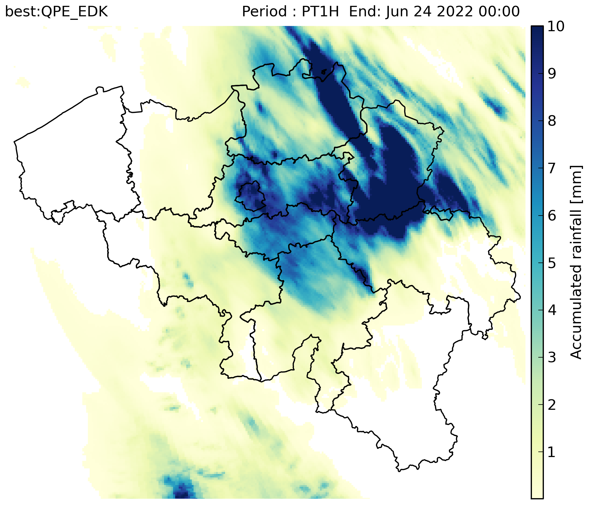
RADCLIM is a historical dataset based on weather radar observations that provides gridded accumulated precipitation composites over Belgium and surrounding regions. The data are distributed in ODIM_H5 version 2.2 format. The reported quantity is accumulated precipitation (ACRR) for 5-minute and 1-hour accumulation periods. UTC is used as the time reference, and the timestamp in the filename corresponds to the end of the accumulation period. The dataset is produced on a 700 × 700 grid with 1 km spatial resolution in the Belgian Lambert 2008 projection (Lambert Conformal Conic).
-
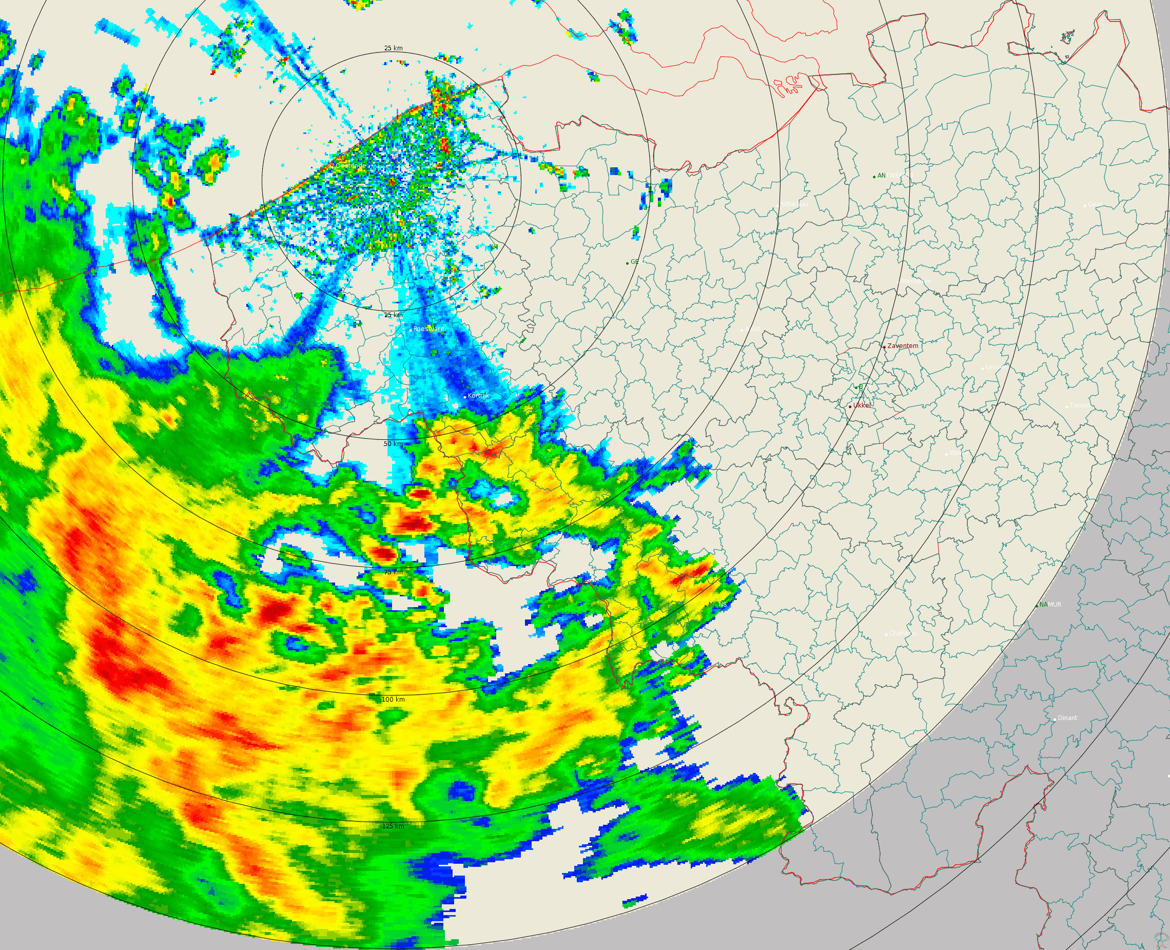
Polar volume reflectivity data from the Jabbeke weather radar. Volume data files are produced every 5 minutes from a multiple elevation scan. This product is not publicly available yet.
-
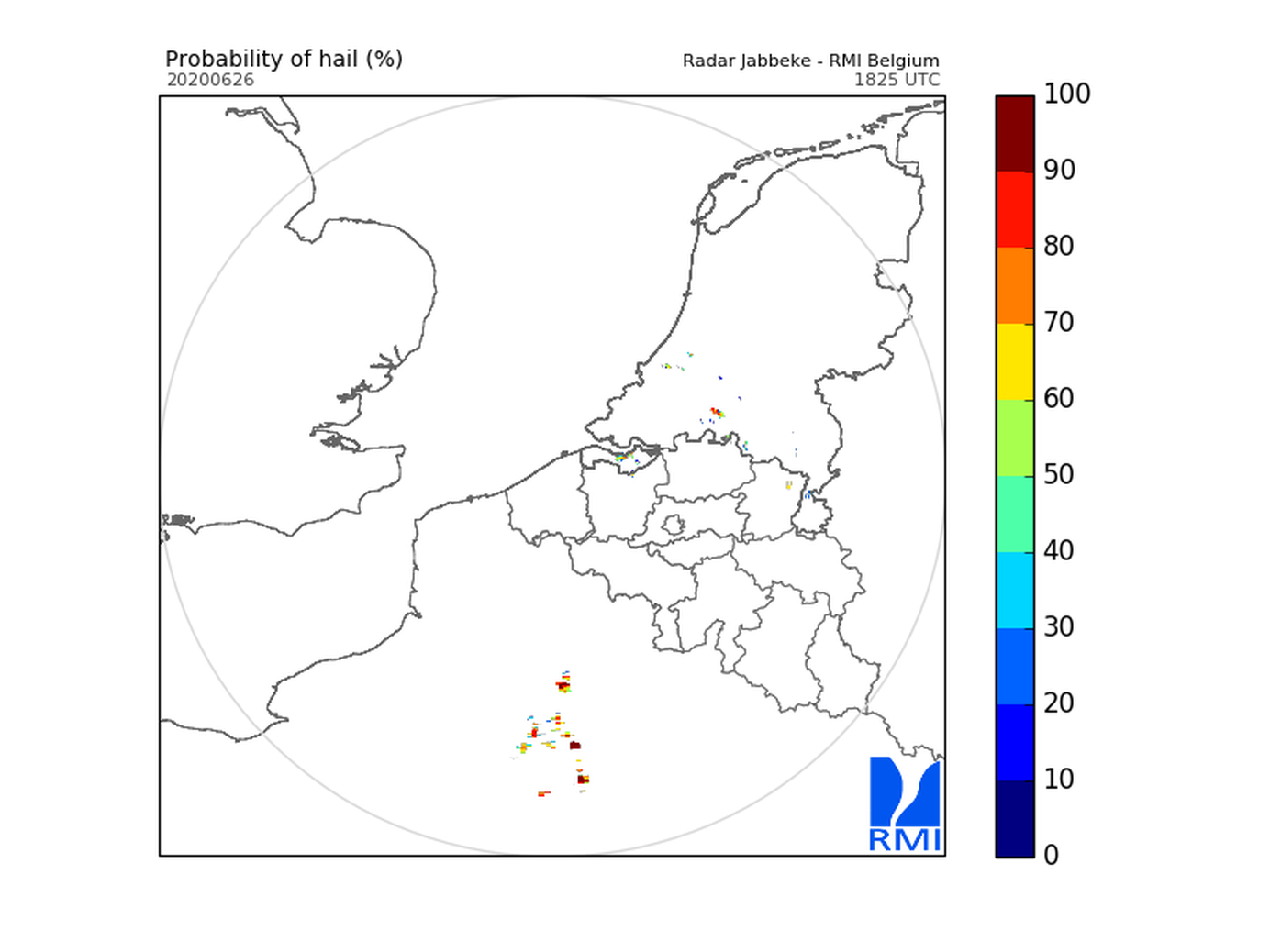
Hail products are derived from the observed vertical profiles of radar reflectivity and the NWP vertical profiles of temperature. Three types of products are generated. poh : probability of hail of any size (larger than 0.5 cm diameter)expressed in %. posh : probability of severe hail(larger than 2cm)expressed in %. mesh : maximum expected size of hailexpressed in mm of hailstone diameter. All products are generated every 5 minutes. This product is not publically available yet.
-
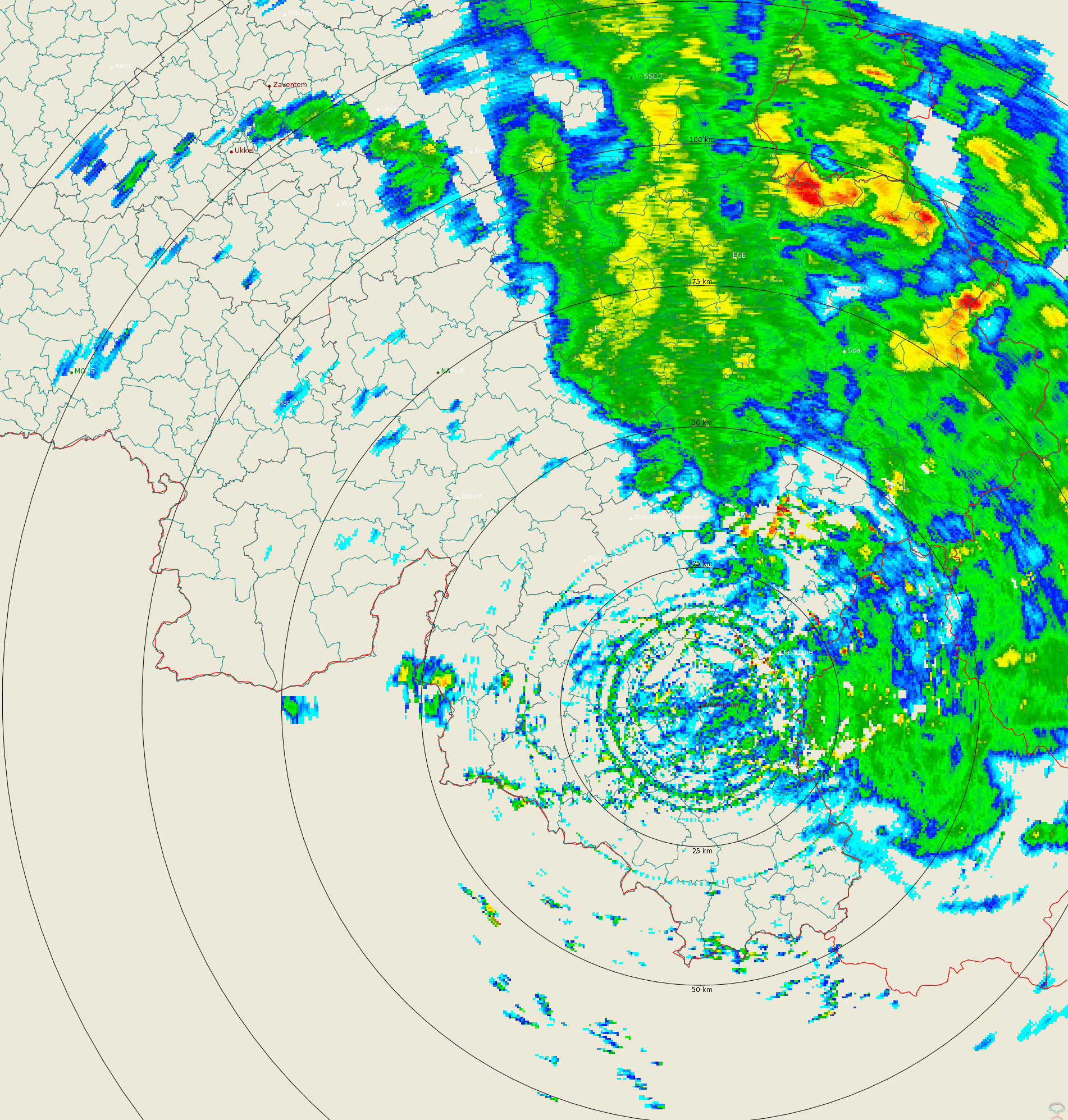
Polar volume reflectivity data from the Wideumont weather radar. Volume data files are produced every 5 minutes from a multiple elevation scan. This product is not publicly available yet.
-

Hail products are derived from the observed vertical profiles of radar reflectivity and the NWP vertical profiles of temperature. Three types of products are generated. poh : probability of hail of any size (larger than 0.5 cm diameter)expressed in %. posh : probability of severe hail(larger than 2cm)expressed in %. mesh : maximum expected size of hailexpressed in mm of hailstone diameter. All products are generated every 5 minutes. This product is not publically available yet.
-
The composite is produced every 5 minutes using the reflectivity data from the Wideumont and Jabbeke weather radars. This product is not publicly available yet.
-
Weather Model 'Alaro' A numerical forecast model is a computer program that simulates the evolution of the atmosphere. Available parameters : Temperature, Max. temperature, Min. temperature, Dewpoint temperature, Wet-bulb potential temperature, Cloud cover (low, medium, high, tot.), U and V wind component, U, V and vertical velocity, Stationary boundary layer (SBL) Gust, Total precipitation, Large scale rain, Convective rain, Large scale snow, Convective snow, Relative Humidity, Specific humidity, Geopotential, Mean sea level pressure, Orography, freezing level / 0°C isotherm, Convective available potential energy (CAPE)
-
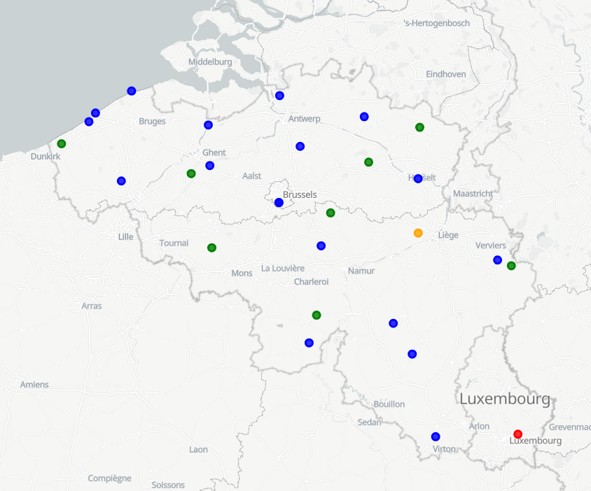
RMI operates a network of 17 automatic weather stations in Belgium. These weather stations report meteorological paramaters such as air pressure, temperature, relative humidity, precipitation (quantity,duration), wind (speed, gust, direction), sunshine duration, shortwave solar radiation and infrared radiation every 10 minutes.
-

This web service provides a display of the Administrative Units - INSPIRE datase This webservice complies with the INSPIRE specifications.