 geo.be Metadata Catalog
Type of resources
Available actions
Topics
INSPIRE themes
federalThemes
Keywords
Contact for the resource
Provided by
Years
Formats
Representation types
Update frequencies
status
Resolution
-
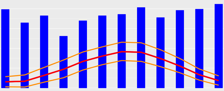
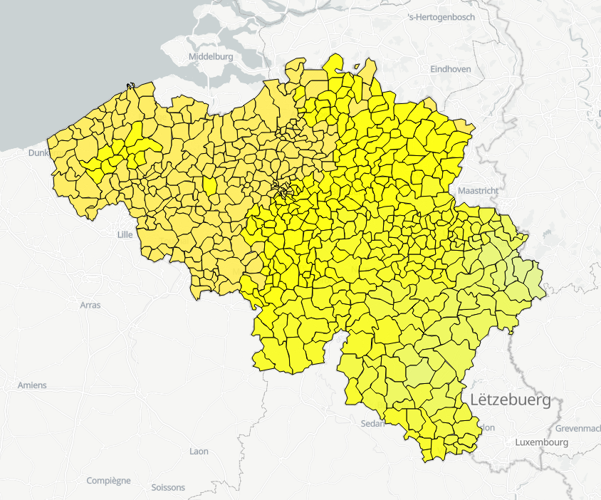
A climate normal is an average over a 30-years period. The period 1981-2010 is the current reference period recommended by the World Meteorological Organization (WMO). Recent climate normals are available for any locations in Belgium and several parameters including air temperature, precipitations and solar radiation. Climate normals for the reference period 1981-2010 are available for air temperature, precipitation and derived parameters (e.g., annual number of summer days, annual number of precipitation days, etc.). For solar radiation, the reference period had to be adjusted to 1984-2013 because of data availability. These climate normals are available as maps and as table for each Belgian municipality.
-
Whole of marks whose height with respect to the zero mark of the second general leveling is known.
-
Network of marks whose planimetric coordinates are known with precision according to the reference systems which are used in Belgium.
-

Geodetic markers of which the 3D coordinates are precisely known in common Belgian reference systems.
-
Hourly forecasts for each belgian commune, from current hour up to the next 5 days. This product is not publically available.
-

The data consists in tables of estimated extreme precipitation quantities for precipitation durations ranging from 10 minutes to 30 days and return periods ranging from 2 to 200 years for each Belgian municipality.