 geo.be Metadata Catalog
National Geographic Institute
Type of resources
Available actions
Topics
INSPIRE themes
federalThemes
Keywords
Contact for the resource
Provided by
Years
Formats
Representation types
Update frequencies
status
Service types
Scale
Resolution
-
The national wastewater-based epidemiological surveillance of SARS-CoV-2 monitors the SARS-CoV-2 presence in several wastewater treatment plants across Belgium. This download service contains the results per treatment plant since the beginning of the surveillance in September 2020. The results consist in the SARS-CoV2 concentrations over time as well as other data needed for the interpretations such as the flow rates of the treatment plants and their covering populations.
-
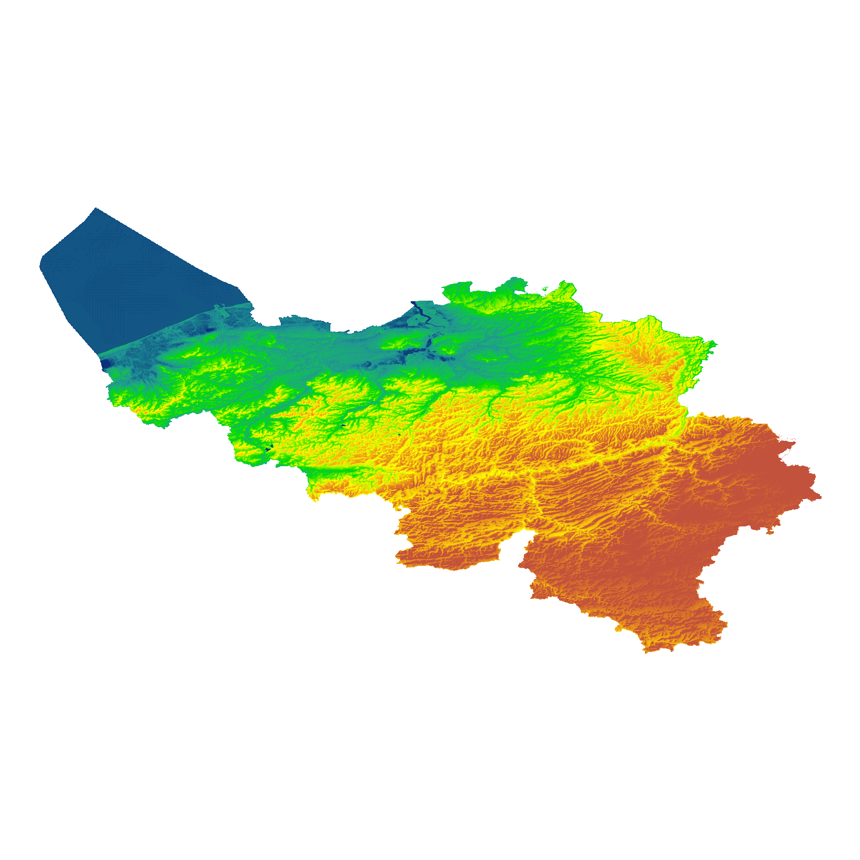
The eTOD digital terrain model (DTM) is a homogeneous and regular point grid indicating the elevation of the ground level in order to make a model of its surface. This DTM is obtained by resampling raw altimetric source data from the Flemish and Walloon Regions, grouped in Lambert 72 and with a resolution of 1 m; as well as data obtained internally by direct photogrammetric recording of structure points and lines based on the most recent aerial photographs for all areas not covered by regional data. For this DTM, the resolution and coordinate reference system are used as defined by the eTOD specifications.
-

This AtomFeed download service provides access to federal datasets that are reported under the INSPIRE Directive. The datasets can be accessible for free or under conditions.
-

Landuse-Particular Zone is the INSPIRE 2D vector data set of the "Particular zones" layer originated from the Top10vector product of the National Geographic Institute in Belgium . It includes the "ExistingLandUseDataSet" features and the "ExistingLandUseObject" features in accordance with the INSPIRE specifications.
-

Top10Vector – Rail network is the data set of the railway network in Belgium. This data set includes three classes. First class: rail network kilometre markers. Second class: railway stop. Third class: railway track segments. This data set can be bought via the corresponding hyperlink.
-

Buildings is the INSPIRE 2D vector data set of the "Constructions" layer originated from the Top10vector product of the National Geographic Institute in Belgium . It includes the "Building" features and the "OtherConstruction" features in accordance with the INSPIRE specifications.
-

Geodetic markers of which the 3D coordinates are precisely known in common Belgian reference systems.
-

Electricity network is the INSPIRE vector data set originated from the High-Tension network of the product TOP10Vector of the National Geographic Institute in Belgium. The Electricity network is regularly updated with the ELIA Group data sources. It includes the "ElectricityCable" features and the "Pole" features in accordance with the INSPIRE specifications.
-

This dataset corresponds to the dataset of address points on the Belgian territory. The result is obtained by merging the three regions on the basis of XML files which has been supplied to BOSA for the cooperation agreement BeStAddress. The dataset is freely downloadable.
-

Under the territorial divisions are grouped different datasets that represent fully recognised Belgian geographical units. The AdminVector dataset encompasses the statistical sectors defined by the FPS Economy, the administrative units maintained by the FPS Finance and their centres, as well as the boundary stones. The datasets of the judicial cantons and judicial districts are built on the basis of their definition in the Judicial Code. The dataset of electoral districts is built on the basis of its definition in the Electoral Code. The dataset of the postal districts contains the boundaries of the Belgian postcodes managed by bpost.