geo.be Metadata Catalog
Territorial Divisions
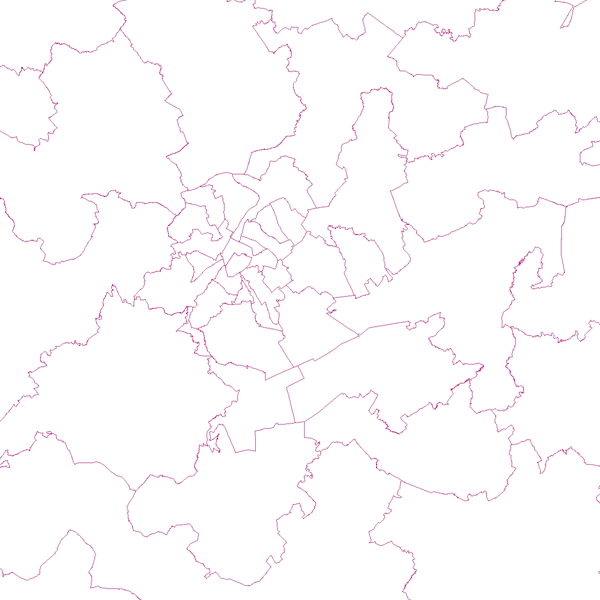
Territorial Divisions is the vectorproduct representing the geographical units of Belgium. The product consists of 16 feature types grouped into 4 topics: ‘AdminVector’, ‘Judicial cantons and arrondissements’, ‘Electoral cantons’ and ‘Postal cantons’.
The AdminVector dataset includes the statistical, geographical and administrative units of Belgium.
The dataset of the judicial cantons and arrondissements displays the geographical units used for the organisation of the courts.
The dataset of the electoral cantons consists of geographical units used for the organisation of elections.
The dataset of the postal cantons includes the boundaries of the Belgian postal cantons.
The product can be downloaded in its entirety via the links in 'Access' at the bottom of this page. Each of the themes is also available as separate datasets on their own webpage.
Simple
- Date (Creation)
- 2022-03-30
- Date (Revision)
- 2026-07-16
- Citation identifier
- BE.NGI-IGN / 1cd00540-b0ca-11ec-a863-186571a04de2
- Status
- Completed
- Point of contact
-
Organisation name Individual name Electronic mail address Role National Geographic Institute
David Robberechts
Custodian
- Maintenance and update frequency
- As needed
- Keywords
-
-
HVD_cat_administrative units
-
- Use constraints
- Other restrictions
- Other constraints
- https://creativecommons.org/licenses/by/4.0/
- Access constraints
- Other restrictions
- Other constraints
- No limitations on public access
- Use limitation
- https://creativecommons.org/licenses/by/4.0/
- Spatial representation type
- Vector
- Denominator
- 10000
- Language
- Français
- Language
- Nederlands; Vlaams
- Character set
- 8859 Part 15
- Topic category
-
- Boundaries
- Description
-
Belgium
))
- Distribution format
-
Name Version GeoPackage 1.3.0
Esri Shapefile 10.2
Digital transfer options
- OnLine resource
-
Protocol Linkage Name WWW:DOWNLOAD-1.0-http--download
https://ac.ngi.be/remoteclient-open/ngi-standard-open/Vectordata/TerritorialDivisions/TerritorialDivisions-All/1cd00540-b0ca-11ec-a863-186571a04de2_geopackage+sqlite3_3812.zip
Digital transfer options
- OnLine resource
-
Protocol Linkage Name WWW:DOWNLOAD-1.0-http--download
https://ac.ngi.be/remoteclient-open/ngi-standard-open/Vectordata/TerritorialDivisions/TerritorialDivisions-All/1cd00540-b0ca-11ec-a863-186571a04de2_geopackage+sqlite3_4326.zip
Digital transfer options
- OnLine resource
-
Protocol Linkage Name WWW:DOWNLOAD-1.0-http--download
https://ac.ngi.be/remoteclient-open/ngi-standard-open/Vectordata/TerritorialDivisions/TerritorialDivisions-All/1cd00540-b0ca-11ec-a863-186571a04de2_x-shapefile_3812.zip
Digital transfer options
- OnLine resource
-
Protocol Linkage Name WWW:DOWNLOAD-1.0-http--download
https://ac.ngi.be/remoteclient-open/ngi-standard-open/Vectordata/TerritorialDivisions/TerritorialDivisions-All/1cd00540-b0ca-11ec-a863-186571a04de2_x-shapefile_4326.zip
Digital transfer options
- OnLine resource
-
Protocol Linkage Name WWW:LINK-1.0-http--link
https://ac.ngi.be/remoteclient-open/ngi-standard-open/Specifications/Vectordata/TerritorialDivisions_ProductSpecification_ENG.pdf OGC:WMS
https://data.geo.be/ws/territorialdivisions/wms?request=getcapabilities&service=wms
- Hierarchy level
- Dataset
Domain consistency
- Name of measure
-
INSPIRE Conformity
Conformance result
- Date (Publication)
- 2010-12-08
- Explanation
-
The dataset’s compliance with the technical requirements as defined by the Commission Regulation (EU) No 1089/2010 of 23 November 2010 has not been checked
- Statement
-
AdminVector is updated annually with the authentic administrative data of the FPS Finance, except for the border markers and former municipalities. Based on this source and other relevant information, the postal cantons, electoral cantons and judicial districts were constructed according to their definition in their respective codes.
Metadata
- File identifier
- 1cd00540-b0ca-11ec-a863-186571a04de2 XML
- Metadata language
- English
- Character set
- UTF8
- Hierarchy level
- Dataset
- Date stamp
- 2026-10-02T14:22:35
- Metadata standard name
-
ISO 19115:2003/19139
- Metadata standard version
-
1.0
- Metadata author
-
Organisation name Individual name Electronic mail address Role National Geographic Institute
Floor Van Damme
Point of contact
- Other language
-
Language Character encoding French Dutch; Flemish German English UTF8