 geo.be Metadata Catalog
Buildings
Type of resources
Available actions
Topics
INSPIRE themes
federalThemes
Keywords
Contact for the resource
Provided by
Years
Formats
Representation types
Update frequencies
status
Service types
Scale
Resolution
-
Points Of Interest - Cult elements contains point elements relating to the cult, namely churchs (anglican, catholic, orthodox, protestant), mosques, synanogues, buddhist temples, chapels, abbeys, priories and other religious buildings or small monuments in Belgium.
-

Points Of Interest - patrimonial elements contains point elements relating to the patrimony, namely (water and wind)mill, (historic, commemoration, fortified) building, historic mound, ice house, castle, kiosk, shoring, non-religious monument, monumental stairs in Belgium.
-

This web service allows viewing datasets from Buildings
-

CadGIS Viewer is an application developed by the General Administration of Patrimonial Documentation of the FPS Finance. This application allows to: - consult the current situation of the land register plan and the administrative units and print them out; - consult all the tax situations since 2018 (situation as on 1 January) for the land register plan and administrative units; - search and geolocate the objects on the land register plan on the basis of space characteristics or queries; - ask for and print out cadastral plan parcels within a certain range around or adjacent to one or more parcels ; - search graphically on the map for surveyors' plans (only for surveyors); - add additional data to the map, both from a predefined list (IGN - Belgian national geographical institute’s aerial photographs, Cartoweb, regional reference frames such as GRB and PICC, ...) as well as other data via the URL of web services.
-

'Top10Vector – Particular Zones' is the vector dataset covering areas within Belgium that are designated for a specific purpose. This dataset contains just one feature type [ZO_particularzone]. The dataset can be downloaded via the links in 'Access' at the bottom of this page.
-
'Top10Vector – Constructions' is the vector dataset of constructions in Belgium. The dataset consists of 7 feature types, including those for buildings [CO_constructions] and those for bridges and tunnels [CO_brunnel]. The geometry of buildings can be supplemented with additional point [CO_toweronbuilding] or surface elements [CO_additionalpolygongeometry], which indicate the position of towers or other structures on buildings. Other structures are polygon [CO_particularpolyconstruction], linear [CO_particularlineconstruction] or point [CO_particularpointconstruction] feature types. The dataset can be downloaded via the links in 'Access' at the bottom of this page.
-
Vector dataset of aeronautical obstacles with a height of 60 meters or more above the ground. The update of this dataset takes place on a multi-year cycle; for each obstacle and for each location, the situation is indicated as applicable at the time of its last update. Based on the horizontal range of an obstacle, it is classified into one of three classes: polygonal obstacle if the smallest rectangular area enclosing the obstacle has a length and width of more than 100 meters; line obstacle if the smallest rectangular area enclosing the obstacle has a length of more than 100 meters, but a width of less than 100 meters; point obstruction in other cases.
-
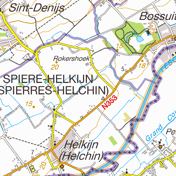
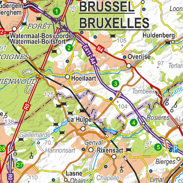
TopoMaps is a WMS allowing visualizing all images corresponding to the standard topographic cartographies made by the National Geographic Institute. As a result, it allows viewing cartographies on a 1:25 000 scale (Top25Map), on a 1:50 000 scale (Top50Map), on a 1:100 000 scale (Landcover100Map) and on a 1:250 000 scale (Top250Map), as well as the administrative map (AdminMap). With the exception of the administrative map, the cartographies show all themes of the topo-geographic inventory of the Belgian territory (ITGI) which is made and kept up-to-date by the National Geographic Institute: land use, transport, hydrography, buildings and constructions, relief, map lettering and toponyms.
-
Land register plan - current situation corresponds to the dataset of land register from the reference database for the land register data CadGIS. The land register plan is one of the elements that make up the patrimonial documentation. It is defined as “the graphic representation and assembling on a plan of all the cadastral plan parcels of the Belgian territory”. A plan parcel, such as defined in Article 2 of the Royal Decree of 30 July 2018, is a part of Belgian territory, geographically delimited and identified by the General Administration of Patrimonial Documentation on the land register plan, which corresponds to the ground surface area of one or more patrimonial cadastral parcel(s) (real estate property as mentioned in Article 472 of the 1992 Income Tax Code in respect of which the cadastral income is fixed). This dataset corresponds to the current situation at the time of consultation. It is composed of fourteen geometric layers. The first five are the administrative units, namely the country, the regions, the provinces, the districts and the municipalities. The sixth and seventh layers correspond to the cadastral units, divisions and sections. the eighth layer includes the cadastral blocks, the ninth, the property stones, the tenth, the addresses, the eleventh, the polders and wateringues, the twelfth, the cadastral plan parcels, the thirteenth the buildings managed by the AGDP, and the fourteenth, buildings managed by the regions. The dataset is freely downloadable via the ad hoc WFS.
-
Top250Map is a digital version of the NGI’s topographic cartography on a scale of 1:250 000. It is the smallest scale used by the NGI to produce a cartographic representation of Belgium. It focuses mainly on inhabited places and transport networks. The whole territory is available in one single file. This map is characterized by the great number of toponyms of inhabited places.