 geo.be Metadata Catalog
GeoPackage
Type of resources
Available actions
Topics
INSPIRE themes
federalThemes
Keywords
Contact for the resource
Provided by
Years
Formats
Representation types
Update frequencies
status
Scale
Resolution
-
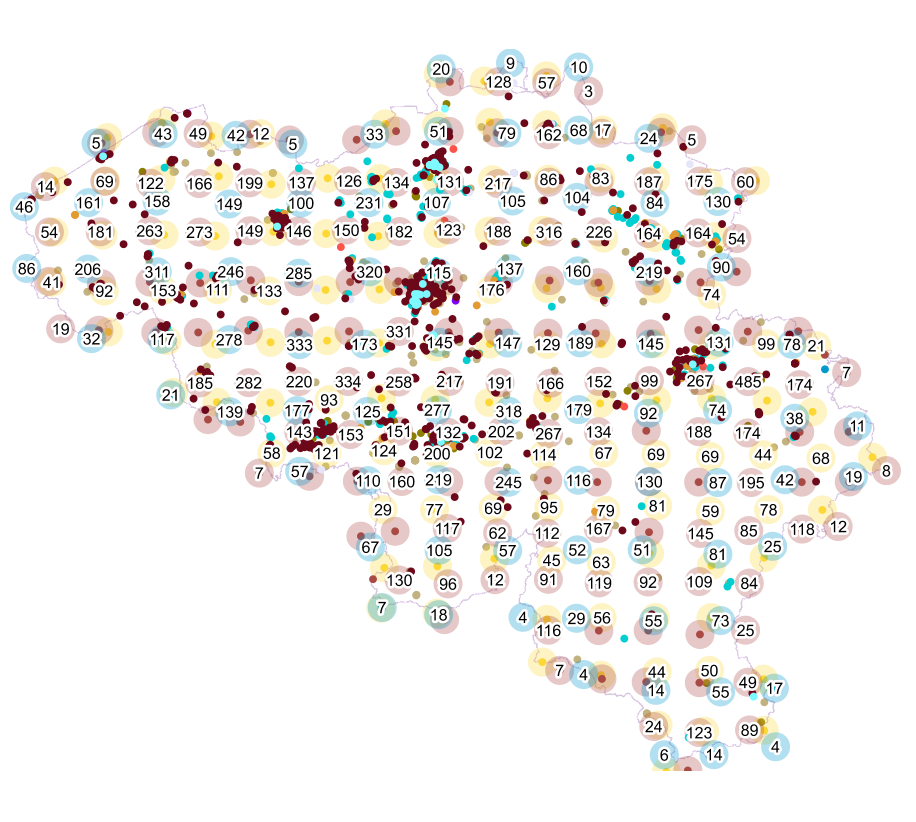
Points Of Interest - Cult elements contains point elements relating to the cult, namely churchs (anglican, catholic, orthodox, protestant), mosques, synanogues, buddhist temples, chapels, abbeys, priories and other religious buildings or small monuments in Belgium.
-
The files contain the population characteristics (total, gender and/or age groups) by statistical sector in Belgium on January 1st, according to the Belgian definition of the population. The Belgian definition does not take into account the 12-months criterion and excludes asylum seekers. More information at https://ec.europa.eu/eurostat/cache/metadata/en/demo_pop_esms.htm#unit_measure1589188532500.
-

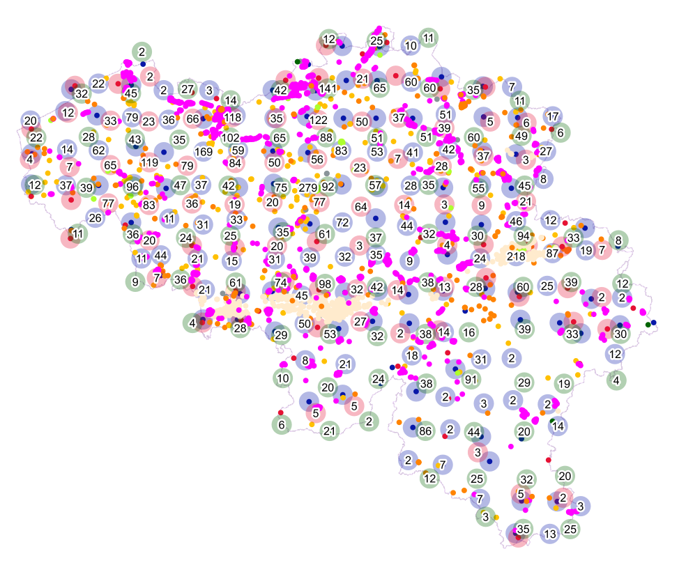
'Top10Vector – Constructions' is the vector dataset of constructions in Belgium. The dataset consists of 7 feature types, including those for buildings [CO_constructions] and those for bridges and tunnels [CO_brunnel]. The geometry of buildings can be supplemented with additional point [CO_toweronbuilding] or surface elements [CO_additionalpolygongeometry], which indicate the position of towers or other structures on buildings. Other structures are polygon [CO_particularpolyconstruction], linear [CO_particularlineconstruction] or point [CO_particularpointconstruction] feature types. The dataset can be downloaded via the links in 'Access' at the bottom of this page.
-
Points Of Interest - Infrastructures interest contains point elements indicating the location of a infrastructure, such as a container depot, incinerator, brunnel (bridges and tunnels), rail traffic, subway access, subway and tram stops, heli- and airport, control tower, light mast, lighthouse, water tower, flashing-lamp, breakwater, harbour area, marina, ship lift, dock, embankment, sluice, stilt structure and water point in Belgium.
-

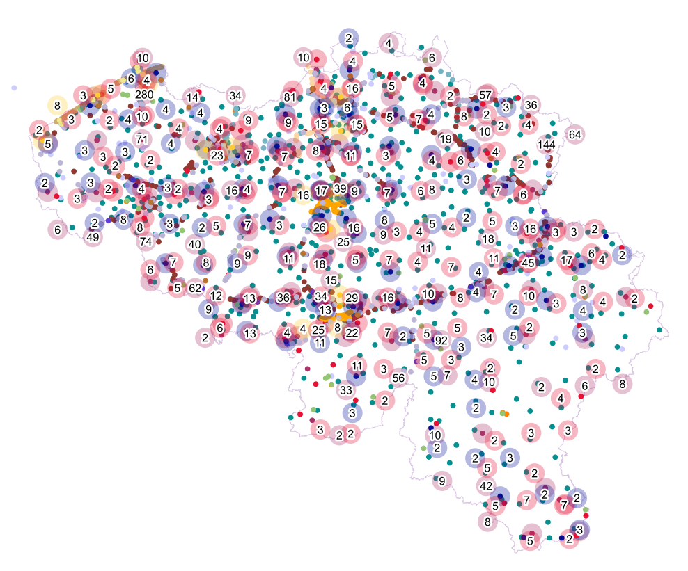
Territorial Divisions is the vectorproduct representing the geographical units of Belgium. The product consists of 16 feature types grouped into 4 topics: ‘AdminVector’, ‘Judicial cantons and arrondissements’, ‘Electoral cantons’ and ‘Postal cantons’. The AdminVector dataset includes the statistical, geographical and administrative units of Belgium. The dataset of the judicial cantons and arrondissements displays the geographical units used for the organisation of the courts. The dataset of the electoral cantons consists of geographical units used for the organisation of elections. The dataset of the postal cantons includes the boundaries of the Belgian postal cantons. The product can be downloaded in its entirety via the links in 'Access' at the bottom of this page. Each of the themes is also available as separate datasets on their own webpage.
-

The files contain the population characteristics (total, gender and/or age groups) by 1 km² square grid cell in Belgium on January 1st, according to the European definition of the population. The European definition takes into account the 12-months criterion and includes asylum seekers. More information at https://ec.europa.eu/eurostat/cache/metadata/en/demo_pop_esms.htm#unit_measure1589188532500.
-
Points Of Interest - Economy interest contains point elements indicating the location of an economic activity, such as a brewery, wholesale market, (commercial, industrial) building, cooling tower, gas processing/disposal, slagheap, telecommunications, wind turbine, solar panel park in Belgium.
-
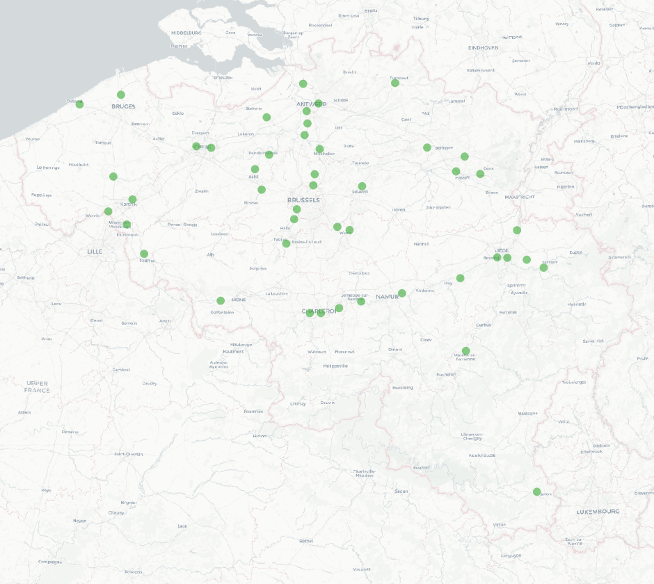
The national wastewater-based epidemiological surveillance of SARS-CoV-2 monitors the SARS-CoV-2 presence in several wastewater treatment plants across Belgium. This dataset contains the results per treatment plant since the beginning of the surveillance in September 2020. The results consist of the SARS-CoV-2 concentrations over time as well as other data needed for the interpretations such as the flow rates of the treatment plants and the population covered.
-
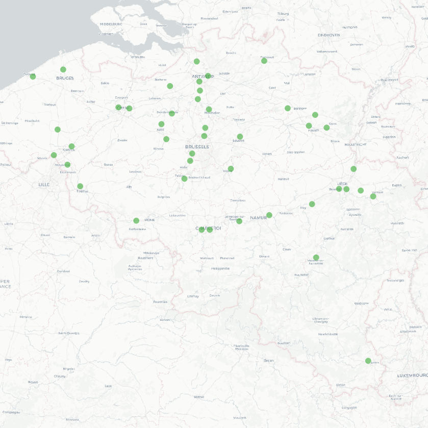
The national wastewater-based epidemiological surveillance monitors public health parameters in several wastewater treatment plants across Belgium. The PMMoV virus is an indicator of human faecal contamination used to estimate the population load in wastewater samples. The results of this dataset consist of PMMoV concentrations over time as well as other data needed for the interpretations such as the flow rates of the treatment plants and the population covered.
-
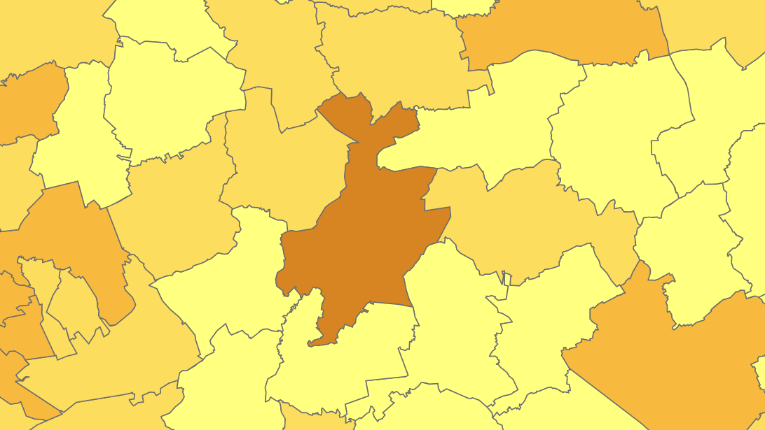
The files contain the population characteristics (total, gender and/or age groups) by municipality in Belgium on January 1st, according to the Belgian definition of the population. The Belgian definition does not take into account the 12-months criterion and excludes asylum seekers. More information at https://ec.europa.eu/eurostat/cache/metadata/en/demo_pop_esms.htm#unit_measure1589188532500.