 geo.be Metadata Catalog
marine monitoring
Type of resources
Available actions
Topics
INSPIRE themes
federalThemes
Keywords
Contact for the resource
Provided by
Years
Formats
Representation types
Update frequencies
Service types
-
This web service allows viewing the datasets under the Marine Strategy Framework Directive (MSFD).
-

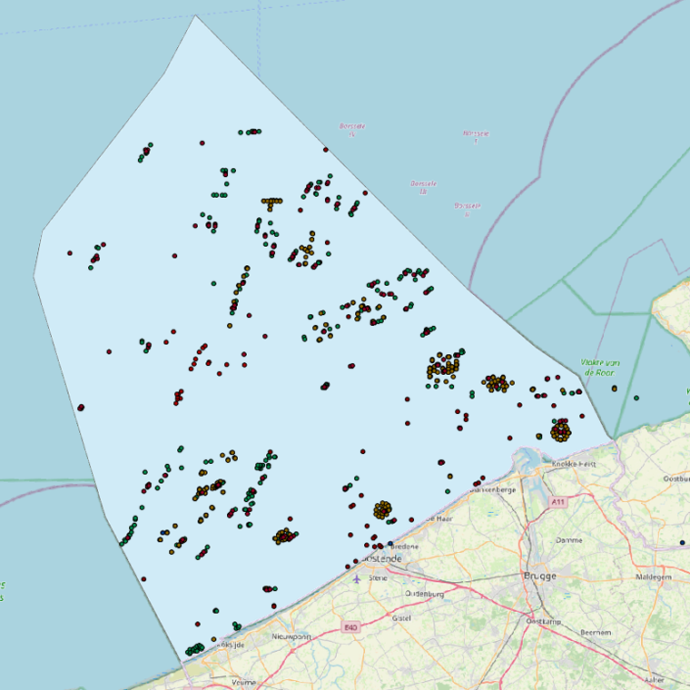
This dataset is part of the 2018 Belgian submission for the Marine Strategy Framework Directive (MSFD) linked to descriptor 8, criterion 3. This dataset gives an overview of the observed slicks during aerial survey operations of the Belgian part of the North Sea (2011-2016). Related to significant acute pollution, it includes the observations linked to the Flinterstar incident in 2015. Besides this, all observations of illegal discharges of MARPOL (International Convention for the Prevention of Pollution from Ships) annex I and II substances are included as an additional dataset.
-
This dataset is part of the 2024 Belgian submission for the Marine Strategy Framework Directive (MSFD) linked to descriptor 7, criterion 1. This dataset describes the zones that are subject to noticeable permanent alteration of the hydrographic conditions due to human activities and man-made infrastructures for the time period 1992-2022. The data format is shapefiles and includes the zone area (m²) as attribute.
-
This dataset presents findings from an environmental impact assessment conducted along three gradients extending northeastward, southeastward, and southwestward from the Princess Elisabeth Energy Island. Samples were collected at 20 locations in 2024, and 8 locations in 2025 in triplicate, using a 0.1 m² Van Veen Grab, assessing sediment grain size distribution and total organic carbon content. Macrobenthos samples were preserved, stained, and analyzed in the laboratory.
-
This dataset is part of the 2024 Belgian submission for the Marine Strategy Framework Directive (MSFD) linked to descriptor 1, criterion 2. It originates from the ICES DATRAS (Database of Trawl Surveys), which compiles standardised bottom trawl survey data collected from various European waters; for this indicator, the Belgian Beam Trawl Survey (BTS) data from the North Sea were used. The dataset includes species abundance, length and age distributions, catch per unit effort, and environmental parameters, providing key insights on the population abundance of thornback ray (Raja clavata) and lesser-spotted dogfish (Scyliorhinus canicula) for stock assessment and fisheries management.
-
This dataset is part of the 2018 Belgian submission for the Marine Strategy Framework Directive (MSFD) linked to descriptor 1, criterion 1. Stranded porpoises often show traces of incidental catch in fishing nets (bycatch), a major cause of death for this cetacean in the North Sea. Based on the number of stranded animals showing traces of bycatch, it can be estimated that up to a few dozen porpoises are caught per year. For extrapolation of bycatch data to effects at population level, reference is made to (future) initiatives at regional level.
-
This dataset is part of the 2024 Belgian submission for the Marine Strategy Framework Directive (MSFD) linked to descriptor 1, criterion 3. This dataset reports the breeding success (population demographic characteristics) of benthic-feeding, pelagic-feeding, surface-feeding and wading birds breeding along the Belgian coast.
-
This dataset is part of the 2024 Belgian submission for the Marine Strategy Framework Directive (MSFD) linked to descriptor 6, criterion 4. This dataset describes and maps the areal extent of EUNIS level 2 broad-scale habitat types and gravel beds in the Belgian part of the North Sea (BPNS), to assess whether the spatial extent of these habitats fluctuates beyond the accuracy margin of the current distribution maps.
-
This dataset is part of the 2024 Belgian submission for the Marine Strategy Framework Directive (MSFD) linked to descriptor 6, criterion 5. It reports on the condition of benthic habitats in the Belgian part of the North Sea (BPNS), combining soft-sediment macrobenthos monitoring (in the framework of dredge disposal/sand extraction impact assessment, and offshore wind farm monitoring) with natural hard-substrate benthos monitoring, to evaluate adverse effects on the biotic and abiotic structure and function of benthic habitat types.
-
This dataset is part of the 2018 Belgian submission for the Marine Strategy Framework Directive (MSFD) linked to descriptor 8, criterion 1. This dataset describes the contaminant concentrations in biota. The priority substances mercury, hexachlorobutadiene and hexachlorobenzene are measured in mussels and flounder in the BPNS. Results for other parameters that are part of the OSPAR Coordinated Environmental Monitoring Program are also included: polychlorinated biphenyls (PCBs), polycyclic aromatic hydrocarbons (PAHs), heavy metals, organotin-compounds and polybrominated diphenyl ethers (PBDEs) for the period 2011-2016. The analyses are performed by ILVO and KBIN-OD Nature that both participate in the Quasimeme ring tests for additional quality control. Bird eggs of 2008, 2010 and 2015 are measured for mercury (Hg), dichlorodiphenyltrichloroethane (DDT), hexachlorobenzene (HCB) and hexachlorocyclohexane (HCH). Eggs from the are measured and compared with OSPAR norms Common Tern (Sterna hirundo) are gathered in Zeebrugge and are analyzed by the Insitut für vogelforschung in Wilhelmshaven according to a standard protocol.