 geo.be Metadata Catalog
application/xml
Type of resources
Topics
INSPIRE themes
Keywords
Contact for the resource
Provided by
Years
Formats
Representation types
Scale
-
This datasets is a summary of the CTD profiles measured with the RV Belgica. It provides general meta-information such as the campaign code, the date of measurement and the geographical information. An important information is the profile quality flag that describes the validity of the data. A quality flag = 2 means the data is generally good although some outliers can still be present. A quality flag = 4 means the data should not be trusted. 1 meter binned data can be download on the SeaDataNet CDI portal (enter the cruise_id in the search bar) ONLY for the good quality profiles. Full acquisition frequency datasets are available on request to BMDC.
-

This dataset represents the exact location of disused telecommunication cables installed in the Belgian Part of the North Sea.
-
This dataset represents the exact location of electrical cables installed in the Belgian Part of the North Sea, including these for for the wind farms.
-
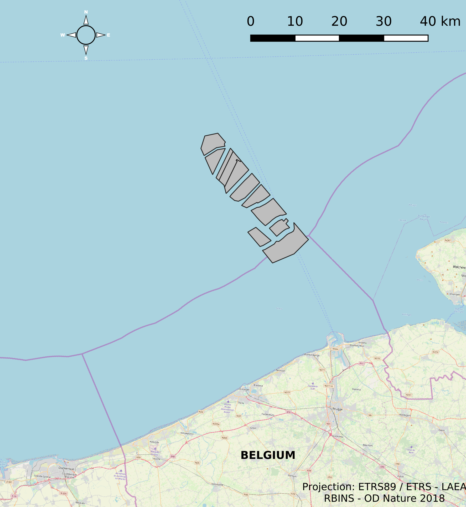
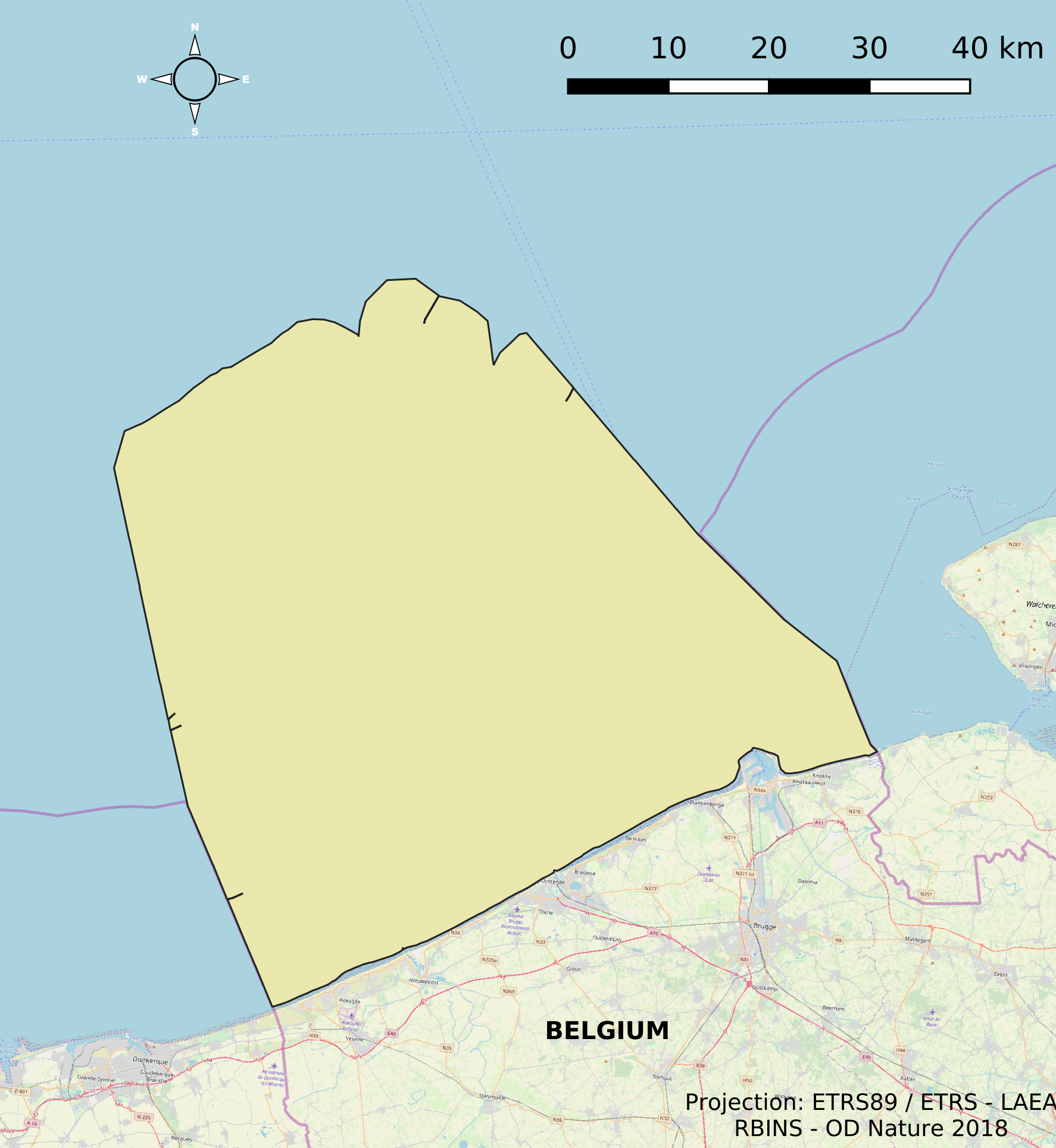
This dataset represents the location of the windfarms concessions in the Belgian Part of the North Sea.
-
This dataset describes the extents and location of Reefs in the Belgian Part of the North Sea (BPNS) as required for article 17 of the Council Directive 92/43/EEC of 21 May 1992 on the conservation of natural habitats and of wild fauna and flora. The Council Directive seeks to contribute to ensuring biodiversity in the European Union by the conservation of natural habitats and wild fauna and flora species.
-

This dataset represents the exact location of active telecommunication cables (verified in 2010) installed in the Belgian Part of the North Sea.
-
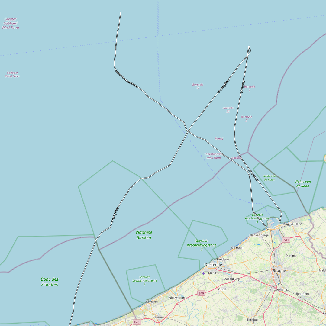
This dataset represents the exact location of gas pipelines installed in the Belgian Part of the North Sea.
-
This dataset represents the location of the Princess Elizabeth zone in the Belgian Part of the North Sea as described in the Royal Decree of May 22th, 2019, establishing a marine spatial plan for the period 2020-2026. Art. 8. § 3.
-
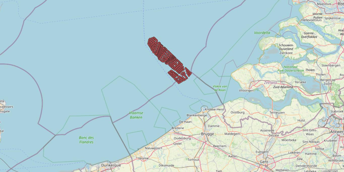
This dataset represents the exact location of the wind turbines in the Belgian Part of the North Sea.
-
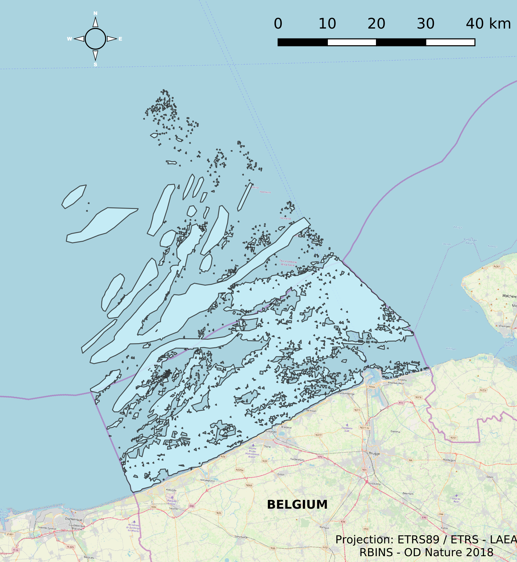
This dataset describes the extents and location of Sandbanks (code 1110) in the Belgian Part of the North Sea (BPNS) as required for article 17 of the Council Directive 92/43/EEC of 21 May 1992 on the conservation of natural habitats and of wild fauna and flora. The Council Directive seeks to contribute to ensuring biodiversity in the European Union by the conservation of natural habitats and wild fauna and flora species.