 geo.be Metadata Catalog
GeoJSON
Type of resources
Available actions
Topics
INSPIRE themes
federalThemes
Keywords
Contact for the resource
Provided by
Years
Formats
Representation types
Update frequencies
status
Service types
Scale
-

Since August 2019, users of the RMI smartphone app are able to send an observation of the meteorological conditions at a certain place and a certain time. The observations provide information about the weather conditions and potentially severe weather to the other users and to RMI. The collection of citizen weather reports is a valuable complement to the information obtained with the classical instruments like stations, radar and satellite. The data can be exploited for nowcasting, warnings and model verification, and eventually in assimilation. A general introduction of the data and their characteristics can be found in Reyniers et al. (2023). A basic quality control is implemented on the received observations via a plausibility check. This plausibility check determines whether an observation is plausible, suspicious or false, by comparing it to the INCA-BE nowcasting system using a simple thresholding scheme. INCA-BE is RMI's operational nowcasting system described in Reyniers et al. (2021). There is no strict spatial extent since there is no restriction at the input side: users can send observations from all over the globe. The bulk of the observations are received from within Belgium. Note that the plausibility check is not available for reports from outside Belgium.
-
-
-
The data set presents in the form of polygons the breakdown of Belgium in almost 20,000 statistical sectors. The statistical sector is the basic territorial unit resulting from the subdivision of the territory of municipalities by STATBEL since 1970 for the dissemination of its statistics at a finer level than the municipal level. A statistical sector cannot extend over two municipalities and any point in the municipal territory is part of one and the same statistical sector. The 1970 and 1981 versions are shown in analogue format while the 2001, 2011, 2018, 2019 etc. versions are available in digital vector format. The files can be linked to the data on population, housing and disposable income on the website of Statbel.
-
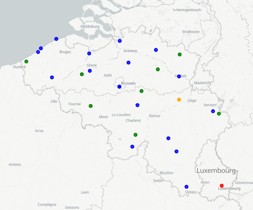
RMI operates a network of 17 automatic weather stations in Belgium. These weather stations report meteorological paramaters such as air pressure, temperature, relative humidity, precipitation (quantity,duration), wind (speed, gust, direction), sunshine duration, shortwave solar radiation and infrared radiation every 10 minutes.
-

Download Service (WFS) for Synoptic observations
-
Download Service (WFS) for Automatic weather station (AWS) observations
-

INSPIRE compliant download service (WFS) for geographic information of the datasets of the Marine Strategic Framework Directive made available by the Royal Belgian Institute for Natural Sciences (RBINS).
-

INSPIRE compliant download service (WFS) for geographic information of the Marine Spatial Plan made available by the Royal Belgian Institute for Natural Sciences (RBINS).
-

Download Service (WFS) for Networks of automatic lidar-ceilometer systems The data are updated each 10 minutes. Only the archives of the last 30 days are available.