 geo.be Metadata Catalog
Area management/restriction/regulation zones and reporting units
Type of resources
Available actions
Topics
INSPIRE themes
federalThemes
Keywords
Contact for the resource
Provided by
Years
Formats
Representation types
status
Service types
Scale
Resolution
-

INSPIRE compliant view service for geographic information of the Marine Spatial Plan made available by the Royal Belgian Institute for Natural Sciences (RBINS).
-

INSPIRE compliant download service (WFS) for geographic information of the Marine Spatial Plan made available by the Royal Belgian Institute for Natural Sciences (RBINS).
-
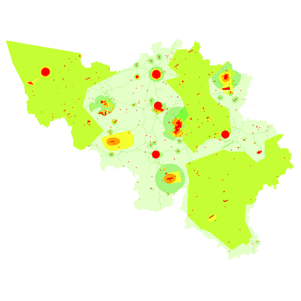
The "Aeronautical Obstacle Evaluation Map for Belgium" allows to know whether advice is required for a construction or structure that, due to its height, may have an influence on aviation: if the planned construction or structure exceeds the height indicated on the map, the Civil Aviation Authority of the Federal Public Service Mobility and Transport should be requested for advice, according to the procedure on https://mobilit.belgium.be/nl/luchtvaart/veiligheid/hindernissen-en-bebakening. The height indicated on the map is determined by the federal ministers responsible for Civil Aviation and Defence. This height is determined in order to protect the civil and military aerodromes, the visual aviation routes, the military aviation areas and the civil and military aeronautical installations for communication, navigation and surveillance (CNS). Consequently, the use of this map allows the application of the following Regulation : Regulation (EC) N° 1108/2009 of the European Parliament and of the Council of 21 October 2009 amending Regulation (EC) No 216/2008 in the field of aerodromes, air traffic management and air navigation services and repealing Directive 2006/23/EC. In the Flemish Region the use of this chart allows the application of the article 35 §16 of “het besluit van de Vlaamse Regering van 27 november 2015 tot uitvoering van het decreet van 25 april 2014 betreffende de omgevingsvergunning”. The same data limited to the flemish Region are available on the Digitaal Vlaanderen website.
-
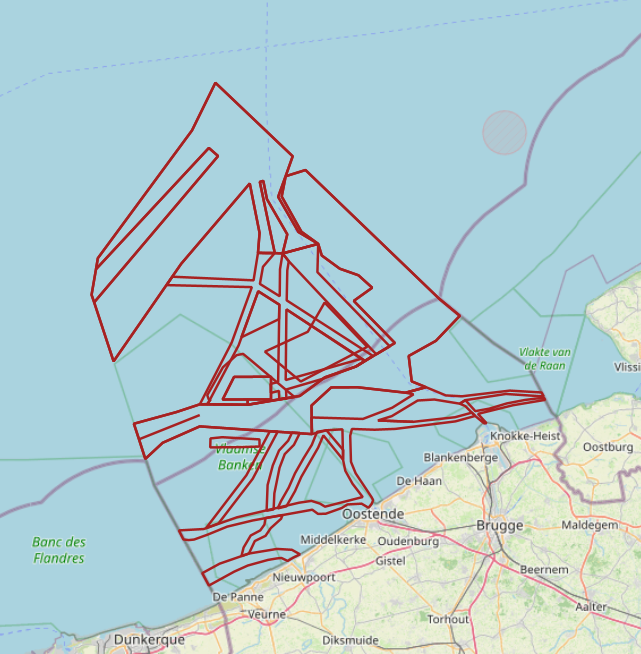
The Royal Decree of 20 March 2026 establishing the marine spatial plan for the period 2026 to 2034 in the Belgian marine areas defines 20 shipping and ports zones: IMO shipping zones (Art. 14§2), Traffic separation schemes (Art. 14§2), IMO traffic separation scheme "Noordhinder South" (Art. 14§2.1°), IMO precautionary area "in the vicinity of Thornton and Blighbank" (Art. 14§2.10°), Other routes and traffic flows (Royal Decree) (Art. 14§2.11°-19°), IMO traffic separation scheme "Off Noordhinder" (Art. 14§2.2°), IMO precautionary area "Noordhinder Junction" (Art. 14§2.3°), IMO traffic separation scheme "At Westhinder" (Art. 14§2.4°), Separation line "At West Hinder" (Art. 14§2.4°), IMO precautionary area "At Westhinder" (Art. 14§2.5°), IMO area to be avoided "At Westhinder" (Art. 14§2.6°), IMO deep-water route "Approach to the Scheldt" (Art. 14§2.7°), IMO two-way route "Westpit" (Art. 14§2.8°), IMO precautionary area "At Gootebank" (Art. 14§2.9°), Anchorage area "Oostdyck" (Art. 14§3.1°), IMO anchorage area "At Westhinder" (Art. 14§3.2°), Maritime safety research zone: Zone 1 (Art. 14§5.1°), Maritime safety research zone: Zone 2 (Art. 14§5.2°), Maritime safety research zone: Zone 3 (Art. 14§5.3°). It replaces the 2020 Marine Spatial Plan. Please refer to the Belgian official gazette ("Moniteur belgeBelgisch Staatsblad") for official reference information.
-
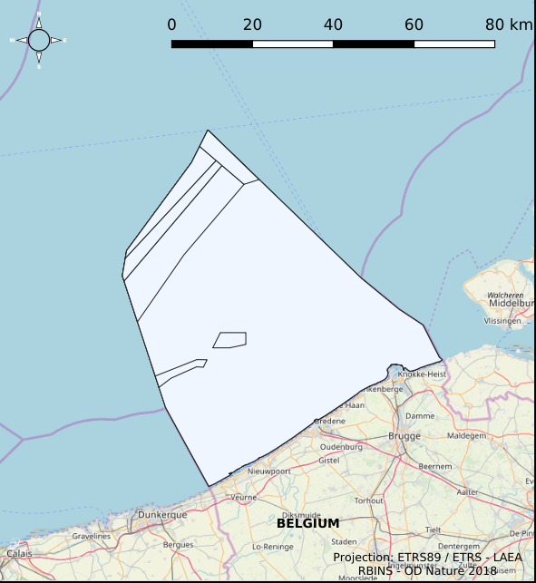
The Royal Decree of 22 May 2019 establishing a marine spatial plan defines 20 shipping and ports zones: Shipping regular regime (Art. 10§1), Northbound traffic flow starting at separation line 'Noordhinder Sud' (Art. 10§2.1°), Separation zone 'Noordhinder Sud' (Art. 10§2.1°), Precaution zone 'Near Thornton and Blighbank ' (Art. 10§2.10°), Northbound traffic flow starting at separation zone 'Off Noordhinder' (Art. 10§2.2°), Separation zone 'Off Noordhinder' (Art. 10§2.2°), Southbound traffic flow starting at separation line 'Off Noordhinder' (Art. 10§2.2°), Precaution zone 'Noordhinder Jonction' (Art. 10§2.3°), Eastbound traffic flow starting at separation line 'At West Hinder' (Art. 10§2.4°), Eastbound traffic flow starting at separation zone 'At West Hinder' (Art. 10§2.4°), Precaution zone 'At West Hinder ' (Art. 10§2.4°), Separation zone 'At West Hinder' (Art. 10§2.4°), Westbound traffic flow starting at separation line 'At West Hinder' (Art. 10§2.4°), Area to be Avoided 'At West Hinder' (Art. 10§2.6°), Deep water route 'Westerschelde approach' (Art. 10§2.7°), Border line 1 of two-way shipping lane 'Westpit' (Art. 10§2.8°), Border line 2 of two-way shipping lane 'Westpit' (Art. 10§2.8°), Precaution zone 'At Gootebank' (Art. 10§2.9°), Anchoring zone 'Oostdyck' (Art. 10§3.1°), Anchoring zone 'Westhinder' (Art. 10§3.2°). It replaces the 2014 Marine Spatial Plan, which is included for completeness. The Royal Decree of 20 March 2014 establishing a marine spatial plan defines in its Art. 9, nine zones with regards to shipping and ports: seven shipping zones (Shipping regular regime, Art. 9 § 1; Shipping route Northhinder South, Art. 9 § 2.1°; Shipping route Northhinder junction, Art. 9 § 2.2°; Shipping route Westhinder, Art. 9 § 2.3°; Shipping route Westhinder precautionary area, Art. 9 § 2.4°; Shipping route Westhinder area to be avoided, Art. 9 § 2.5°; Deep water shipping route Western Scheldt approach, Art. 9 § 2.6°) and two anchorage places (Anchorage place 'Oostdyck', Art. 9 § 4.1° and Anchorage place 'Westhinder', Art. 9 § 4.2°). These zones are made available digitally in the resource described by this metadata document. Please refer to the Belgian official gazette (\"Moniteur belge/Belgisch Staatsblad\") for official reference information.
-

INSPIRE compliant download service (ATOM) for geographic information of general marine datasets made available by the Royal Belgian Institute for Natural Sciences (RBINS).
-
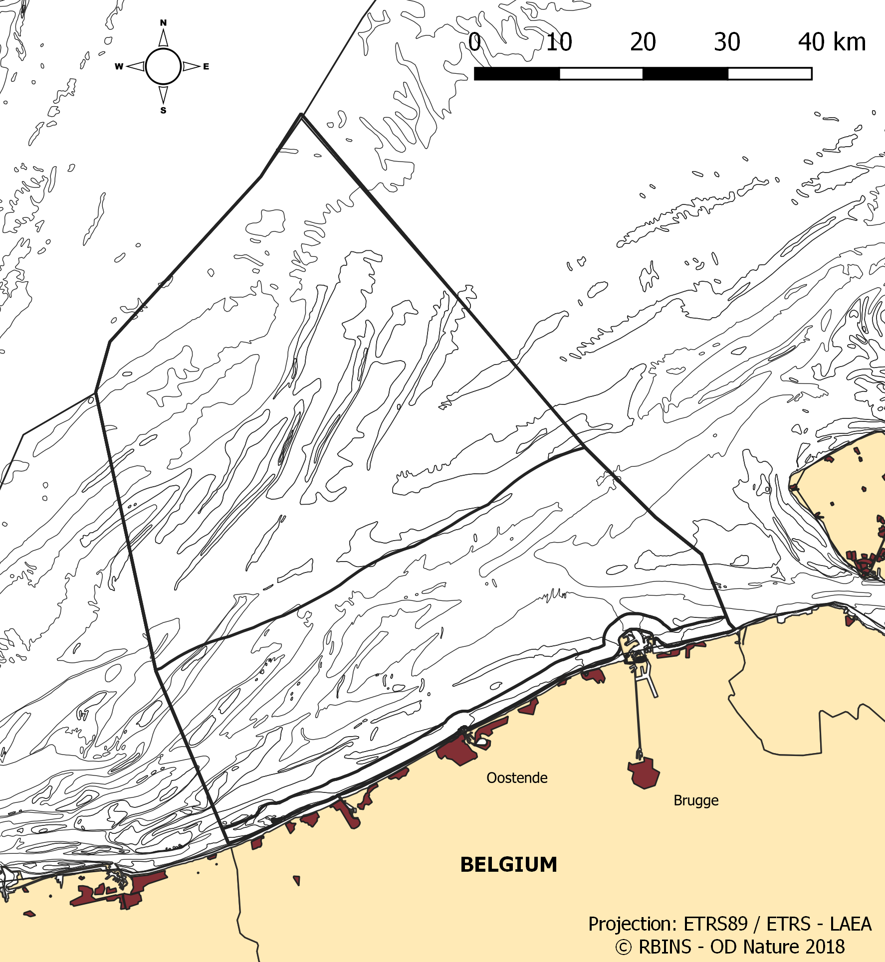
The dataset contains the borders of the Belgian marine waters in the North Sea and the different geographical areas (‘reporting units’) used when reporting in the frame of the the Marine Strategy Framework Directive 2008/56/EC (MSFD) and the Water Framework directive 2000/60/EC (WFD). The ecological status in the frame of WFD is reported for the coastal waters, defined as the one-nautical mile area, while the chemical status needs to be reported for the territorial waters (up to 12 nautical miles). MSFD requires information for the whole area, encompassing the territorial waters and the Belgian Exclusive Economic Zone. For some descriptors, results have been reported separately for the WFD subdivisions during the update of the initial assessment in 2018.
-
INSPIRE compliant view service for geographic information of the Marine Spatial Plan made available by the Royal Belgian Institute for Natural Sciences (RBINS).
-

INSPIRE compliant download service for geographic information of general marine datasets made available by the Royal Belgian Institute for Natural Sciences (RBINS). More specific products such as the Marine Spatial Plan and the MSFD data are provided by other WMS services.
-
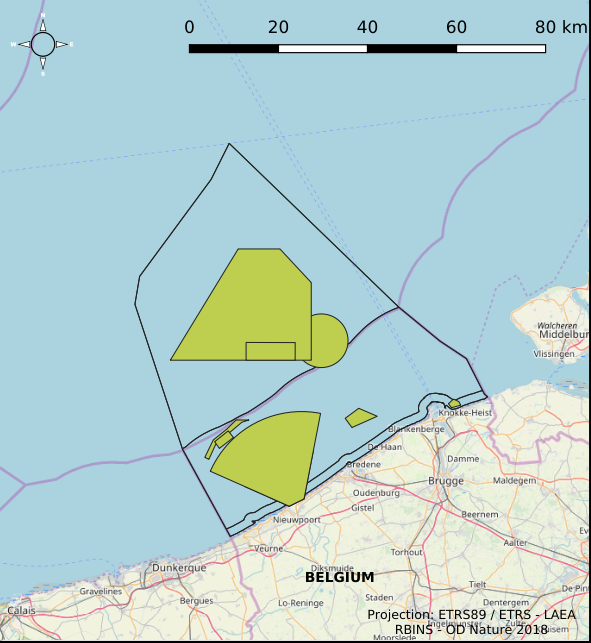
The Royal Decree of 22 May 2019 establishing a marine spatial plan defines 11 military use and storage sites for war munition zones: Exercise area for sweeping mines (Buiten Ratel) (Art. 17§1), Exercise area for sweeping mines - NB-01 (Westhinder) (Art. 17§1), Exercise area for sweeping mines - NBH-10 (Wenduine) (Art. 17§1), Exercise area for sweeping mines - QZR 040 (Art. 17§1), Munition destruction area (Art. 17§2), Area for shooting exercises on floating objects (Art. 17§3), Area for exercises in shallow waters (Art. 17§4), Area for shooting exercises from land - big sector (Art. 17§5), Area for shooting exercises from land - medium sector (Art. 17§5), Area for shooting exercises from land - small sector (Art. 17§5), Storage site for war munition Paardenmarkt (Art. 18§1). It replaces the 2014 Marine Spatial Plan, which is included for completeness. The Royal Decree of 20 March 2014 establishing a marine spatial plan defines in its Art. 13. and Art. 14., resp. nine zones for military use and one storage site for war munition: three zones for shooting exercises from land direction sea (Art 13. § 1 small sector, Art 13. § 1 medium sector, Art 13. § 1 large sector), four exercise areas for sweeping mines (Art 13. § 3, Exercise area 1 for sweeping mines, Art 13. § 5, Exercise area 2 for sweeping mines, Art 13. § 9, Exercise area 3 for sweeping mines, Art 13. § 13, Exercise area 4 for sweeping mines), one area for shooting exercises on floating objects (Art 13. § 7), one area for defusing mines (Art 13. § 11) and one zone to safeguard the closed storage site for war munition \"Paardenmarkt\" (Art. 14. § 1). These zones are made available digitally in the resource described by this metadata document. Please refer to the Belgian official gazette (\"Moniteur belge/Belgisch Staatsblad\") for official reference information.