 geo.be Metadata Catalog
Utilities communication
Type of resources
Available actions
Topics
INSPIRE themes
federalThemes
Keywords
Contact for the resource
Provided by
Years
Formats
Representation types
Update frequencies
status
Scale
-

Govroam is a " wifi roaming " solution. This service offers to the users a simple and secure access to the wireless network of their institution, but also to networks of other participating institutions. A user from an organization that participates in govroam will be able to connect to any wireless access point broadcasting govroam. The data provided here makes it possible to locate these access points.
-

‘Top10Vector – High-tension network’ is the vector dataset for the Belgian high-tension grid. The dataset consists of 2 feature types: high-voltage line segments [HT_hightensionlinesegment] and high-voltage pylons [HT_powerpylon]. The dataset can be downloaded via the links in 'Access' at the bottom of this page.
-
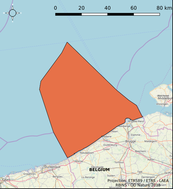
2019 Belgian MSP - Princess Elizabeth Zone for renewable Energy in the Belgian Part of the North Sea
This dataset represents the location of the Princess Elizabeth zone in the Belgian Part of the North Sea as described in the Royal Decree of May 22th, 2019, establishing a marine spatial plan for the period 2020-2026. Art. 8. § 3.
-

MapIndex is a regular grid of rectangular or square cells coded with alphanumeric characters. It has been defined for the Belgian territory and allows geolacating several events. The present version is a beta (v2)version which is submitted to the emergency services. It will evolve to a standard cartographic grid.
-
This dataset represents the exact location of electrical cables installed in the Belgian Part of the North Sea, including these for for the wind farms.
-
The Royal Decree of 22 May 2019 establishing a marine spatial plan defines 1 radar tower: Radar Oostdyck (Art. 21§3). Please refer to the Belgian official gazette (\"Moniteur belge/Belgisch Staatsblad\") for official reference information.
-

This dataset represents the exact location of disused telecommunication cables installed in the Belgian Part of the North Sea.
-

This dataset represents the exact location of active telecommunication cables (verified in 2010) installed in the Belgian Part of the North Sea.
-
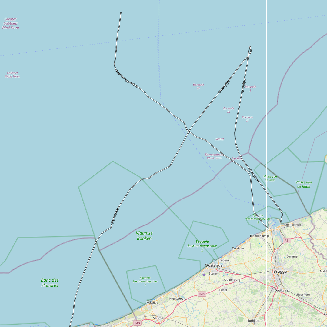
This dataset represents the exact location of gas pipelines installed in the Belgian Part of the North Sea.
-
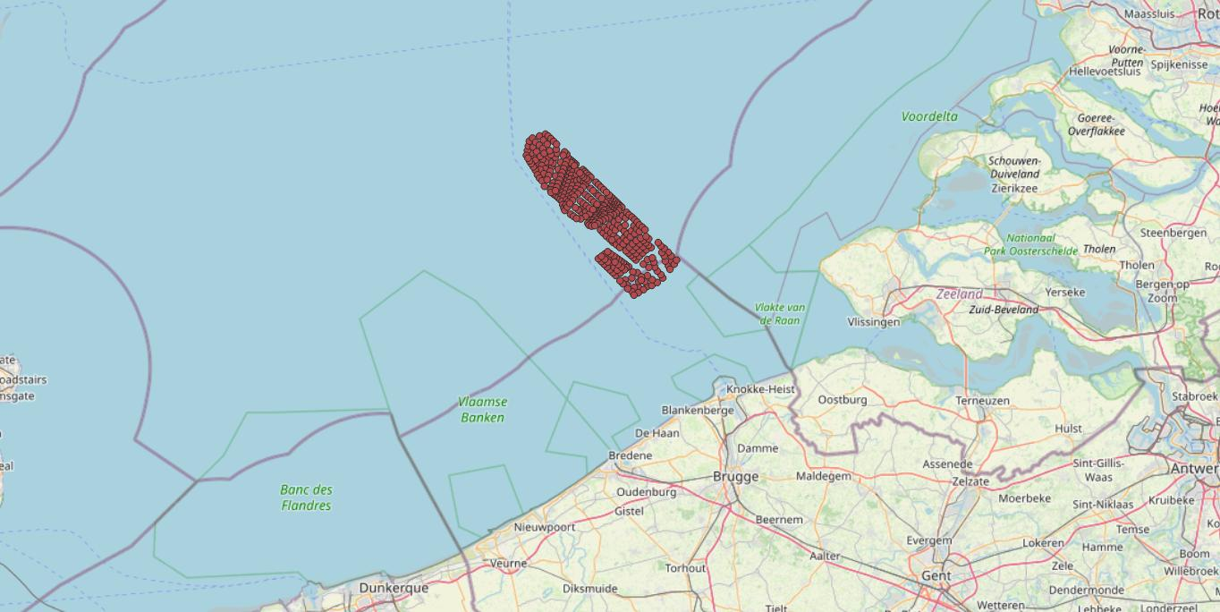
This dataset represents the exact location of the wind turbines in the Belgian Part of the North Sea.