 geo.be Metadata Catalog
Mobility
Type of resources
Available actions
Topics
INSPIRE themes
federalThemes
Keywords
Contact for the resource
Provided by
Years
Formats
Representation types
Update frequencies
status
Service types
Scale
Resolution
-
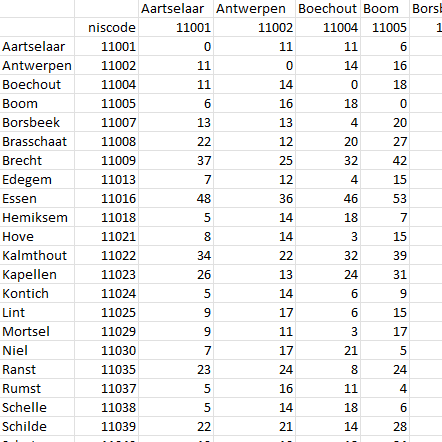
This dataset contains a matrix of distances between all Belgian municipality centres as defined in the AdminVector product. The distance is in km and is rounded to an integer.
-

‘Top10Vector – Railway network’ is the dataset of the railway network in Belgium. This dataset includes 3 feature types, namely the railway track segments [RA_railwaytracksegment], railway stops [RA_railwaystop] and railway kilometer markers [RA_railwaykilometremarker]. The dataset can be downloaded via the links in 'Access' at the bottom of this page.
-
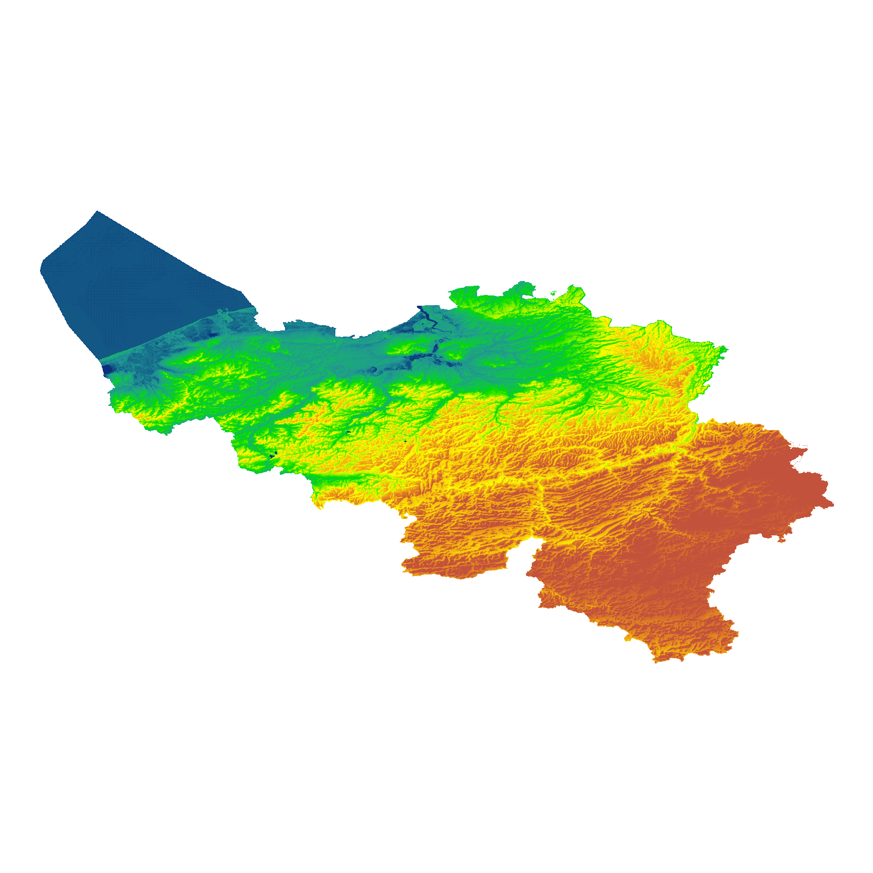
The eTOD digital terrain model (DTM) is a homogeneous and regular point grid that models the height of the ground level for Belgian territory and the height of the sea level in the maritime zone. The primary source is the NGI DTM 5m, which is itself compiled based on the most recent altimetry data of the three Belgian regions and is periodically updated per map sheet at a scale of 1:50,000 using recent stereoscopic aerial images. Where available, updates from the notification platform for aviation obstacles and terrain changes are also integrated. For this DTM, the resolution (1 arcsecond) and the coordinate reference system (WGS84 + EGM2008) are used as defined in the eTOD specifications.
-
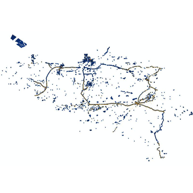
Vector dataset of aeronautical obstacles with a height of 60 meters or more above the ground. The update of this dataset takes place on a multi-year cycle; for each obstacle and for each location, the situation is indicated as applicable at the time of its last update. Based on the horizontal range of an obstacle, it is classified into one of three classes: polygonal obstacle if the smallest rectangular area enclosing the obstacle has a length and width of more than 100 meters; line obstacle if the smallest rectangular area enclosing the obstacle has a length of more than 100 meters, but a width of less than 100 meters; point obstruction in other cases.
-
Web service with currently available electronic terrain and obstacle data in Area 1 related to: - Implementing Regulation (EU) No 2017/373 on, inter alia, the common requirements for air navigation service providers, as subsequently amended; - Annex 15 to the Chicago Convention on International Civil Aviation; - ICAO document 10066 PANS-AIM: Procedures for air navigation services, Aeronautical Information Management.
-
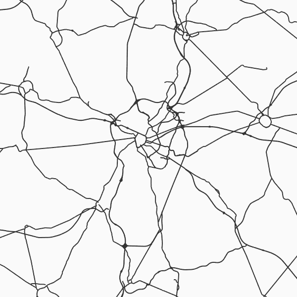
'Top10Vector - Road network' is the vector dataset of the Belgian road network. It contains five feature types including 3 types of segments: road segments [RO_roadsegment], path segments [RO_pathsegment] and dirt road segments [RO_dirtroadsegment]. In addition, there are two other feature types consisting of point elements, namely kilometre markers [RO_roadkilometremarker] and traffic obstacles [RO_obstruction]. The dataset can be downloaded via the links in 'Access' at the bottom of this page.
-
The "Aeronautical Obstacle Evaluation Map for Belgium" allows to know whether advice is required for a construction or structure that, due to its height, may have an influence on aviation: if the planned construction or structure exceeds the height indicated on the map, the Civil Aviation Authority of the Federal Public Service Mobility and Transport should be requested for advice, according to the procedure on https://mobilit.belgium.be/nl/luchtvaart/veiligheid/hindernissen-en-bebakening. The height indicated on the map is determined by the federal ministers responsible for Civil Aviation and Defence. This height is determined in order to protect the civil and military aerodromes, the visual aviation routes, the military aviation areas and the civil and military aeronautical installations for communication, navigation and surveillance (CNS). Consequently, the use of this map allows the application of the following Regulation : Regulation (EC) N° 1108/2009 of the European Parliament and of the Council of 21 October 2009 amending Regulation (EC) No 216/2008 in the field of aerodromes, air traffic management and air navigation services and repealing Directive 2006/23/EC. In the Flemish Region the use of this chart allows the application of the article 35 §16 of “het besluit van de Vlaamse Regering van 27 november 2015 tot uitvoering van het decreet van 25 april 2014 betreffende de omgevingsvergunning”. The same data limited to the flemish Region are available on the Digitaal Vlaanderen website.
-
The entities included in the dataset represent the Belgian rail transport network in the sense of the Inspire European directive. The dataset comprises several classes and is in accordance with the INSPIRE specifications. The RailLink class represents, in a linear manner, all of the rail links between each pair of dots for the network considered. The RailwayStationNode class represents occasionally all of the stations located along the network. In addition to this are two classes without geometry. The RailwatType class ranks the segments according to the type of rail transport for which they were designed. All the segments for this dataset belong to the train category. The "RailwaytElectrification" class lists the segments according to whether they are electrified or not.
-

The entities included in dataset represent the Belgian waterway transport network in the sense of the Inspire European directive. The dataset comprises several classes and is in accordance with the INSPIRE specifications. The class represents, in a linear manner, all of the waterway links between each pair of dots for the network considered. In addition to this is one class without geometry. The RestrictionForWaterCehicles class specifies for each segment the maximum tonnage of the building using the segment.