 geo.be Metadata Catalog
CSV
Type of resources
Available actions
Topics
INSPIRE themes
federalThemes
Keywords
Contact for the resource
Provided by
Years
Formats
Representation types
Update frequencies
status
Service types
Scale
Resolution
-
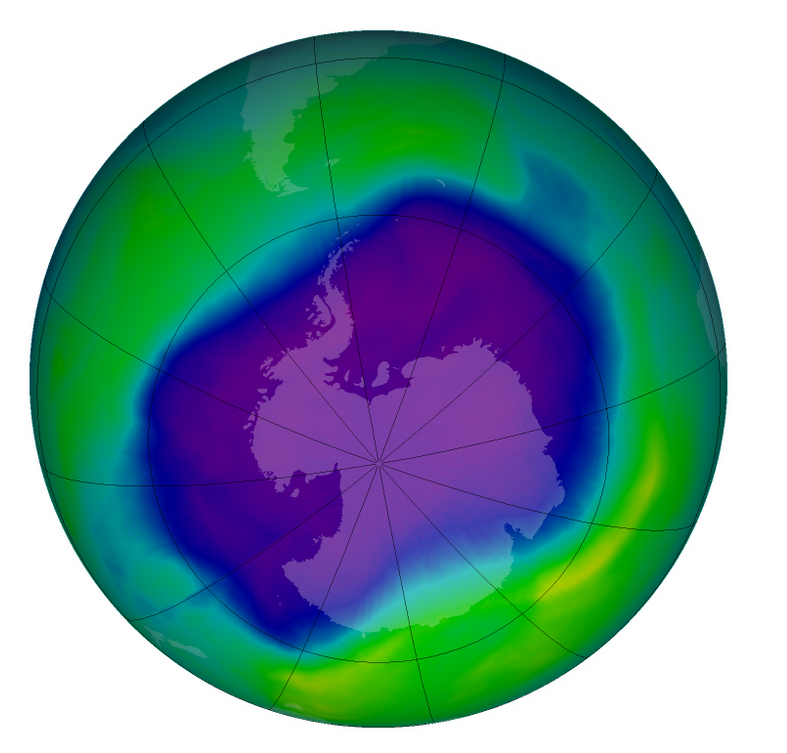
From multiple observations during the day with UV spectrophotometers a daily value of the ozone column is calculated. This product is not publically available yet.
-

Share of the cadastral surface area that is not artificially developed in the cadastral and not unknown surface area to the administrative entity (region, province, district and municipality) for Wallonia
-
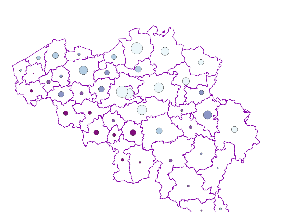
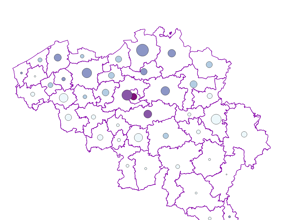
The ratio of the number of people aged over 80 to the number of people aged over 65 according to official statistics, per administrative entity (region, province, district and municipality) for Wallonia
-

Buyers' origin - Natural persons corresponds to the dataset describing the origin of the buyers (natural persons) of real estate located in Belgium according to their municipality of residence for residents and according to their country or territory of residence for the non-residents (residence at the date of the deed). This dataset is made up of seven classes. The first class shows, at national level, for each type of property, the total number of parcels, the number of parcels acquired by buyers from each Belgian municipality and the number of parcels acquired by buyers from each country or territory. The number of parcels takes into account the shares actually acquired. The second class shows this information at the level of the three regions. The following classes do the same at the level of provinces, arrondissements, municipalities, land register divisions and statistical sectors. The dataset is freely downloadable, in the form of zipped CSV files.
-
Characteristics of cadastral parcels - Concentration of cadastral income corresponds to the dataset measuring the concentration of cadastral income for parcels of a housing-like nature. This dataset is composed of seven classes. The first class shows, at the national level, for each category of parcels dedicated to housing, the number of parcels and the total cadastral income of the parcels by cadastral income bracket. The second class includes this information at the level of the three regions. The following classes do the same at the level of provinces, arrondissements, municipalities, cadastral divisions and statistical sectors. The dataset can be freely downloaded as a zipped CSV.
-

Characteristics of the cadastral parcels - Rights of natural persons corresponds to the dataset describing the natural persons holding real rights on the parcels such as recorded by the FPS Finance for registration purposes. This dataset is composed of seven classes. The first class shows, at the national level, for each cadastral nature and for each type of real right, the number of parcels, their total cadastral income, as well as the number of parcels on which natural persons of the age and sex concerned hold the concerned real rights. The second class includes this information at the level of the three regions. The following classes do the same at the level of provinces, arrondissements, municipalities, cadastral divisions and statistical sectors. The dataset can be freely downloaded as a zipped CSV.
-
Total of undeveloped aera en de part of undeveloped aera in relation to the total surface - Flanders
The areas not included in the settelement area considered to be categories of open space. However, open space should not be confused with green or undeveloped space. The settelement area also includes various forms of non-paved green space, such as gardens and parks or sports grounds and these are counted as developed area. These indicators show the total area of open space expressed in m² en de part of open area in relation to the total surface per administrative unit (region, province, district and municipality) for Flanders.
-

Characteristics of the cadastral parcels - Exemption from withholding tax on immovable property corresponds to the dataset describing the parcels exempted from withholding tax on immovable property. The first class shows, at the national level, the number of parcels per exemption category, the total amount of cadastral income of these parcels, their surface area as well as the median cadastral income of each category. The second class includes this information at the level of the three regions. The following classes do the same at the level of provinces, arrondissements, municipalities, cadastral divisions and statistical sectors. The dataset can be freely downloaded as a zipped CSV.
-
The ratio of the number of people aged over 80 to the number of people aged over 65 according to official statistics, per administrative entity (region, province, district and municipality) for Flanders
-
Real estate transactions - annual version corresponds to the dataset describing transactions of real rights on real estate property such as recorded by the FPS Finance for registration purposes. This dataset is composed of five classes. The first class shows, at the national level, for each cadastral nature and for each type of transaction, the number of real estate property concerned by a transaction as well as market values of these transactions. The second class includes this information at the level of the three regions. The following classes do the same at the level of provinces, arrondissements, municipalities. The dataset can be freely downloaded as a zipped CSV.