 geo.be Metadata Catalog
boundaries
Type of resources
Available actions
Topics
INSPIRE themes
federalThemes
Keywords
Contact for the resource
Provided by
Years
Formats
Representation types
Update frequencies
status
Scale
Resolution
-
The data set includes three types of breakdown: Cities, Larger Urban zones or Functional Urban areas. BE_StatisticsBelgium_SH_SU_UA_CITY presents in the form of polygons the borders of the Belgian cities participating to the Urban Audit of the European Commission. Some cities consist in only one municipality (LAU2) while the others are the result of the aggregation of several municipalities (LAU2). Several versions of the breakdown (2001, 2002, 2010, 2019) follow one another because over the years new cities have taken part in it. The files can be linked to the statistical data collected for the Urban Audit. BE_StatisticsBelgium_SH_SU_UA_LUZ and BE_StatisticsBelgium_SH_SU_UA_FUA present in the form of polygons the areas of influence of the Urban Audit cities on the surrounding municipalities. The initial concept of Larger Urban Zones (LUZ) was replaced by the concept of Functional Urban areas (FUA) to take into account the movement of workers to the Urban Audit cities. LUZ / FUA are an aggregation of municipalities (LAU2). Several versions of the breakdown (2001, 2002, 2010, 2019) follow one another because over the years new LUZ / FUA have appeared or have seen their extension modified. The files can be linked to the statistical data collected for the Urban Audit.
-

The dataset shows in the form of polygons the sand and gravel extraction sites in the Belgian marine areas as defined by the successive marine spatial plans. A 2014 version illustrates the 2014-2020 plan while the 2020 version illustrates the 2020-2026 plan.
-
AdminMap is the digital version of the administrative map. Two versions exist: the most complete one on the scale of 1:300 000 and a simplified version on the scale of 1:500 000. These maps show the different administrative units on the Belgian territory, from the federal State to the center of the districts for the 1:500 000. The map also shows the map grid of the National Geographic Institute. An index allows localizing the different units. The index also contains information on the linguistic statutes and on the postal codes.
-

Administrative Units - INSPIRE corresponds to the dataset of the Belgian administrative units that complies with the INSPIRE specifications. This dataset is composed of two classes. The first class contains administrative units and the second class contains administrative boundaries. The class are composed of the following administrative level: Kingdom, Regions, Provinces, and arrondissements, and municipalities. The entire dataset can be downloaded via the ad hoc WFS.
-

Territorial Divisions is the vectorproduct representing the geographical units of Belgium. The product consists of 16 feature types grouped into 4 topics: ‘AdminVector’, ‘Judicial cantons and arrondissements’, ‘Electoral cantons’ and ‘Postal cantons’. The AdminVector dataset includes the statistical, geographical and administrative units of Belgium. The dataset of the judicial cantons and arrondissements displays the geographical units used for the organisation of the courts. The dataset of the electoral cantons consists of geographical units used for the organisation of elections. The dataset of the postal cantons includes the boundaries of the Belgian postal cantons. The product can be downloaded in its entirety via the links in 'Access' at the bottom of this page. Each of the themes is also available as separate datasets on their own webpage.
-

The dataset of the electoral cantons represents the geographical unit used for the organization of the elections. The electoral cantons were digitised based on the definitions in the Annex of the Electoral Code, which is managed by the FPS Home Affairs. The dataset consists of a single feature type, namely the boundaries of the electoral cantons [electoralcanton]. This dataset can be downloaded via the links in 'Access' at the bottom of this page.
-

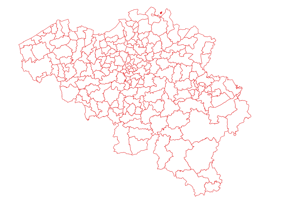
The data set has been established according to the INSPIRE format. It presents in the form of polygons the breakdown of Belgium in almost 20,000 statistical sectors. The statistical sector is the basic territorial unit resulting from the subdivision of the territory of municipalities by STATBEL since 1970 for the dissemination of its statistics at a finer level than the municipal level. A statistical sector cannot extend over two municipalities and any point in the municipal territory is part of one and the same statistical sector. The 1970 and 1981 versions are shown in analogue format while the 2001, 2011, 2018, 2019 etc. versions are available in digital vector format. The files can be linked to the data on population, housing and disposable income on the website of Statbel.
-
The dataset of the judicial cantons and arrondissements represents the geographical subdivisions used in the organization of the courts. The dataset was digitized based on the definitions in the ‘Judicial Code – Annex: Definition of jurisdiction and seat of courts and tribunals’, which is managed by the FPS Justice. The dataset consists of 3 feature types, including the boundaries of the judicial cantons [judicialcanton] and arrondissements [judicialarrondissement]. Each judicial canton has at least one peace court [peacecourt], which also constitutes an object type in the dataset. This dataset can be downloaded via the links in 'Access' at the bottom of this page.
-
The data set presents in the form of polygons the breakdown of Belgium in almost 20,000 statistical sectors. The statistical sector is the basic territorial unit resulting from the subdivision of the territory of municipalities by STATBEL since 1970 for the dissemination of its statistics at a finer level than the municipal level. A statistical sector cannot extend over two municipalities and any point in the municipal territory is part of one and the same statistical sector. The 1970 and 1981 versions are shown in analogue format while the 2001, 2011, 2018, 2019 etc. versions are available in digital vector format. The files can be linked to the data on population, housing and disposable income on the website of Statbel.
-
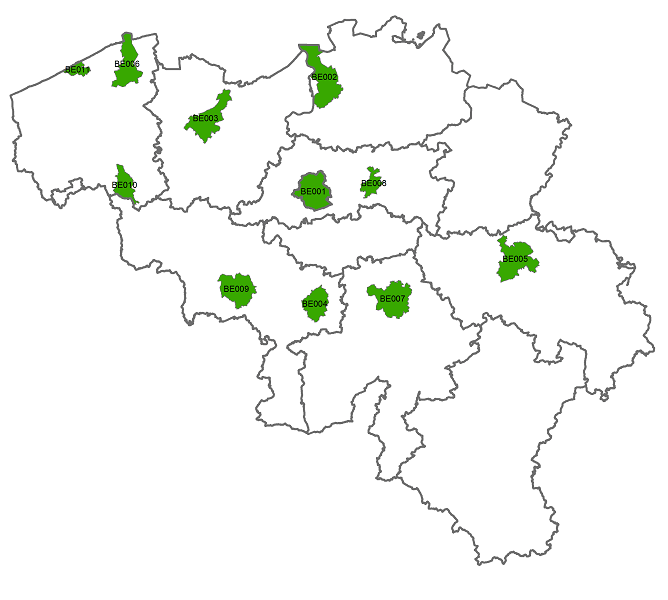
Police zones corresponds to the dataset of the territorial delimitation of the police areas such as defined by the Royal Decrees of April 28th 2000 in accordance with the law of December 7th 1998 organising an integrated police service. This dataset is composed of two classes. The first class contains the identifiers, names and geometries of the various areas; the second is a class without geometry and corresponds to the table of Belgian municipalities with the police area for each of them. The dataset can be freely downloaded as a zipped shapefiles.