 geo.be Metadata Catalog
Marine Strategy Framework Directive
Type of resources
Available actions
Topics
INSPIRE themes
federalThemes
Keywords
Contact for the resource
Provided by
Years
Formats
Representation types
Update frequencies
Service types
-
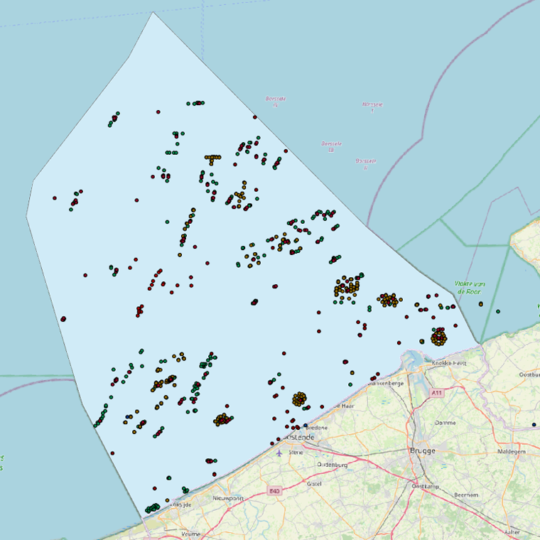
This web service allows viewing the datasets under the Marine Strategy Framework Directive (MSFD).
-

This dataset is part of the 2024 Belgian submission for the Marine Strategy Framework Directive (MSFD) linked to descriptor 10, criterion 1. The seafloor dataset describes the litter gathered between 2012 and 2014 during beam trawl (BTS) fishery surveys in the Belgian part of the North Sea (BPNS). It provides the date, location and haul information, type of litter found and information on the size of the items. Additionally the ship name and cruise references are reported. The data is recorded following ICES guidelines allowing future inclusion in the ICES online database DATRAS (Database of Trawl Surveys). The sludge dataset describes the litter found between 2013 and 2016 on dredge disposal sites located in the coastal area of the Belgian part of the North Sea (BPNS). It provides the date, location, amount and type of litter as well as methodological information (e.g. mesh size). Additionally, the ship name and cruise references are reported. The beach litter dataset contains information on beach litter for the period 2016-2021, washed ashore on reference beaches (Oostende Halve Maan, Oostende Raversijde and, from 2020 onwards, Nieuwpoort Lombardsijde). 17 surveys (100m transects) have been executed until Spring 2021. Monitoring & data recording has been done according to the OSPAR Guideline for Monitoring Marine Litter on the beaches in the OSPAR maritime area (OSPAR, 2010). Besides the number of litter items, the category is also noted. The dataset is characterized by a high variation in the number of items. The data are under consideration to be reported to the OSPAR beach litter database, under the condition that the data cannot be used for trend analyses, because of the nature of the data.
-
This dataset is part of the 2018 Belgian submission for the Marine Strategy Framework Directive (MSFD) linked to descriptor 1, criterion 1. Stranded porpoises often show traces of incidental catch in fishing nets (bycatch), a major cause of death for this cetacean in the North Sea. Based on the number of stranded animals showing traces of bycatch, it can be estimated that up to a few dozen porpoises are caught per year. For extrapolation of bycatch data to effects at population level, reference is made to (future) initiatives at regional level.
-
This dataset is part of the 2024 Belgian submission for the Marine Strategy Framework Directive (MSFD) linked to descriptor 6, criterion 5. It reports on the condition of benthic habitats in the Belgian part of the North Sea (BPNS), combining soft-sediment macrobenthos monitoring (in the framework of dredge disposal/sand extraction impact assessment, and offshore wind farm monitoring) with natural hard-substrate benthos monitoring, to evaluate adverse effects on the biotic and abiotic structure and function of benthic habitat types.
-
This dataset is part of the 2024 Belgian submission for the Marine Strategy Framework Directive (MSFD) linked to descriptor 6, criterion 2. This dataset describes and maps the physical disturbance to the seabed in the Belgian part of the North Sea (BPNS) between 2010 and 2021. The dataset combines different layers of human activities leading to a disturbance of the seabed, including 'soft' beach and foreshore nourishments, dredging and dumping, sand extraction, fisheries, burial of cables, war ammunition stocking and construction of wind farms. The area disturbed is mapped and quantified per year and per activity, and plotted on the predominant broad-scale benthic habitat types of the EUSeaMap 2023. Infield cables from wind farms and Elia cables (NEMO and MOG) are not shown due to mutual agreements. This dataset is part of the 2024 Belgian submission for the Marine Strategy Framework Directive (MSFD) linked to descriptor 6, criterion 1. This dataset describes and maps the physical loss of the seabed in the Belgian part of the North Sea (BPNS) between 2010 and 2021. The dataset combines different layers of human activities leading to a loss of the seabed, including 'hard' coastal defence structures, ports, measuring poles and radar station, protection of pipelines and cables, construction of wind farms, and wrecks and other obstacles. The area lost is mapped and quantified per year and per activity, and plotted on the predominant broad-scale benthic habitat types of the EUSeaMap 2023.
-
This dataset is part of the 2024 Belgian submission for the Marine Strategy Framework Directive (MSFD) linked to descriptor 2, criterion 1. This dataset lists the newly-introduced species encountered in the Belgian part of the North Sea (BPNS) between 2016 and 2021, combining dedicated non-indigenous species (NIS) surveys of artificial hard substrates with incidental NIS records collected during the soft-sediment and epibenthos monitoring programmes.
-
This dataset is part of the 2024 Belgian submission for the Marine Strategy Framework Directive (MSFD) linked to descriptor 8, criterion 1. This dataset reports concentrations of PFAS and dioxins in biota (mussels Mytilus edulis and flounder Platichthys flesus) in the Belgian part of the North Sea.
-
This dataset is part of the 2018 Belgian submission for the Marine Strategy Framework Directive (MSFD) linked to descriptor 4, criterion 2. Three distinct datasets are published for this criterion.'Occurrence of breeding seabirds' describes the observation of eight seabird species (Common tern, Black-headed Gull, Herring Gull, Common Gull, Small Black-backed Gull, Yellow-legged gull, Big Stern and Little Stern) on the Belgian coast between 1992 and 2015. 'Density of seabirds' describes the density of seabirds (N birds/km) observed at large in the Belgian part of the North Sea between 1987 and 2016 (three surveys a year). Thirteen species are monitored and the evolution of each species density is shown as diagrams.'Occurrence of important benthic species' describes the results of Van Veen sampling campaigns performed between 2009 and 2014 in the Belgian part of the North Sea. Benthic species are counted and identified (e.g. Annelida, Echinodermata,..).
-
This dataset is part of the 2024 Belgian submission for the Marine Strategy Framework Directive (MSFD) linked to descriptor 7, criterion 1. This dataset describes the zones that are subject to noticeable permanent alteration of the hydrographic conditions due to human activities and man-made infrastructures for the time period 1992-2022. The data format is shapefiles and includes the zone area (m²) as attribute.
-
This dataset is part of the 2024 Belgian submission for the Marine Strategy Framework Directive (MSFD) linked to descriptor 8, criterion 4. This dataset reports the proportion of oiled Common Guillemots (Uria aalge) among stranded seabirds along the Belgian coast, as an indicator of acute oil pollution (environmental target: average proportion of oiled guillemots below 10% of the total found dead or dying on the beaches).