 geo.be Metadata Catalog
Aerial photographs and orthophotographs
Type of resources
Available actions
Topics
INSPIRE themes
federalThemes
Keywords
Contact for the resource
Provided by
Years
Formats
Representation types
Update frequencies
status
Service types
Resolution
-
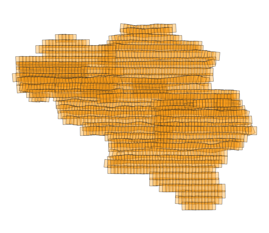
This service allows consultation of the spatial metadata of the complete collection of aerial photos of the National Geographic Institute (NGI), from 1946 to today. The data is accessible via a Web Feature Service (WFS). The collection comprises more than 100,000 aerial photos. The images are predominantly panchromatic (black and white). From the late 1970s onwards, colour images were also taken, and from the end of 2004 onwards all images were taken in colour. The analogue aerial photos in the collection were scanned in high resolution. More recent aerial photos were captured directly in digital format. This specific service includes three layers: the centroids (centre points) of the individual aerial photos, the footprints (the outlines of the area on the ground covered by each photo), and the flight paths of the aircraft used during image acquisition. For each aerial photo, all known metadata is included in the attribute table, such as the acquisition date, the flight and the strip, the dimensions, the scale, the ground resolution, the radiometry (black and white or colour), the coordinates of the centre point, and the camera, lens and film used. This data makes it possible to find out which aerial photos are available for a given location and period, and what the characteristics of each photo are. The aerial photos can be ordered in high resolution via https://shop.ngi.be/nl/luchtfotos/.
-
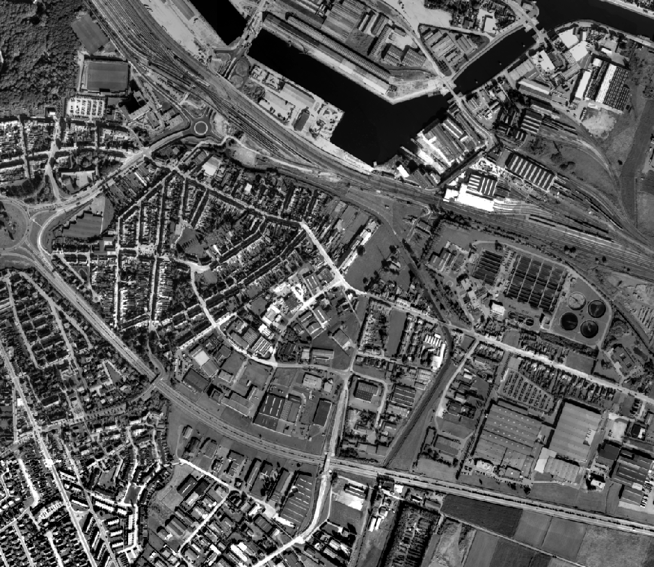
This dataset contains historical orthophoto mosaics based on available aerial photographs covering parts of the Belgian territory. Orthophotos are aerial photographs that have been geometrically corrected (orthorectified) to eliminate distortions caused by terrain relief, lens distortion, and camera tilt. Unlike raw aerial imagery, orthophotos have a uniform scale and accurate geometry, making them suitable for cartography, measurements, and visual analysis. This specific dataset includes historical orthophotos from 2000, 2001, 2002, 2003, 2004, 2005, 2006, 2007, 2008, and 2009, derived from aerial surveys carried out by the National Geographic Institute (NGI) and the Regions. From this period onward, both analogue and digital aerial photographs are available. The analogue images were scanned at high resolution and, like the digital ones, orthorectified. The resulting orthophotos were assembled into mosaics and georeferenced in the Lambert 2008 coordinate system. The orthophotos are either panchromatic (black and white) or in colour (RGB), depending on the year and location. The ground resolution (GSD) varies between 10 cm and 100 cm, depending on the sensor used and the surveyed area. The spatial coverage of this dataset is limited to the areas for which aerial photographs were available during the mentioned period. The data can be visualized via the corresponding web services (WMS/WMTS). The orthophotos and the original aerial photographs can be ordered in high resolution via https://shop.ngi.be/nl/luchtfotos/.
-
This dataset contains historical orthophoto mosaics based on available aerial photographs covering parts of the Belgian territory. Orthophotos are aerial photographs that have been geometrically corrected (orthorectified) to eliminate distortions caused by terrain relief, lens distortion, and camera tilt. Unlike raw aerial imagery, orthophotos have a uniform scale and accurate geometry, making them suitable for cartography, measurements, and visual analysis. This specific dataset includes historical orthophotos from 1989, derived from aerial surveys carried out by the National Geographic Institute (NGI). During this period, only analogue aerial photographs are available. The analogue images were scanned at high resolution and orthorectified. The resulting orthophotos were assembled into mosaics and georeferenced in the Lambert 2008 coordinate system. All orthophotos are panchromatic (black and white). The ground resolution (GSD) is 10 cm. The spatial coverage of this dataset is limited to the areas for which aerial photographs were available during the mentioned period. The data can be visualized via the corresponding web services (WMS/WMTS). The orthophotos and the original aerial photographs can be ordered in high resolution via https://shop.ngi.be/nl/luchtfotos/.
-
This service allows the visualization of historical orthophoto mosaics based on available aerial photographs covering parts of the Belgian territory. The data is accessible via a Web Map Service (WMS). Orthophotos are aerial photographs that have been geometrically corrected (orthorectified) to eliminate distortions caused by terrain relief, lens distortion, and camera tilt. Unlike raw aerial imagery, orthophotos have a uniform scale and accurate geometry, making them suitable for cartography, measurements, and visual analysis. This specific service includes historical orthophotos from 1989, derived from aerial surveys carried out by the National Geographic Institute (NGI). During this period, only analogue aerial photographs are available. The analogue images were scanned at high resolution and orthorectified. The resulting orthophotos were assembled into mosaics and georeferenced in the Lambert 2008 coordinate system. All orthophotos are panchromatic (black and white). The ground resolution (GSD) is 10 cm. The spatial coverage of this service is limited to the areas for which aerial photographs were available during the mentioned period. The service has been cached using the WebMercator TileMatrixSet, with a maximum scale denominator of 4,265.459167699568 metres (scale level 17).
-
This service allows the visualization of historical orthophoto mosaics based on available aerial photographs covering parts of the Belgian territory. The data is accessible via a Web Map Service (WMS). Orthophotos are aerial photographs that have been geometrically corrected (orthorectified) to eliminate distortions caused by terrain relief, lens distortion, and camera tilt. Unlike raw aerial imagery, orthophotos have a uniform scale and accurate geometry, making them suitable for cartography, measurements, and visual analysis. This specific service includes historical orthophotos from 1970, 1971, 1976, 1977, 1978 and 1979, derived from aerial surveys carried out by the National Geographic Institute (NGI). During this period, only analogue aerial photographs are available. The analogue images were scanned at high resolution and orthorectified. The resulting orthophotos were assembled into mosaics and georeferenced in the Lambert 2008 coordinate system. All orthophotos are panchromatic (black and white). The ground resolution (GSD) varies between 25 cm and 50 cm, depending on the sensor used and the surveyed area. The spatial coverage of this service is limited to the areas for which aerial photographs were available during the mentioned period. The service has been cached using the WebMercator TileMatrixSet, with a maximum scale denominator of 4,265.459167699568 metres (scale level 17).
-
This service allows the visualization of historical orthophoto mosaics based on available aerial photographs covering parts of the Belgian territory. The data is accessible via a Web Map Service (WMS). Orthophotos are aerial photographs that have been geometrically corrected (orthorectified) to eliminate distortions caused by terrain relief, lens distortion, and camera tilt. Unlike raw aerial imagery, orthophotos have a uniform scale and accurate geometry, making them suitable for cartography, measurements, and visual analysis. This specific service includes historical orthophotos from 2000, 2001, 2002, 2003, 2004, 2005, 2006, 2007, 2008, and 2009, derived from aerial surveys carried out by the National Geographic Institute (NGI) and the Regions. From this period onward, both analogue and digital aerial photographs are available. The analogue images were scanned at high resolution and, like the digital ones, orthorectified. The resulting orthophotos were assembled into mosaics and georeferenced in the Lambert 2008 coordinate system. The orthophotos are either panchromatic (black and white) or in colour (RGB), depending on the year and location. The ground resolution (GSD) varies between 10 cm and 100 cm, depending on the sensor used and the surveyed area. The spatial coverage of this service is limited to the areas for which aerial photographs were available during the mentioned period. The service has been cached using the WebMercator TileMatrixSet, with a maximum scale denominator of 4,265.459167699568 metres (scale level 17).
-
This service allows the visualization of historical orthophoto mosaics based on available aerial photographs covering parts of the Belgian territory. The data is accessible via a Web Map Service (WMS). Orthophotos are aerial photographs that have been geometrically corrected (orthorectified) to eliminate distortions caused by terrain relief, lens distortion, and camera tilt. Unlike raw aerial imagery, orthophotos have a uniform scale and accurate geometry, making them suitable for cartography, measurements, and visual analysis. This specific service includes historical orthophotos from 2010, 2011, 2012, 2013, 2014 and 2015, derived from aerial surveys carried out by the National Geographic Institute (NGI) and the Regions. During this period, both analogue and digital aerial photographs are available. The analogue images were scanned at high resolution and, like the digital ones, orthorectified. The resulting orthophotos were assembled into mosaics and georeferenced in the Lambert 2008 coordinate system. All orthophotos are in colour (RGB). The ground resolution (GSD) varies between 10 cm and 50 cm, depending on the sensor used and the surveyed area. The spatial coverage of this service is limited to the areas for which aerial photographs were available during the mentioned period. The service has been cached using the WebMercator TileMatrixSet, with a maximum scale denominator of 4,265.459167699568 metres (scale level 17).
-
This dataset contains historical orthophoto mosaics based on available aerial photographs covering parts of the Belgian territory. Orthophotos are aerial photographs that have been geometrically corrected (orthorectified) to eliminate distortions caused by terrain relief, lens distortion, and camera tilt. Unlike raw aerial imagery, orthophotos have a uniform scale and accurate geometry, making them suitable for cartography, measurements, and visual analysis. This specific dataset includes historical orthophotos from 2010, 2011, 2012, 2013, 2014 and 2015, derived from aerial surveys carried out by the National Geographic Institute (NGI) and the Regions. During this period, both analogue and digital aerial photographs are available. The analogue images were scanned at high resolution and, like the digital ones, orthorectified. The resulting orthophotos were assembled into mosaics and georeferenced in the Lambert 2008 coordinate system. All orthophotos are in colour (RGB). The ground resolution (GSD) varies between 10 cm and 50 cm, depending on the sensor used and the surveyed area. The spatial coverage of this dataset is limited to the areas for which aerial photographs were available during the mentioned period. The data can be visualized via the corresponding web services (WMS/WMTS). The orthophotos and the original aerial photographs can be ordered in high resolution via https://shop.ngi.be/nl/luchtfotos/.
-
This dataset contains historical orthophoto mosaics based on available aerial photographs covering parts of the Belgian territory. Orthophotos are aerial photographs that have been geometrically corrected (orthorectified) to eliminate distortions caused by terrain relief, lens distortion, and camera tilt. Unlike raw aerial imagery, orthophotos have a uniform scale and accurate geometry, making them suitable for cartography, measurements, and visual analysis. This specific dataset includes historical orthophotos from 1995, 1997, 1998 and 1999, derived from aerial surveys carried out by the National Geographic Institute (NGI). During this period, only analogue aerial photographs are available. The analogue images were scanned at high resolution and orthorectified. The resulting orthophotos were assembled into mosaics and georeferenced in the Lambert 2008 coordinate system. All orthophotos are panchromatic (black and white). The ground resolution (GSD) varies between 25 cm and 100 cm, depending on the sensor used and the surveyed area. The spatial coverage of this dataset is limited to the areas for which aerial photographs were available during the mentioned period. The data can be visualized via the corresponding web services (WMS/WMTS). The orthophotos and the original aerial photographs can be ordered in high resolution via https://shop.ngi.be/nl/luchtfotos/.
-
This dataset contains the spatial metadata of the complete collection of aerial photos of the National Geographic Institute (NGI), from 1946 to today. The aerial photos themselves are not part of the dataset. The collection comprises more than 100,000 aerial photos. The images are predominantly panchromatic (black and white). From the late 1970s onwards, colour images were also taken, and from the end of 2004 onwards all images were taken in colour. The analogue aerial photos in the collection were scanned in high resolution. More recent aerial photos were captured directly in digital format. This specific dataset includes three layers: the centroids (centre points) of the individual aerial photos, the footprints (the outlines of the area on the ground covered by each photo), and the flight paths of the aircraft used during image acquisition. For each aerial photo, all known metadata is included in the attribute table, such as the acquisition date, the flight and the strip, the dimensions, the scale, the ground resolution, the radiometry (black and white or colour), the coordinates of the centre point, and the camera, lens and film used. This data makes it possible to find out which aerial photos are available for a given location and period, and what the characteristics of each photo are. The data can be consulted via the associated web service (WFS). The aerial photos can be ordered in high resolution via https://shop.ngi.be/nl/luchtfotos/.