 geo.be Metadata Catalog
Royal Belgian Institute of Natural Sciences (RBINS)
Type of resources
Topics
INSPIRE themes
Keywords
Contact for the resource
Provided by
Years
Formats
Representation types
Scale
-
The Royal Decree of 20 March 2026 establishing the marine spatial plan for the period 2026 to 2034 in the Belgian marine areas defines 12 sand and gravel extraction zones: Sand and gravel extraction sector 1a (Thorntonbank) (Art. 19§1.1°), Sand and gravel extraction sector 4d (Art. 19§1.10°), Sand and gravel extraction sector 5 (Blighbank) (Art. 19§1.11°), Sand extraction sector 2kb (Kwintebank) (Art. 19§1.2°), Sand extraction sector 2br (Buiten Ratel) (Art. 19§1.3°), Sand extraction sector 2od (Oostdyck) (Art. 19§1.4°), Sand and gravel extraction sector 3a (Sierra Ventana) (Art. 19§1.5°), Sand and gravel extraction sector 3b (Sierra Ventana) (Art. 19§1.6°), Sand and gravel extraction sector 4a (Noordhinder) (Art. 19§1.7°), Sand and gravel extraction sector 4b (Oosthinder North) (Art. 19§1.8°), Sand and gravel extraction sector 4c (Oosthinder South) (Art. 19§1.9°), Extraction search zone (Art. 19§4). It replaces the 2020 Marine Spatial Plan. Please refer to the Belgian official gazette ("Moniteur belgeBelgisch Staatsblad") for official reference information.
-
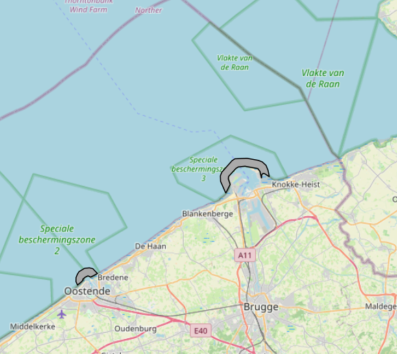
The Royal Decree of 20 March 2026 establishing the marine spatial plan for the period 2026 to 2034 in the Belgian marine areas defines 2 potential seaport expansion zones: Potential expansion of the Port of Ostend (Art. 16§2), Potential expansion of the Port of Zeebrugge (Art. 16§3). It replaces the 2020 Marine Spatial Plan. Please refer to the Belgian official gazette ("Moniteur belgeBelgisch Staatsblad") for official reference information.
-
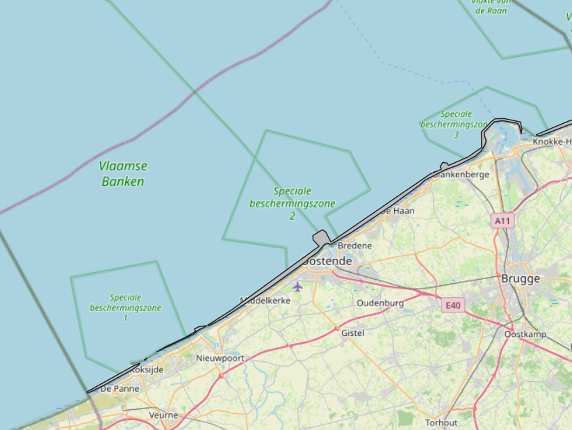
The Royal Decree of 20 March 2026 establishing the marine spatial plan for the period 2026 to 2034 in the Belgian marine areas defines 1 coastal protection experiments zone: Coastal protection belt (Art. 20§2). It replaces the 2020 Marine Spatial Plan. Please refer to the Belgian official gazette ("Moniteur belgeBelgisch Staatsblad") for official reference information.
-
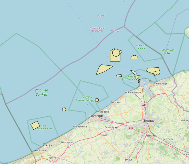
The Royal Decree of 20 March 2026 establishing the marine spatial plan for the period 2026 to 2034 in the Belgian marine areas defines 13 dredging zones: Dredge spoil disposal zone S1 (Art. 15§1.1°), Dredge spoil disposal zone S2 (Art. 15§1.2°), Dredge spoil disposal zone "Public Works Ostend" (Art. 15§1.3°), Dredge spoil disposal zone "Public Works Zeebrugge East" (Art. 15§1.4°), Dredge spoil disposal zone "Public Works Zeebrugge West" (Art. 15§1.5°), Dredge spoil disposal site "Public Works Nieuwpoort" (Art. 15§1.6°), Dredge spoil disposal zone "Zeebrugge Erosion Pit" (Art. 15§1.7°), Zone 1 for future replacement of dredge spoil zone S1 (Art. 15§4.1°), Zone 2 for future replacement of dredge spoil zone S1 (Art. 15§4.2°), Search zone 1 for future replacement of Zeebrugge East and West (Art. 15§6), Search zone 2 for future replacement of Zeebrugge East and West (Art. 15§6), Search zone 3 for future replacement of Zeebrugge East and West (Art. 15§6), Dredge spoil disposal zone for future replacement "Public Works Nieuwpoort" (Art. 15§8). It replaces the 2020 Marine Spatial Plan. Please refer to the Belgian official gazette ("Moniteur belgeBelgisch Staatsblad") for official reference information.
-
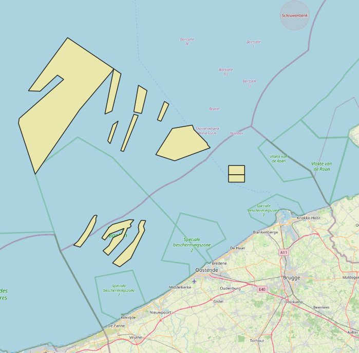
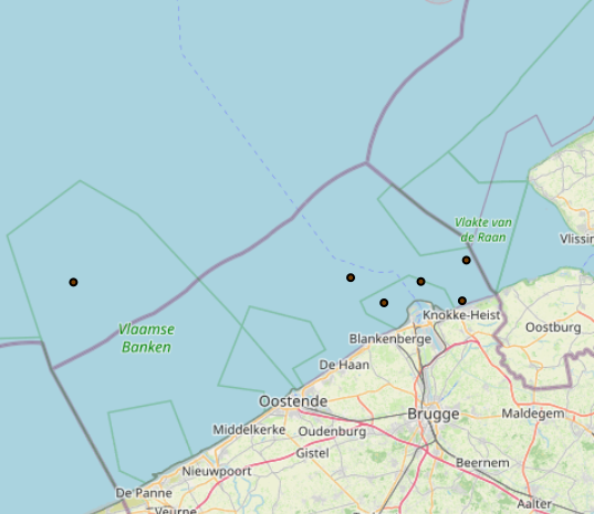
2019 Belgian MSP - Princess Elizabeth Zone for renewable Energy in the Belgian Part of the North Sea
This dataset represents the location of the Princess Elizabeth zone in the Belgian Part of the North Sea as described in the Royal Decree of May 22th, 2019, establishing a marine spatial plan for the period 2020-2026. Art. 8. § 3.
-

This dataset represents the exact location of active telecommunication cables (verified in 2010) installed in the Belgian Part of the North Sea.
-
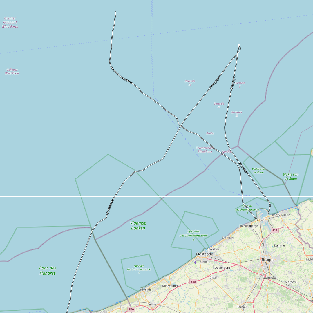
This dataset represents the exact location of gas pipelines installed in the Belgian Part of the North Sea.
-
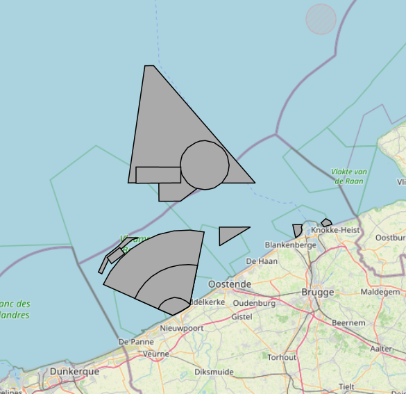
The Royal Decree of 20 March 2026 establishing the marine spatial plan for the period 2026 to 2034 in the Belgian marine areas defines 13 military use zones: Mine warfare exercise zone – QZR 040 (Art. 21§1.1°), Mine warfare exercise zone – NBH-10 (Wenduine) (Art. 21§1.2°), Mine warfare exercise zone – NB-01 (Westhinder) (Art. 21§1.3°), Mine warfare exercise zone (Buiten Ratel) (Art. 21§1.4°), Belgisch Nationaal Oefengebied voor Marineschepen (BNOM) (Art. 21§1.5°), Shallow Water Zone (Art. 21§1.6°), Zone for detonation exercises and operations (Art. 21§2), Lombardsijde firing sector: small sector (Art. 21§3.1°), Lombardsijde firing sector: middle sector (Art. 21§3.2°), Lombardsijde firing sector: large sector (Art. 21§3.3°), Paardenmarkt munitions disposal site (Art. 22§1). It replaces the 2020 Marine Spatial Plan. Please refer to the Belgian official gazette ("Moniteur belgeBelgisch Staatsblad") for official reference information.
-
The Royal Decree of 20 March 2026 establishing the marine spatial plan for the period 2026 to 2034 in the Belgian marine areas defines 1 measuring pole: Measurement poles (Art. 25§2). It replaces the 2020 Marine Spatial Plan. Please refer to the Belgian official gazette ("Moniteur belgeBelgisch Staatsblad") for official reference information.
-

This dataset represents the exact location of disused telecommunication cables installed in the Belgian Part of the North Sea.