 geo.be Metadata Catalog
Earth observation and environment
Type of resources
Topics
INSPIRE themes
Keywords
Contact for the resource
Provided by
Years
Formats
Representation types
Scale
-
This dataset represents main data about the cores of Belgian boreholes that are stored by the Royal Belgian Institute of Natural Sciences. Data is distributed as shapefile with multiple meta-infomations such as unique borehole reference, depth, location, lithology and a link to access the core and lithological descriptions.
-

This dataset is part of the 2024 Belgian submission for the Marine Strategy Framework Directive (MSFD) linked to descriptor 1, criterion 1. It reports the mortality rate of marine mammals, in particular harbour porpoise (Phocoena phocoena), from incidental bycatch in the Belgian part of the North Sea, combining strandings investigations, reported incidental catches and aerial abundance surveys.
-
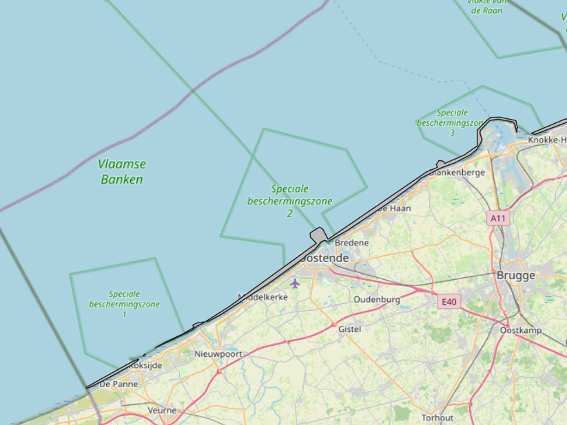
The Royal Decree of 20 March 2026 establishing the marine spatial plan for the period 2026 to 2034 in the Belgian marine areas defines 1 coastal protection experiments zone: Coastal protection belt (Art. 20§2). It replaces the 2020 Marine Spatial Plan. Please refer to the Belgian official gazette ("Moniteur belgeBelgisch Staatsblad") for official reference information.
-
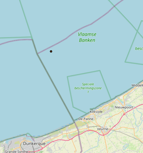
The Royal Decree of 20 March 2026 establishing the marine spatial plan for the period 2026 to 2034 in the Belgian marine areas defines 1 radar tower: Oostdyck radar tower (Art. 25§3). It replaces the 2020 Marine Spatial Plan. Please refer to the Belgian official gazette ("Moniteur belgeBelgisch Staatsblad") for official reference information.
-
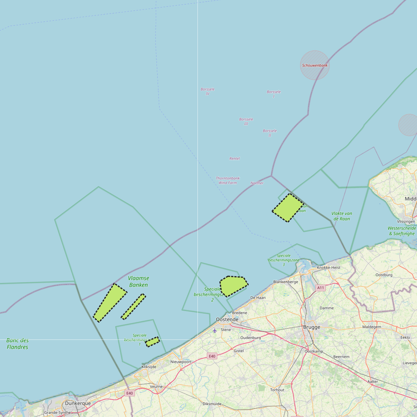
The Royal Decree of 22 May 2019 establishing a marine spatial plan defines 5 commercial and industrial zones: Zone A for commercial and industrial activities (Art. 23§1), Zone B for commercial and industrial activities (Art. 23§1), Zone C for commercial and industrial activities (Art. 23§1), Zone D for commercial and industrial activities (Art. 23§1), Zone E for commercial and industrial activities (Art. 23§1). Please refer to the Belgian official gazette (\"Moniteur belge/Belgisch Staatsblad\") for official reference information.
-
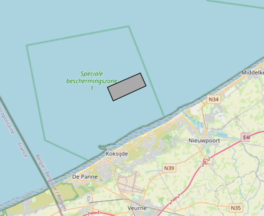
The Royal Decree of 20 March 2026 establishing the marine spatial plan for the period 2026 to 2034 in the Belgian marine areas defines 1 commercial and industrial zones: Zone C for commercial and industrial activities (Art. 27§1). It replaces the 2020 Marine Spatial Plan. Please refer to the Belgian official gazette ("Moniteur belgeBelgisch Staatsblad") for official reference information.
-
This dataset is part of the 2018 Belgian submission for the Marine Strategy Framework Directive (MSFD) linked to descriptor 1, criterion 3. Occurrence of breeding seabirds describes the observation of eight seabird species (Common tern, Black-headed Gull, Herring Gull, Common Gull, Small Black-backed Gull, Yellow-legged gull, Big Stern and Little Stern) on the Belgian coast between 1992 and 2015.
-
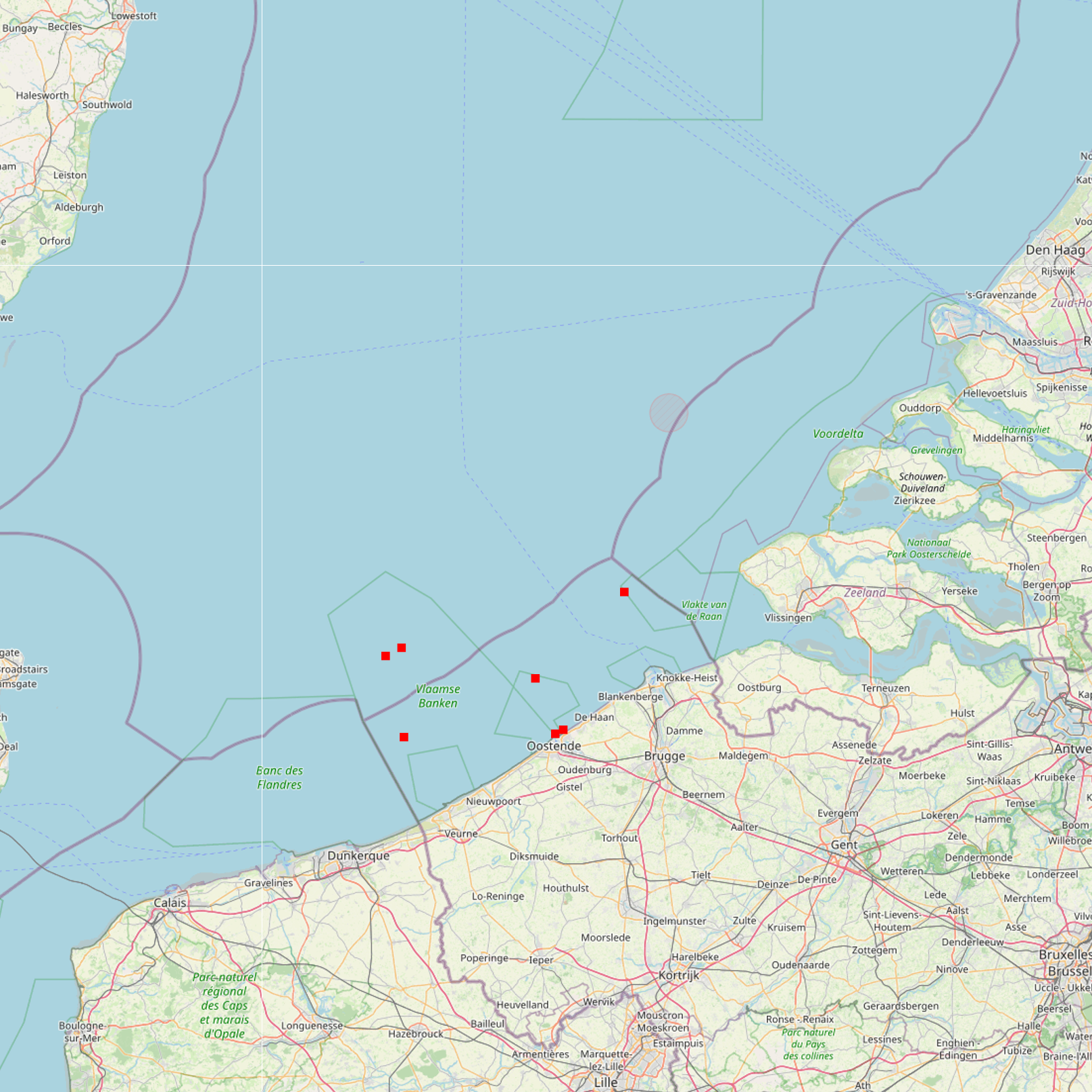
The Royal Decree of 22 May 2019 establishing a marine spatial plan defines 7 cultural heritage (wrecks) zones: 'HMS Briljant' wreck (Art. 22), 'SS Kilmore' wreck (Art. 22), '’t Vliegend Hart' wreck (Art. 22), 'U-11' wreck (Art. 22), 'West Hinder' wreck (Art. 22), Wooden wreck 'Oostende' (Art. 22), Wreck site 'Buiten Ratel' (Art. 22). Please refer to the Belgian official gazette (\"Moniteur belge/Belgisch Staatsblad\") for official reference information.
-
This dataset is part of the 2018 Belgian submission for the Marine Strategy Framework Directive (MSFD) linked to descriptor 8, criterion 1. This dataset describes the contaminant concentrations in biota. The priority substances mercury, hexachlorobutadiene and hexachlorobenzene are measured in mussels and flounder in the BPNS. Results for other parameters that are part of the OSPAR Coordinated Environmental Monitoring Program are also included: polychlorinated biphenyls (PCBs), polycyclic aromatic hydrocarbons (PAHs), heavy metals, organotin-compounds and polybrominated diphenyl ethers (PBDEs) for the period 2011-2016. The analyses are performed by ILVO and KBIN-OD Nature that both participate in the Quasimeme ring tests for additional quality control. Bird eggs of 2008, 2010 and 2015 are measured for mercury (Hg), dichlorodiphenyltrichloroethane (DDT), hexachlorobenzene (HCB) and hexachlorocyclohexane (HCH). Eggs from the are measured and compared with OSPAR norms Common Tern (Sterna hirundo) are gathered in Zeebrugge and are analyzed by the Insitut für vogelforschung in Wilhelmshaven according to a standard protocol.
-
This dataset is part of the 2018 Belgian submission for the Marine Strategy Framework Directive (MSFD) linked to descriptor 7, criterion 1. This dataset describes the impact of an offshore windmills farm on the hydrodynamics in the Belgian part of the North Sea (BPNS). Originally, it is a NetCDF file with the results of the reference simulation made with the COHERENS (COupled Hydrodynamical Ecological model for REgioNal Shelf seas) hydrodynamic model only forced by tides (no wind effect). Model resolution : ~ 12.5m. It contains both the reference situation which is a simulation without any windmill and the modeling result of the influence by the windmills on the hydrodynamic in the BPNS. The dataset contains the results on the most inner nested grid level for one reference spring-neap cycle: - hourly sea surface elevation - hourly bottom shear stress - hourly 3D horizontal velocity components (u,v) - hourly 3D eddy viscosity - time-averaged bottom shear stress over the reference spring-neap cycle - percentile 90 of the bottom shear stress for the reference spring-neap cycle - percentile 90 of the specific kinetic energy at the sea bed - accumulated time during which sedimentation processes are dominant - accumulated time during which re-suspension processes are dominant.