 geo.be Metadata Catalog

Type of resources
Available actions
Topics
INSPIRE themes
federalThemes
Keywords
Contact for the resource
Provided by
Years
Formats
Representation types
Update frequencies
status
Service types
Scale
Resolution
-

Points Of Interest - patrimonial elements contains point elements relating to the patrimony, namely (water and wind)mill, (historic, commemoration, fortified) building, historic mound, ice house, castle, kiosk, shoring, non-religious monument, monumental stairs in Belgium.
-
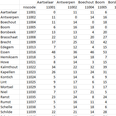
This dataset contains a matrix of distances between all Belgian municipality centres as defined in the AdminVector product. The distance is in km and is rounded to an integer.
-

The ratio of the number of people aged over 80 to the number of people aged over 65 according to official statistics, per administrative entity (region, province, district and municipality) for Flanders
-
Web service with currently available electronic terrain and obstacle data in Area 1 related to: - Implementing Regulation (EU) No 2017/373 on, inter alia, the common requirements for air navigation service providers, as subsequently amended; - Annex 15 to the Chicago Convention on International Civil Aviation; - ICAO document 10066 PANS-AIM: Procedures for air navigation services, Aeronautical Information Management.
-

This web service allows viewing/downloading datasets from Electricity network
-
Share of the cadastral surface area that is artificially developed in the cadastral surface area and not unknown to the administrative entity (region, province, district and municipality) for Wallonia
-

The Solar Ultraviolet - Visible Irradiance Monitoring network (SUVIM) is formed of observation stations operated by the Royal Belgian Institute for Space Aeronomy (IASB-BIRA). At each station, UV solar radiation is measured by several instruments. The network produces UV indices, solar irradiances and ancillary measurements such as meteorological conditions at the stations in quasi-real time. The SUVIM Station Network dataset includes information on the stations. It does not include the measured data, which form the SUVIM Observations dataset.
-

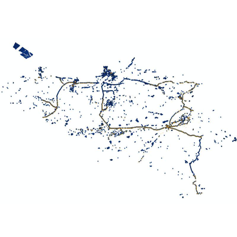
Govroam is a " wifi roaming " solution. This service offers to the users a simple and secure access to the wireless network of their institution, but also to networks of other participating institutions. A user from an organization that participates in govroam will be able to connect to any wireless access point broadcasting govroam. The data provided here makes it possible to locate these access points.
-

Natura 2000 (N2K) is a network of core breeding and resting sites for rare and threatened species, as well as for some rare natural habitat types which are protected in their own right. It stretches across all 28 EU countries, both on land and at sea. The aim of the network is to ensure the long-term survival of Europe's most valuable and threatened species and habitats that are listed under the Birds Directive and the Habitats Directive. This dataset contains the sites in Belgium.
-

This is the discovery service of the pan-European spatial datasets provided by the European mapping and cadastral agencies: EuroGlobalMap, EuroRegionalMap, EuroDEM, Open Cadastral Map, Pan-European Imagery, Open Gazetteer. The datasets are openly available accessible on the platform Open Maps for Europe (OME) http://www.mapsforeurope.org/.