 geo.be Metadata Catalog
view
Type of resources
Available actions
INSPIRE themes
federalThemes
Keywords
Contact for the resource
Provided by
Years
Formats
Update frequencies
status
Service types
-

This service allows the visualization of historical orthophoto mosaics based on available aerial photographs covering parts of the Belgian territory. The data is accessible via a Web Map Service (WMS). Orthophotos are aerial photographs that have been geometrically corrected (orthorectified) to eliminate distortions caused by terrain relief, lens distortion, and camera tilt. Unlike raw aerial imagery, orthophotos have a uniform scale and accurate geometry, making them suitable for cartography, measurements, and visual analysis. This specific service includes historical orthophotos from 2010, 2011, 2012, 2013, 2014 and 2015, derived from aerial surveys carried out by the National Geographic Institute (NGI) and the Regions. During this period, both analogue and digital aerial photographs are available. The analogue images were scanned at high resolution and, like the digital ones, orthorectified. The resulting orthophotos were assembled into mosaics and georeferenced in the Lambert 2008 coordinate system. All orthophotos are in colour (RGB). The ground resolution (GSD) varies between 10 cm and 50 cm, depending on the sensor used and the surveyed area. The spatial coverage of this service is limited to the areas for which aerial photographs were available during the mentioned period. The service has been cached using the WebMercator TileMatrixSet, with a maximum scale denominator of 4,265.459167699568 metres (scale level 17).
-

This view service allows visualization of the Hillshade DSM1m, the shaded version of the digital surface model at a resolution of 1m.
-

This view service allows visualization of the Hillshade DTM1m, the shaded version of the digital terrain model at a resolution of 1m.
-
This service allows the visualization of historical orthophoto mosaics based on available aerial photographs covering parts of the Belgian territory. The data is accessible via a Web Map Service (WMS). Orthophotos are aerial photographs that have been geometrically corrected (orthorectified) to eliminate distortions caused by terrain relief, lens distortion, and camera tilt. Unlike raw aerial imagery, orthophotos have a uniform scale and accurate geometry, making them suitable for cartography, measurements, and visual analysis. This specific service includes historical orthophotos from 1995, 1997, 1998 and 1999, derived from aerial surveys carried out by the National Geographic Institute (NGI). During this period, only analogue aerial photographs are available. The analogue images were scanned at high resolution and orthorectified. The resulting orthophotos were assembled into mosaics and georeferenced in the Lambert 2008 coordinate system. All orthophotos are panchromatic (black and white). The ground resolution (GSD) varies between 25 cm and 100 cm, depending on the sensor used and the surveyed area. The spatial coverage of this service is limited to the areas for which aerial photographs were available during the mentioned period. The service has been cached using the WebMercator TileMatrixSet, with a maximum scale denominator of 4,265.459167699568 metres (scale level 17).
-

This web service provides a display of the Administrative Units - INSPIRE datase This webservice complies with the INSPIRE specifications.
-
This service allows the visualization of historical orthophoto mosaics based on available aerial photographs covering parts of the Belgian territory. The data is accessible via a Web Map Service (WMS). Orthophotos are aerial photographs that have been geometrically corrected (orthorectified) to eliminate distortions caused by terrain relief, lens distortion, and camera tilt. Unlike raw aerial imagery, orthophotos have a uniform scale and accurate geometry, making them suitable for cartography, measurements, and visual analysis. This specific service includes historical orthophotos from 2000, 2001, 2002, 2003, 2004, 2005, 2006, 2007, 2008, and 2009, derived from aerial surveys carried out by the National Geographic Institute (NGI) and the Regions. From this period onward, both analogue and digital aerial photographs are available. The analogue images were scanned at high resolution and, like the digital ones, orthorectified. The resulting orthophotos were assembled into mosaics and georeferenced in the Lambert 2008 coordinate system. The orthophotos are either panchromatic (black and white) or in colour (RGB), depending on the year and location. The ground resolution (GSD) varies between 10 cm and 100 cm, depending on the sensor used and the surveyed area. The spatial coverage of this service is limited to the areas for which aerial photographs were available during the mentioned period. The service has been cached using the WebMercator TileMatrixSet, with a maximum scale denominator of 4,265.459167699568 metres (scale level 17).
-

This web service allows viewingdatasets from bpost.
-

INSPIRE compliant view service for geographic information of the Marine Spatial Plan made available by the Royal Belgian Institute for Natural Sciences (RBINS).
-

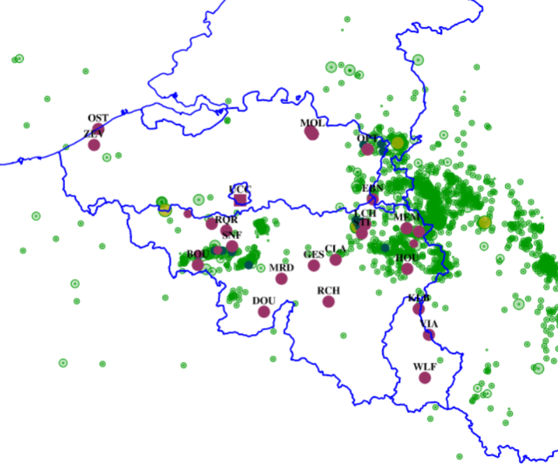
View Service (WMS) for Networks of automatic lidar-ceilometer systems The data are updated each 10 minutes. Only the archives of the last 30 days are available.
-
This web service allows viewing ROB datasets. This service is compliant with the INSPIRE specifications.