 geo.be Metadata Catalog
inlandWaters
Type of resources
Available actions
INSPIRE themes
federalThemes
Provided by
Formats
Representation types
Update frequencies
status
Scale
-

The entities included in dataset represent the Belgian waterway transport network in the sense of the Inspire European directive. The dataset comprises several classes and is in accordance with the INSPIRE specifications. The class represents, in a linear manner, all of the waterway links between each pair of dots for the network considered. In addition to this is one class without geometry. The RestrictionForWaterCehicles class specifies for each segment the maximum tonnage of the building using the segment.
-

Top10Vector – Hydrography is the dataset of the Belgian hydrography. This dataset includes six classes. First class: waterway kilometer markers of the Belgian navigable waterways. Second class: watercourse surfaces. Third class: watercourse segments. Fourth class: water points, which means points where the water arrives at the surface or disappears into the subsoil. Fifth class: wetlands, which means zones where the soil is saturated or regularly flooded. Sixth class: water surfaces. This dataset can be downloaded via the link in 'Access'.
-
The entities included in the dataset represent the physical network in the sense of the Inspire European directive. The dataset comprises several classes and is in accordance with the INSPIRE specifications. The Wetland class represents poorly drained or periodically flooded portions of land, the soil of which is saturated with water but where vegetation is nevertheless able to develop. The StandingWater class represents flooded areas that are, nevertheless, completely surrounded by land.
-
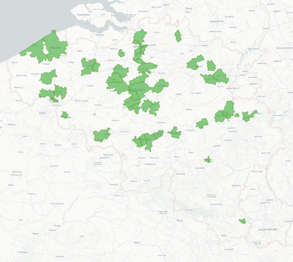
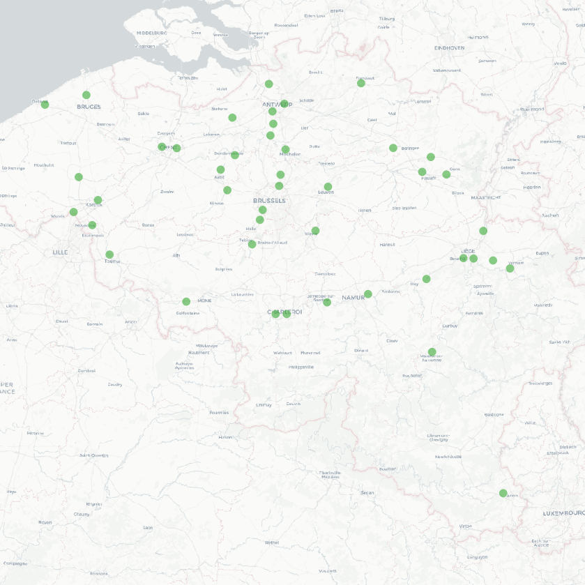
The national wastewater-based epidemiological surveillance monitors public health parameters in several wastewater treatment plants across Belgium. This dataset contains the catchment areas per treatment plant since the beginning of the surveillance in September 2020.
-
The national wastewater-based epidemiological surveillance of respiratory syncytial virus (RSV) monitors the RSV presence in several wastewater treatment plants across Belgium. This dataset contains the results per treatment plant since the beginning of the surveillance in January 2024. The results consist of the RSV concentrations over time as well as other data needed for the interpretations such as the flow rates of the treatment plants and the population covered.
-
The national wastewater-based epidemiological surveillance of psychoactive substances monitors the presence of various psychoactive substances in several wastewater treatment plants across Belgium. This dataset contains the results per treatment plant since the beginning of the surveillance in 2025. The results consist of the psychoactive substances concentrations over time as well as other data needed for the interpretations such as the flow rates of the treatment plants and the population covered.
-
The national wastewater-based epidemiological surveillance monitors public health parameters in several wastewater treatment plants across Belgium. The PMMoV virus is an indicator of human faecal contamination used to estimate the population load in wastewater samples. The results of this dataset consist of PMMoV concentrations over time as well as other data needed for the interpretations such as the flow rates of the treatment plants and the population covered.
-
The national wastewater-based epidemiological surveillance of influenza (commonly known as flu) monitors the influenza presence in several wastewater treatment plants across Belgium. This dataset contains the results per treatment plant since the beginning of the surveillance in January 2024. The results consist of the influenza concentrations over time as well as other data needed for the interpretations such as the flow rates of the treatment plants and the population covered.