 geo.be Metadata Catalog
application/xml
Type of resources
Topics
INSPIRE themes
Keywords
Contact for the resource
Provided by
Years
Formats
Representation types
Scale
-
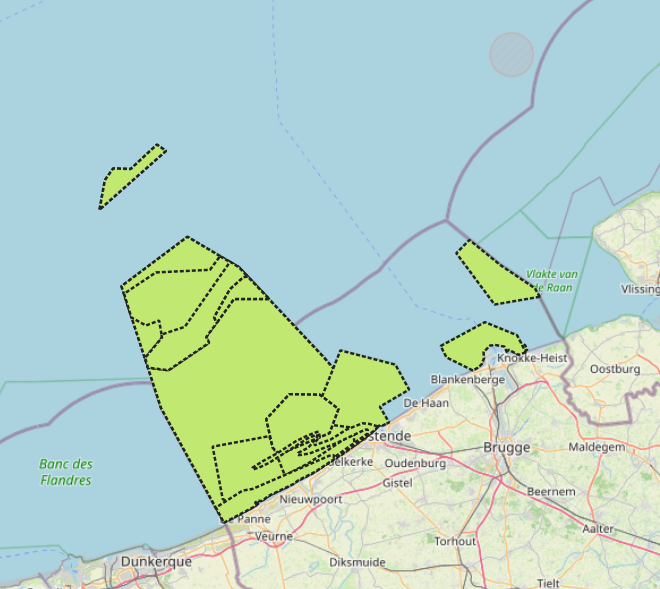
The Royal Decree of 20 March 2026 establishing the marine spatial plan for the period 2026 to 2034 in the Belgian marine areas defines 13 nature conservation areas: Seabed integrity zone: Zone 1, upper (Art. 10§1.1°), Seabed integrity zone: Zone 2, middle (Art. 10§1.2°), Seabed integrity zone: Zone 3, lower (Art. 10§1.3°), Ramsar area (Art. 11), Special Area of Conservation "Vlaamse Banken" (Art. 8§1), Special Area of Conservation "Vlakte van de Raan" (Art. 8§3), Special Protection Area for Birds: SPA 1 (Art. 8§5.1°), Special Protection Area for Birds: SPA 2 (Art. 8§5.2°), Special Protection Area for Birds: SPA 3 (Art. 8§5.3°), Marine reserve: Zone 1, upper (Art. 9§1.1°), Marine reserve: Zone 2a, middle (Art. 9§1.2°), Marine reserve: Zone 2b, middle (Art. 9§2), Marine reserve: Zone 3, lower (Art. 9§3). It replaces the 2020 Marine Spatial Plan. Please refer to the Belgian official gazette ("Moniteur belgeBelgisch Staatsblad") for official reference information.
-
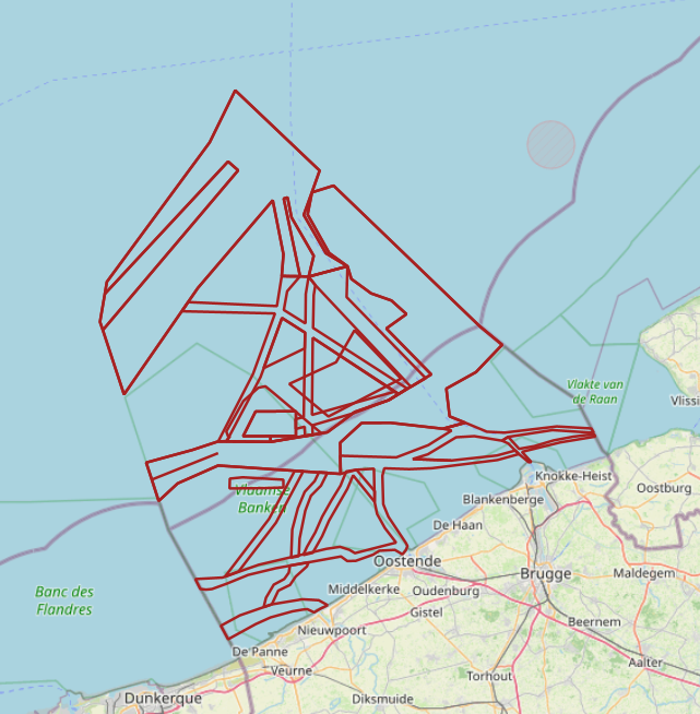
The Royal Decree of 20 March 2026 establishing the marine spatial plan for the period 2026 to 2034 in the Belgian marine areas defines 20 shipping and ports zones: IMO shipping zones (Art. 14§2), Traffic separation schemes (Art. 14§2), IMO traffic separation scheme "Noordhinder South" (Art. 14§2.1°), IMO precautionary area "in the vicinity of Thornton and Blighbank" (Art. 14§2.10°), Other routes and traffic flows (Royal Decree) (Art. 14§2.11°-19°), IMO traffic separation scheme "Off Noordhinder" (Art. 14§2.2°), IMO precautionary area "Noordhinder Junction" (Art. 14§2.3°), IMO traffic separation scheme "At Westhinder" (Art. 14§2.4°), Separation line "At West Hinder" (Art. 14§2.4°), IMO precautionary area "At Westhinder" (Art. 14§2.5°), IMO area to be avoided "At Westhinder" (Art. 14§2.6°), IMO deep-water route "Approach to the Scheldt" (Art. 14§2.7°), IMO two-way route "Westpit" (Art. 14§2.8°), IMO precautionary area "At Gootebank" (Art. 14§2.9°), Anchorage area "Oostdyck" (Art. 14§3.1°), IMO anchorage area "At Westhinder" (Art. 14§3.2°), Maritime safety research zone: Zone 1 (Art. 14§5.1°), Maritime safety research zone: Zone 2 (Art. 14§5.2°), Maritime safety research zone: Zone 3 (Art. 14§5.3°). It replaces the 2020 Marine Spatial Plan. Please refer to the Belgian official gazette ("Moniteur belgeBelgisch Staatsblad") for official reference information.
-
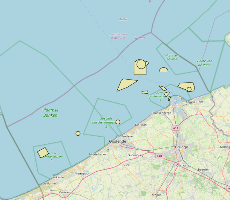
The Royal Decree of 20 March 2026 establishing the marine spatial plan for the period 2026 to 2034 in the Belgian marine areas defines 13 dredging zones: Dredge spoil disposal zone S1 (Art. 15§1.1°), Dredge spoil disposal zone S2 (Art. 15§1.2°), Dredge spoil disposal zone "Public Works Ostend" (Art. 15§1.3°), Dredge spoil disposal zone "Public Works Zeebrugge East" (Art. 15§1.4°), Dredge spoil disposal zone "Public Works Zeebrugge West" (Art. 15§1.5°), Dredge spoil disposal site "Public Works Nieuwpoort" (Art. 15§1.6°), Dredge spoil disposal zone "Zeebrugge Erosion Pit" (Art. 15§1.7°), Zone 1 for future replacement of dredge spoil zone S1 (Art. 15§4.1°), Zone 2 for future replacement of dredge spoil zone S1 (Art. 15§4.2°), Search zone 1 for future replacement of Zeebrugge East and West (Art. 15§6), Search zone 2 for future replacement of Zeebrugge East and West (Art. 15§6), Search zone 3 for future replacement of Zeebrugge East and West (Art. 15§6), Dredge spoil disposal zone for future replacement "Public Works Nieuwpoort" (Art. 15§8). It replaces the 2020 Marine Spatial Plan. Please refer to the Belgian official gazette ("Moniteur belgeBelgisch Staatsblad") for official reference information.
-
This datasets is a compilation of all the campaigns tracks for the two RV Belgica (A962 and 11BU) from 1985 until today. It'll be regularly updated with new data.
-
The law of 13 June 1969 defines “Belgian Continental Shelf” as follows: the seabed and the subsoil of the marine areas adjacent to the Belgian coast but beyond the Belgian territorial sea.
-
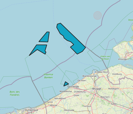
The Royal Decree of 20 March 2026 establishing the marine spatial plan for the period 2026 to 2034 in the Belgian marine areas defines 3 aquaculture zones: Fisheries research zone (Art. 17§2), Zone accessible to aquaculture and passive fisheries (Art. 18), Zone accessible to aquaculture (Art. 18§1). It replaces the 2020 Marine Spatial Plan. Please refer to the Belgian official gazette ("Moniteur belgeBelgisch Staatsblad") for official reference information.
-
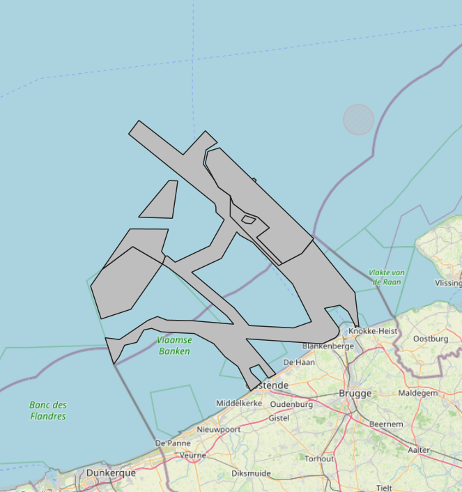
The Royal Decree of 20 March 2026 establishing the marine spatial plan for the period 2026 to 2034 in the Belgian marine areas defines 7 energy, cable and pipeline zones: Renewable energy zone: Zone 1, Eastern Zone (Art. 12§1), Princess Elisabeth renewable energy zone: Zone 2a, Noordhinder North (Art. 12§2.2a°), Princess Elisabeth renewable energy zone: Zone 2b, Noordhinder South (Art. 12§2.2b°), Princess Elisabeth renewable energy zone: Zone 2c, Fairybank (Art. 12§2.3°), Modular offshore grid for electricity transmission (Art. 12§4), Safeguard zone of the Eastern Zone (Art. 12§5), Pipeline and cable corridor (Art. 13§1). It replaces the 2020 Marine Spatial Plan. Please refer to the Belgian official gazette ("Moniteur belgeBelgisch Staatsblad") for official reference information.
-
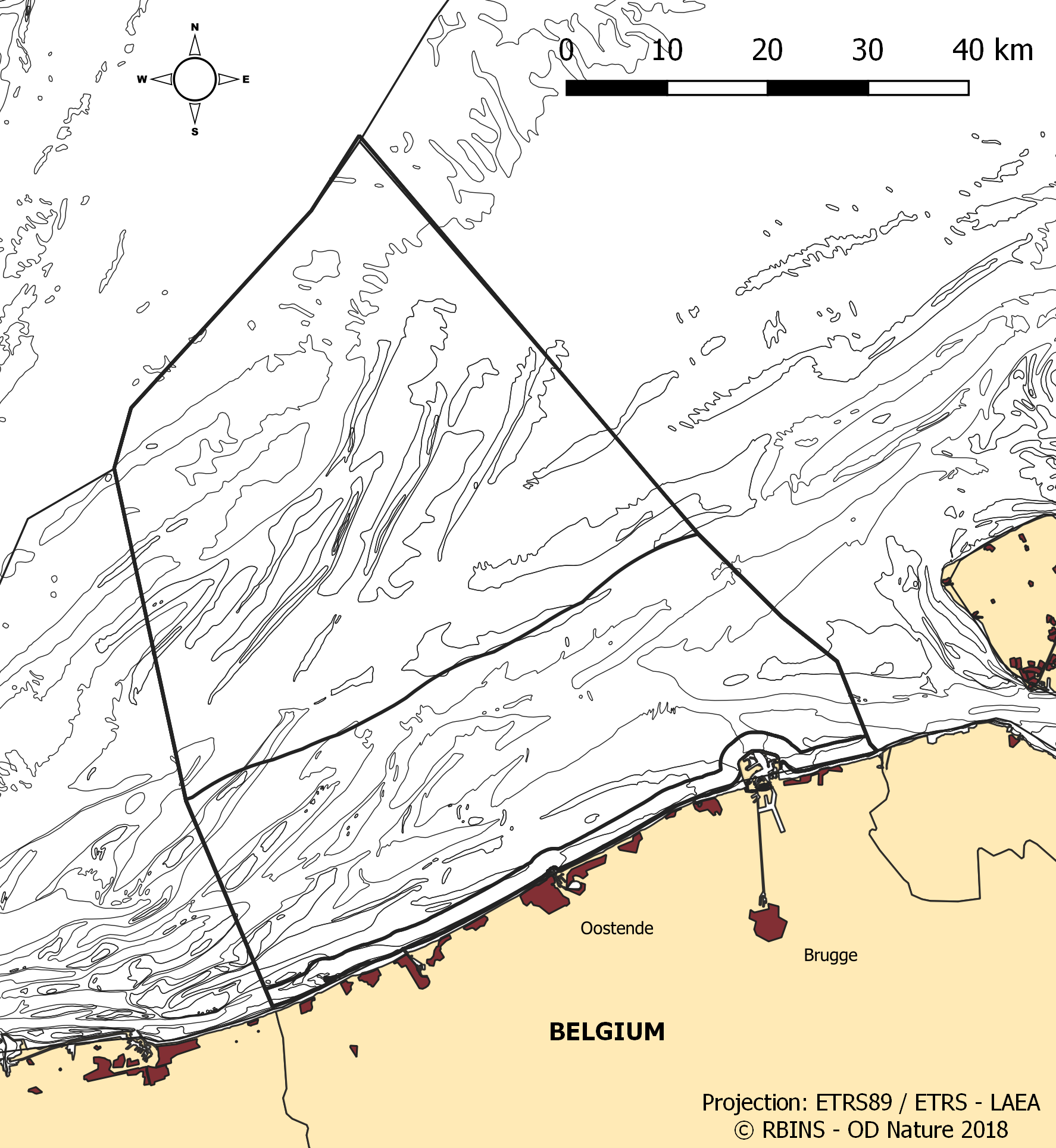
The dataset contains the borders of the Belgian marine waters in the North Sea and the different geographical areas (‘reporting units’) used when reporting in the frame of the the Marine Strategy Framework Directive 2008/56/EC (MSFD) and the Water Framework directive 2000/60/EC (WFD). The ecological status in the frame of WFD is reported for the coastal waters, defined as the one-nautical mile area, while the chemical status needs to be reported for the territorial waters (up to 12 nautical miles). MSFD requires information for the whole area, encompassing the territorial waters and the Belgian Exclusive Economic Zone. For some descriptors, results have been reported separately for the WFD subdivisions during the update of the initial assessment in 2018.
-
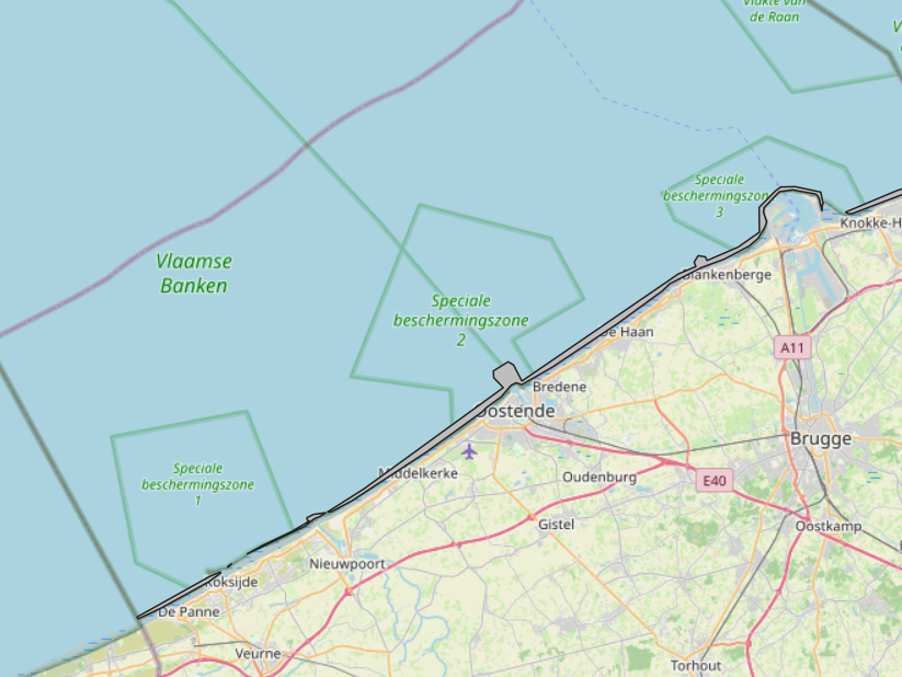
The Royal Decree of 20 March 2026 establishing the marine spatial plan for the period 2026 to 2034 in the Belgian marine areas defines 1 coastal protection experiments zone: Coastal protection belt (Art. 20§2). It replaces the 2020 Marine Spatial Plan. Please refer to the Belgian official gazette ("Moniteur belgeBelgisch Staatsblad") for official reference information.
-
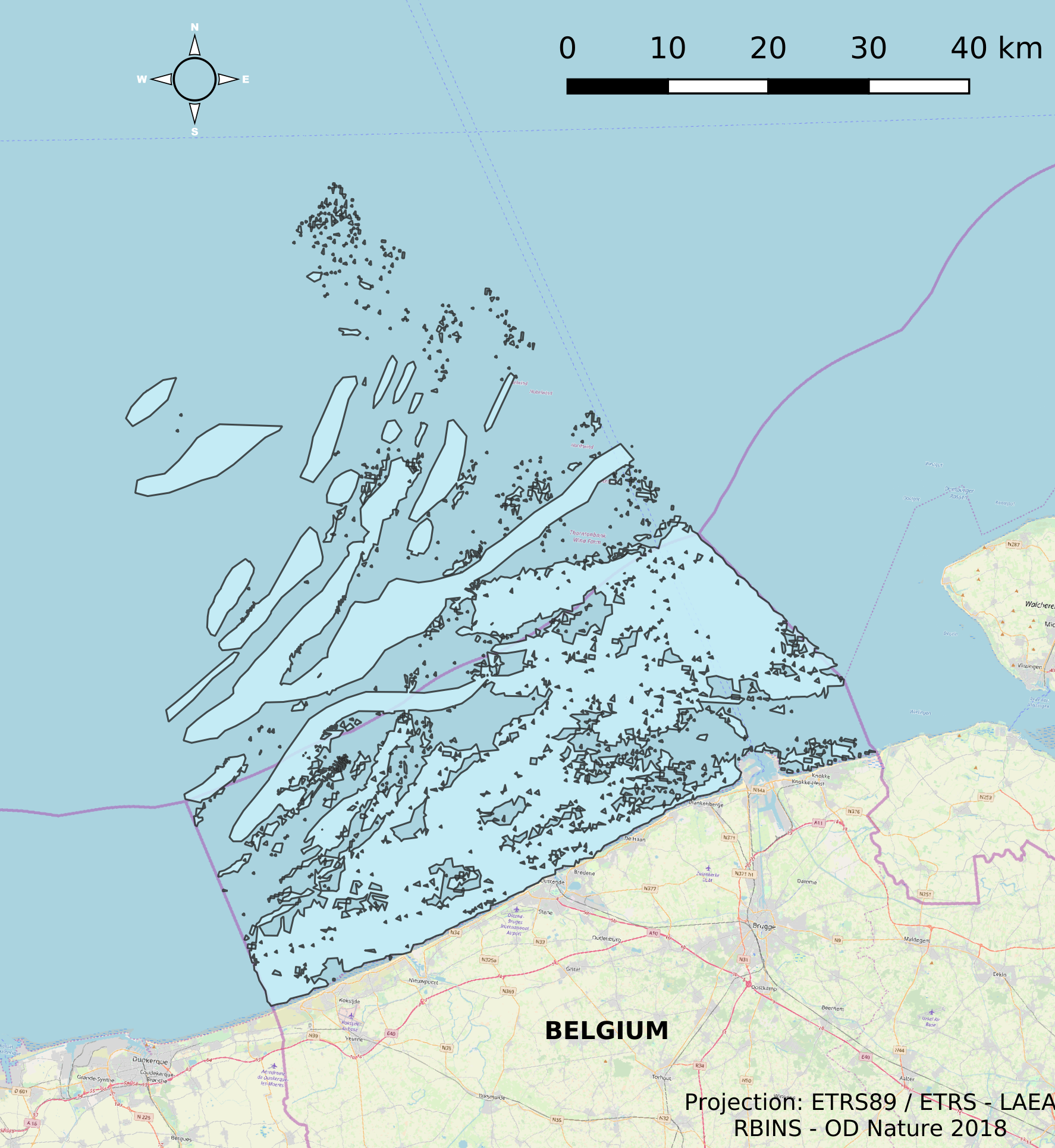
This dataset describes the extents and location of Reefs in the Belgian Part of the North Sea (BPNS) as required for article 17 of the Council Directive 92/43/EEC of 21 May 1992 on the conservation of natural habitats and of wild fauna and flora. The Council Directive seeks to contribute to ensuring biodiversity in the European Union by the conservation of natural habitats and wild fauna and flora species.