 geo.be Metadata Catalog
marine spatial planning
Type of resources
Topics
INSPIRE themes
Keywords
Contact for the resource
Provided by
Years
Formats
Representation types
-
2019 Belgian MSP - Princess Elizabeth Zone for renewable Energy in the Belgian Part of the North Sea
This dataset represents the location of the Princess Elizabeth zone in the Belgian Part of the North Sea as described in the Royal Decree of May 22th, 2019, establishing a marine spatial plan for the period 2020-2026. Art. 8. § 3.
-
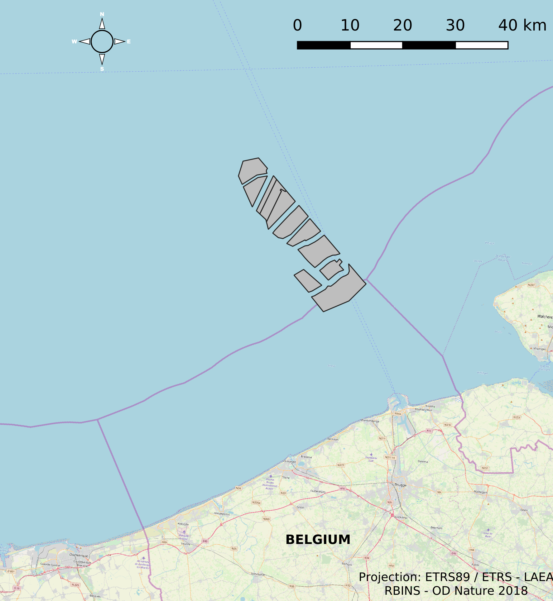
This dataset represents the location of the windfarms concessions in the Belgian Part of the North Sea.
-

This dataset represents the exact location of active telecommunication cables (verified in 2010) installed in the Belgian Part of the North Sea.
-
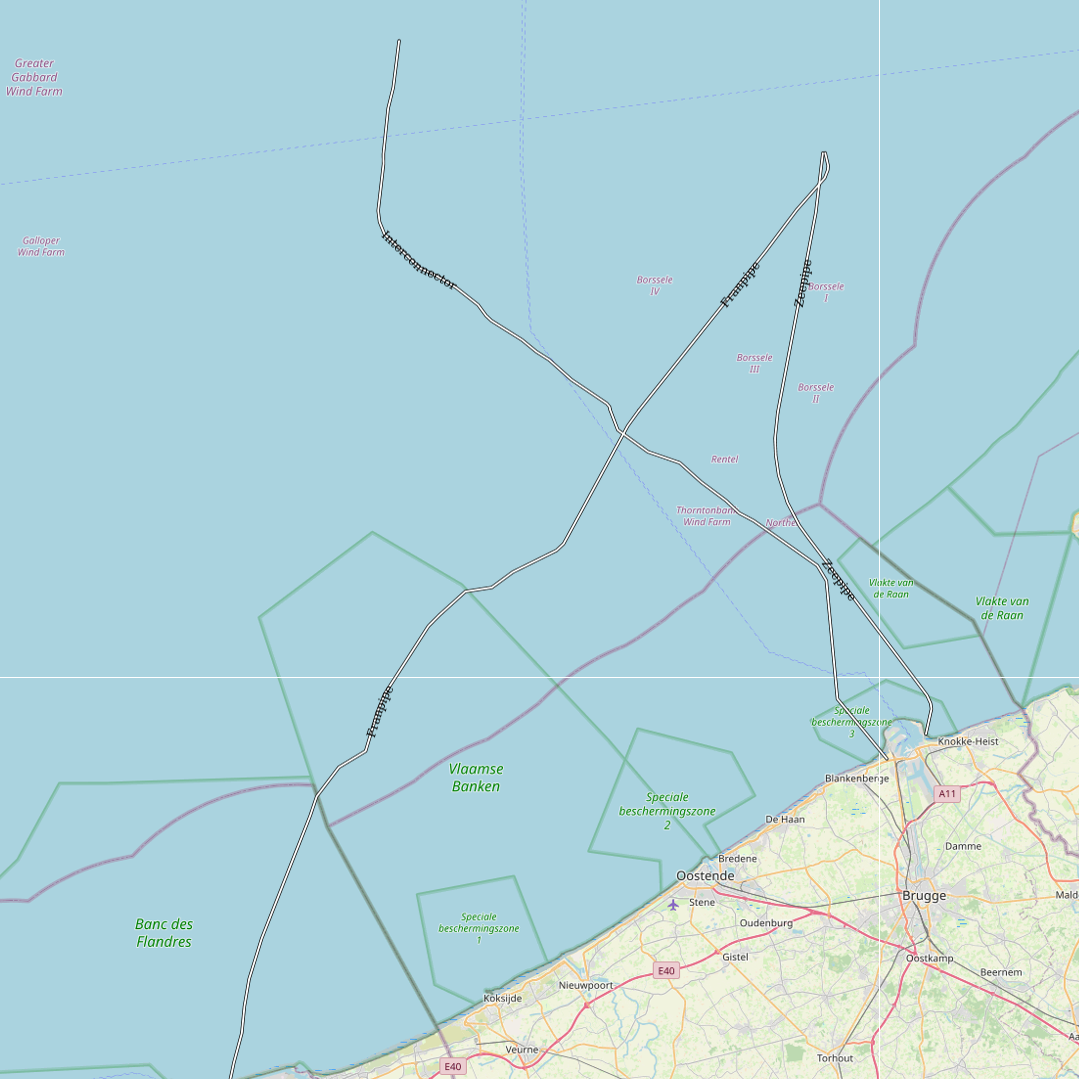
This dataset represents the exact location of gas pipelines installed in the Belgian Part of the North Sea.
-

This dataset represents the exact location of disused telecommunication cables installed in the Belgian Part of the North Sea.
-
This dataset represents the exact location of electrical cables installed in the Belgian Part of the North Sea, including these for for the wind farms.
-
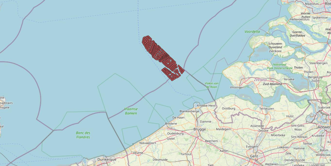
This dataset represents the exact location of the wind turbines in the Belgian Part of the North Sea.