 geo.be Metadata Catalog
Oceanographic Geographical Features
Type of resources
Topics
INSPIRE themes
Keywords
Contact for the resource
Provided by
Years
Formats
Representation types
-

This dataset is part of the 2024 Belgian submission for the Marine Strategy Framework Directive (MSFD) linked to descriptor 10, criterion 3. This dataset reports the amount of plastic ingested (stomach contents) by Northern Fulmars (Fulmarus glacialis) beached along the Belgian coast (environmental target: fewer than 10% of fulmars contain more than 0.1g of plastic in their stomach).
-
This dataset is part of the 2018 Belgian submission for the Marine Strategy Framework Directive (MSFD) linked to descriptor 7, criterion 1. This dataset describes the impact of an offshore windmills farm on the hydrodynamics in the Belgian part of the North Sea (BPNS). Originally, it is a NetCDF file with the results of the reference simulation made with the COHERENS (COupled Hydrodynamical Ecological model for REgioNal Shelf seas) hydrodynamic model only forced by tides (no wind effect). Model resolution : ~ 12.5m. It contains both the reference situation which is a simulation without any windmill and the modeling result of the influence by the windmills on the hydrodynamic in the BPNS. The dataset contains the results on the most inner nested grid level for one reference spring-neap cycle: - hourly sea surface elevation - hourly bottom shear stress - hourly 3D horizontal velocity components (u,v) - hourly 3D eddy viscosity - time-averaged bottom shear stress over the reference spring-neap cycle - percentile 90 of the bottom shear stress for the reference spring-neap cycle - percentile 90 of the specific kinetic energy at the sea bed - accumulated time during which sedimentation processes are dominant - accumulated time during which re-suspension processes are dominant.
-
This dataset is part of the 2024 Belgian submission for the Marine Strategy Framework Directive (MSFD) linked to descriptor 6, criterion 5. It reports on the condition of benthic habitats in the Belgian part of the North Sea (BPNS), combining soft-sediment macrobenthos monitoring (in the framework of dredge disposal/sand extraction impact assessment, and offshore wind farm monitoring) with natural hard-substrate benthos monitoring, to evaluate adverse effects on the biotic and abiotic structure and function of benthic habitat types.
-
This dataset is part of the 2024 Belgian submission for the Marine Strategy Framework Directive (MSFD) linked to descriptor 1, criterion 2. This dataset reports the population abundance (number of individuals, biomass) of benthic-feeding, pelagic-feeding, surface-feeding and wading birds in Belgian waters, combining yearly breeding-colony nest counts along the Belgian coast with ship-based at-sea seabird counts.
-
This dataset is part of the 2024 Belgian submission for the Marine Strategy Framework Directive (MSFD) linked to descriptor 8, criterion 2. This dataset reports the prevalence of external fish diseases in dab (Limanda limanda) in the Belgian part of the North Sea, as an indicator of the adverse effects of contaminants.
-
This dataset is part of the 2024 Belgian submission for the Marine Strategy Framework Directive (MSFD) linked to descriptor 6, criterion 2. This dataset describes and maps the physical disturbance to the seabed in the Belgian part of the North Sea (BPNS) between 2010 and 2021. The dataset combines different layers of human activities leading to a disturbance of the seabed, including 'soft' beach and foreshore nourishments, dredging and dumping, sand extraction, fisheries, burial of cables, war ammunition stocking and construction of wind farms. The area disturbed is mapped and quantified per year and per activity, and plotted on the predominant broad-scale benthic habitat types of the EUSeaMap 2023. Infield cables from wind farms and Elia cables (NEMO and MOG) are not shown due to mutual agreements. This dataset is part of the 2024 Belgian submission for the Marine Strategy Framework Directive (MSFD) linked to descriptor 6, criterion 1. This dataset describes and maps the physical loss of the seabed in the Belgian part of the North Sea (BPNS) between 2010 and 2021. The dataset combines different layers of human activities leading to a loss of the seabed, including 'hard' coastal defence structures, ports, measuring poles and radar station, protection of pipelines and cables, construction of wind farms, and wrecks and other obstacles. The area lost is mapped and quantified per year and per activity, and plotted on the predominant broad-scale benthic habitat types of the EUSeaMap 2023.
-
This dataset is part of the 2018 Belgian submission for the Marine Strategy Framework Directive (MSFD) linked to descriptor 8, criterion 4. This dataset contains measurements on the 7-Ethoxyresorufin-O-deethylase (EROD) activity in Limanda limanda, Imposex (OTIN in Mytilus edulis), fish diseases and counts of oiled common guillemots in the Belgian part of the North Sea.
-
This dataset is part of the 2024 Belgian submission for the Marine Strategy Framework Directive (MSFD) linked to descriptor 1, criterion 3. This dataset reports the breeding success (population demographic characteristics) of benthic-feeding, pelagic-feeding, surface-feeding and wading birds breeding along the Belgian coast.
-
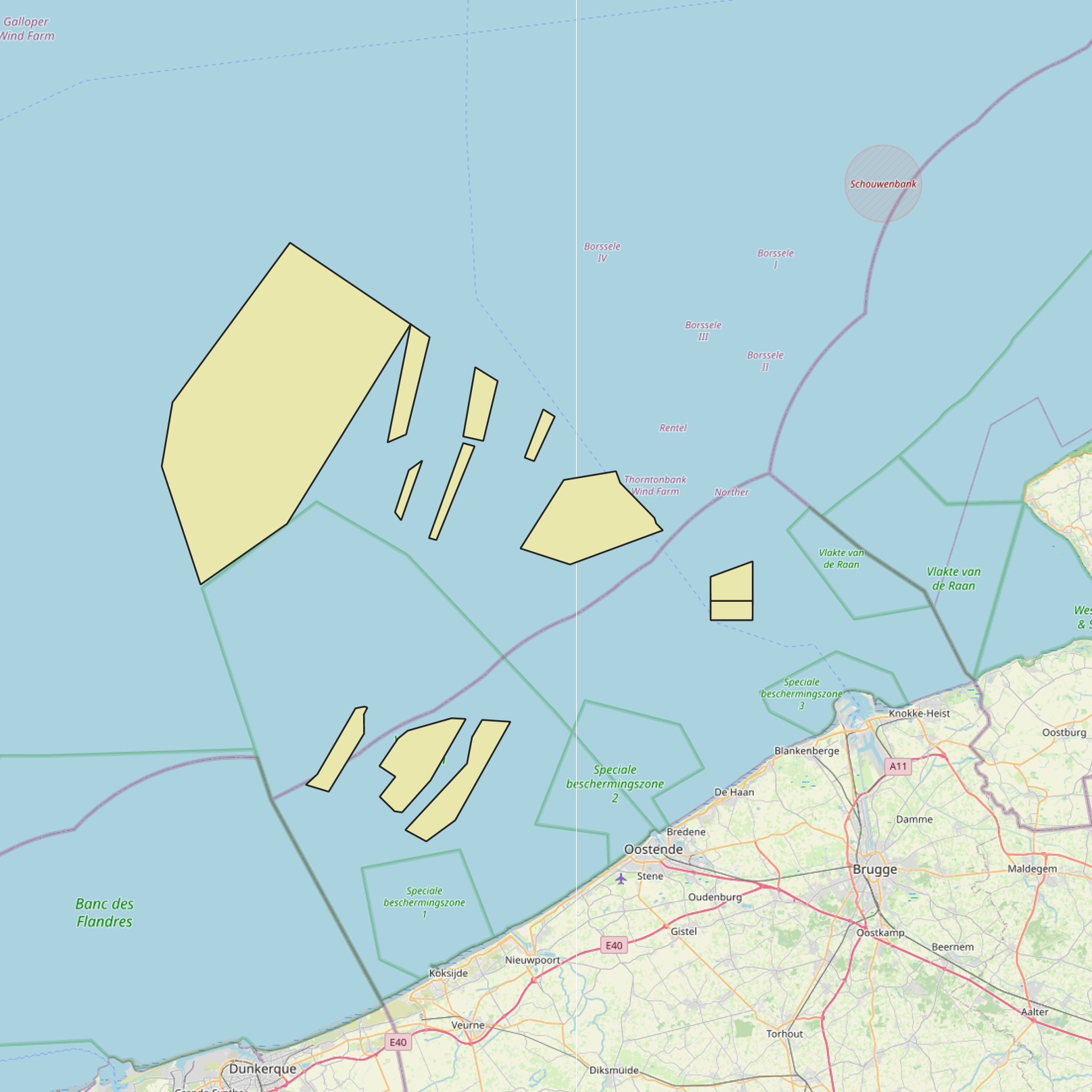
This dataset is part of the 2018 Belgian submission for the Marine Strategy Framework Directive (MSFD) linked to descriptor 1, criterion 2. The Raja clavata dataset describes the results of the Offshore Beam Trawl Surveys (BTS) in the Belgian part of the North Sea (BPNS) between 2010 and 2017. Occurrences of Raja Clavata, along with dates and locations, are reported. The codes used in the attached file are based on the ICES DATRAS (Database of Trawl Surveys) standard. The seabirds dataset describes the density of seabirds (N birds/km) observed in the BPNS between 1987 and 2016 (three surveys a year).
-
This dataset is part of the 2024 Belgian submission for the Marine Strategy Framework Directive (MSFD) linked to descriptor 8, criterion 4. This dataset reports the proportion of oiled Common Guillemots (Uria aalge) among stranded seabirds along the Belgian coast, as an indicator of acute oil pollution (environmental target: average proportion of oiled guillemots below 10% of the total found dead or dying on the beaches).