 geo.be Metadata Catalog
Greater North Sea, incl. the Kattegat and the English Channel
Type of resources
Topics
INSPIRE themes
Keywords
Contact for the resource
Provided by
Years
Formats
Representation types
-
2019 Belgian MSP - Princess Elizabeth Zone for renewable Energy in the Belgian Part of the North Sea
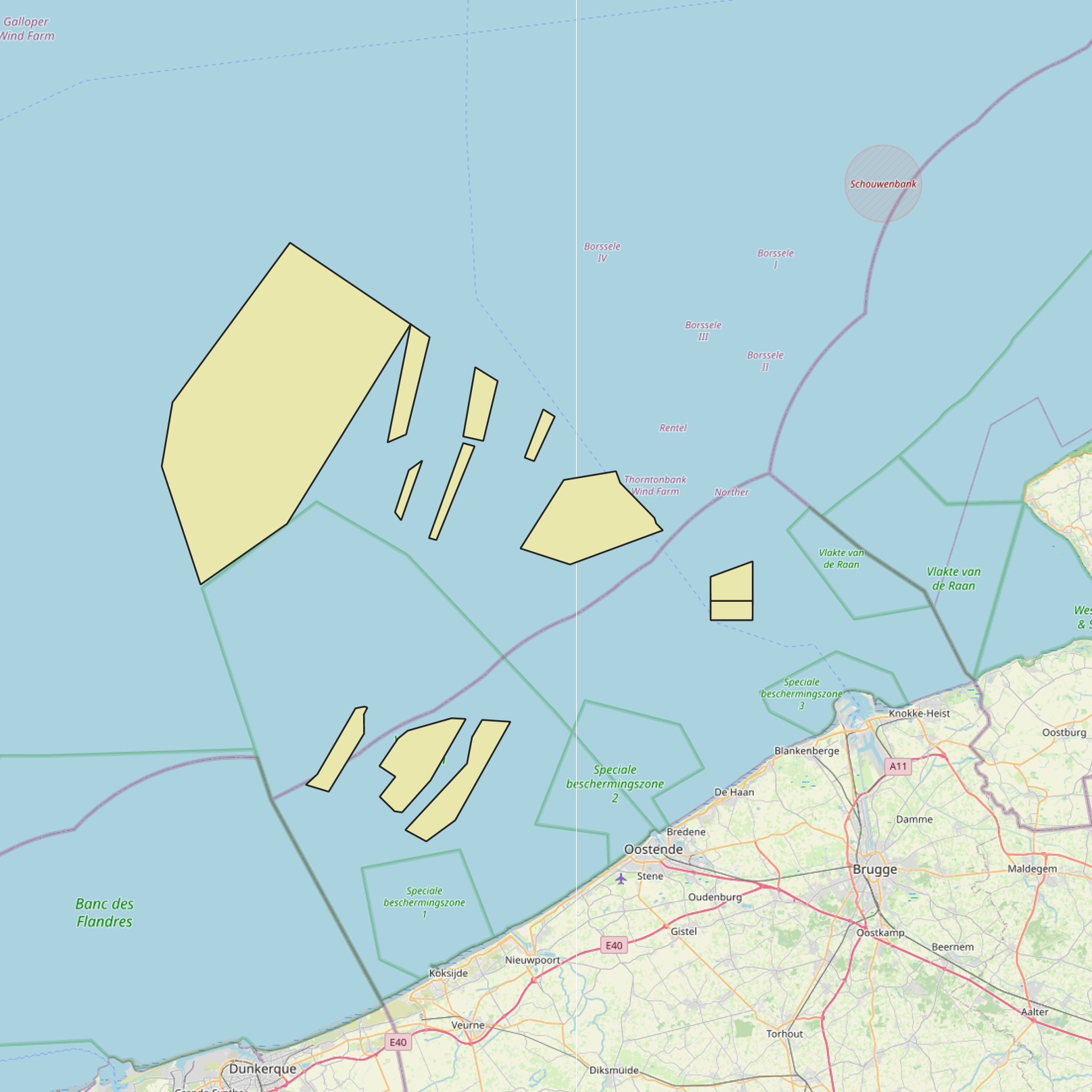
This dataset represents the location of the Princess Elizabeth zone in the Belgian Part of the North Sea as described in the Royal Decree of May 22th, 2019, establishing a marine spatial plan for the period 2020-2026. Art. 8. § 3.
-
This dataset is part of the 2018 Belgian submission for the Marine Strategy Framework Directive (MSFD) linked to descriptor 1, criterion 2. The Raja clavata dataset describes the results of the Offshore Beam Trawl Surveys (BTS) in the Belgian part of the North Sea (BPNS) between 2010 and 2017. Occurrences of Raja Clavata, along with dates and locations, are reported. The codes used in the attached file are based on the ICES DATRAS (Database of Trawl Surveys) standard. The seabirds dataset describes the density of seabirds (N birds/km) observed in the BPNS between 1987 and 2016 (three surveys a year).
-

This dataset is part of the 2024 Belgian submission for the Marine Strategy Framework Directive (MSFD) linked to descriptor 1, criterion 3. This dataset reports the breeding success (population demographic characteristics) of benthic-feeding, pelagic-feeding, surface-feeding and wading birds breeding along the Belgian coast.
-
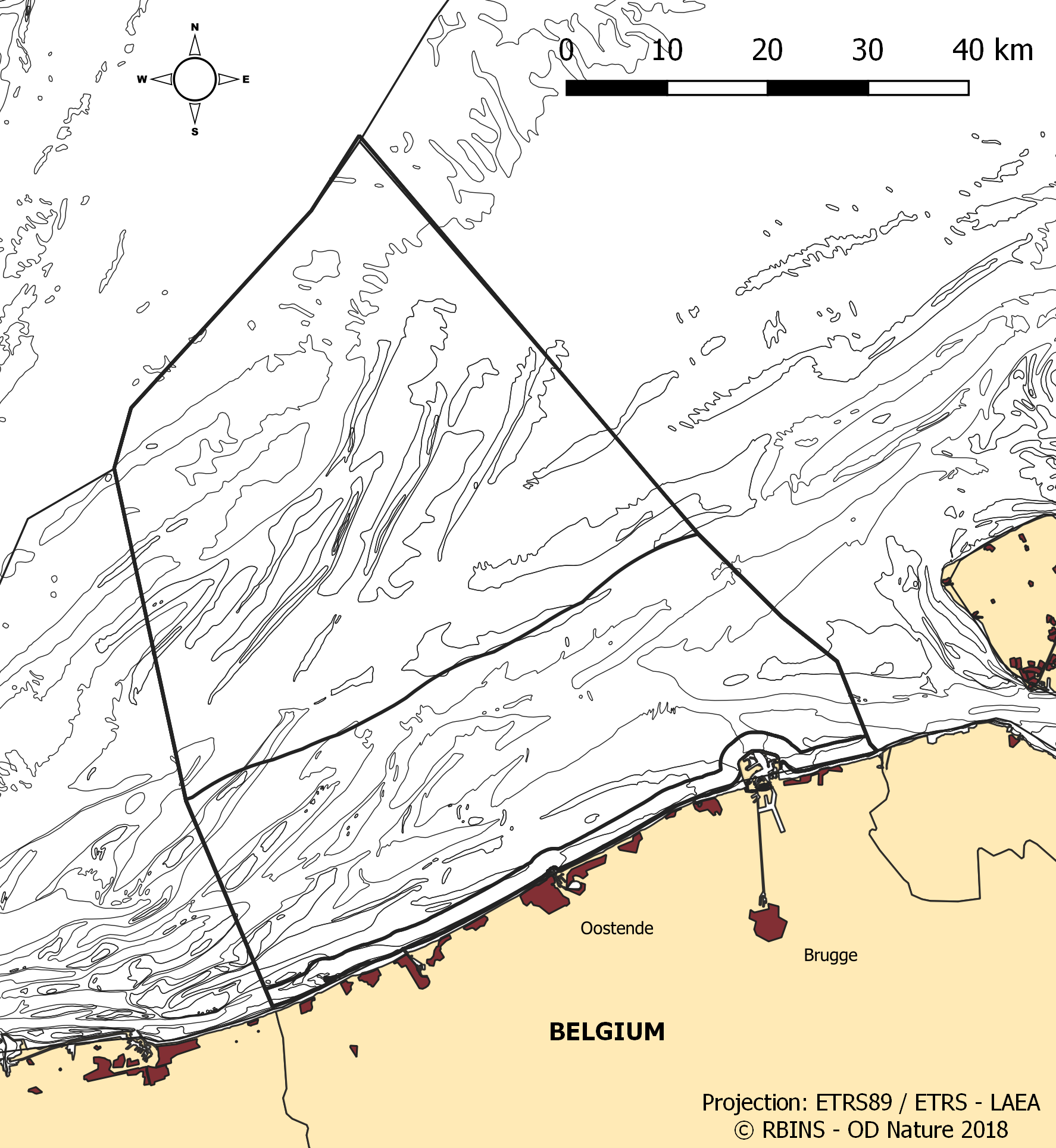
The dataset contains the borders of the Belgian marine waters in the North Sea and the different geographical areas (‘reporting units’) used when reporting in the frame of the the Marine Strategy Framework Directive 2008/56/EC (MSFD) and the Water Framework directive 2000/60/EC (WFD). The ecological status in the frame of WFD is reported for the coastal waters, defined as the one-nautical mile area, while the chemical status needs to be reported for the territorial waters (up to 12 nautical miles). MSFD requires information for the whole area, encompassing the territorial waters and the Belgian Exclusive Economic Zone. For some descriptors, results have been reported separately for the WFD subdivisions during the update of the initial assessment in 2018.
-
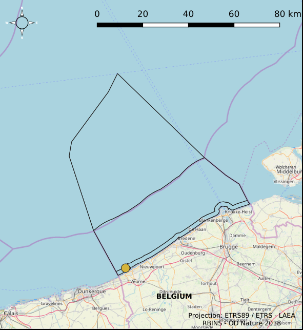
The Royal Decree of 22 May 2019 establishing a marine spatial plan defines 1 coastal protection experiments zone: Zone for coastal protection experiments (Art. 16§2). It replaces the 2014 Marine Spatial Plan, which is included for completeness. The Royal Decree of 20 March 2014 establishing a marine spatial plan defines in its Art. 12. §1 one zone for coastal protection experiments. This zone is made available digitally in the resource described by this metadata document. Please refer to the Belgian official gazette (\"Moniteur belge/Belgisch Staatsblad\") for official reference information.
-
This dataset is part of the 2024 Belgian submission for the Marine Strategy Framework Directive (MSFD) linked to descriptor 6, criterion 2. This dataset describes and maps the physical disturbance to the seabed in the Belgian part of the North Sea (BPNS) between 2010 and 2021. The dataset combines different layers of human activities leading to a disturbance of the seabed, including 'soft' beach and foreshore nourishments, dredging and dumping, sand extraction, fisheries, burial of cables, war ammunition stocking and construction of wind farms. The area disturbed is mapped and quantified per year and per activity, and plotted on the predominant broad-scale benthic habitat types of the EUSeaMap 2023. Infield cables from wind farms and Elia cables (NEMO and MOG) are not shown due to mutual agreements. This dataset is part of the 2024 Belgian submission for the Marine Strategy Framework Directive (MSFD) linked to descriptor 6, criterion 1. This dataset describes and maps the physical loss of the seabed in the Belgian part of the North Sea (BPNS) between 2010 and 2021. The dataset combines different layers of human activities leading to a loss of the seabed, including 'hard' coastal defence structures, ports, measuring poles and radar station, protection of pipelines and cables, construction of wind farms, and wrecks and other obstacles. The area lost is mapped and quantified per year and per activity, and plotted on the predominant broad-scale benthic habitat types of the EUSeaMap 2023.
-
This dataset is part of the 2024 Belgian submission for the Marine Strategy Framework Directive (MSFD) linked to descriptor 6, criterion 4. This dataset describes and maps the areal extent of EUNIS level 2 broad-scale habitat types and gravel beds in the Belgian part of the North Sea (BPNS), to assess whether the spatial extent of these habitats fluctuates beyond the accuracy margin of the current distribution maps.
-
This dataset is part of the 2024 Belgian submission for the Marine Strategy Framework Directive (MSFD) linked to descriptor 8, criterion 1. This dataset reports concentrations of PFAS and dioxins in biota (mussels Mytilus edulis and flounder Platichthys flesus) in the Belgian part of the North Sea.
-
This dataset is part of the 2024 Belgian submission for the Marine Strategy Framework Directive (MSFD) linked to descriptor 8, criterion 2. This dataset reports the prevalence of external fish diseases in dab (Limanda limanda) in the Belgian part of the North Sea, as an indicator of the adverse effects of contaminants.
-
UNDER EMBARGO - This dataset contains marine organic matter source samples, suspended partiluate matter trap samples, and compound-specific nitrogen stable isotope data of amino acids (δ¹⁵N-AA). Source materials include phytoplankton, zooplankton, and faecal pellets from the marine fouling species Mytilus edulis, Jassa herdmani and Metridium senile. Compound-specific nitrogen isotope ratios of individual amino acids were measured using stable isotope analysis. The dataset includes isotopic measurements for all source samples and sediment trap samples.