 geo.be Metadata Catalog
environment
Type of resources
Available actions
Topics
INSPIRE themes
federalThemes
Keywords
Contact for the resource
Provided by
Years
Formats
Representation types
Update frequencies
status
Scale
-

Natura 2000 (N2K) is a network of core breeding and resting sites for rare and threatened species, as well as for some rare natural habitat types which are protected in their own right. It stretches across all 28 EU countries, both on land and at sea. The aim of the network is to ensure the long-term survival of Europe's most valuable and threatened species and habitats that are listed under the Birds Directive and the Habitats Directive. This dataset contains the sites in Belgium.
-
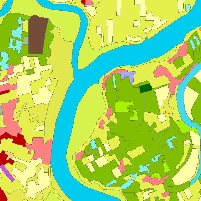
Riparian zones represent transitional areas occurring between land and freshwater ecosystems, characterised by distinctive hydrology, soil and biotic conditions and strongly influenced by the stream water. They provide a wide range of riparian functions (e.g. chemical filtration, flood control, bank stabilization, aquatic life and riparian wildlife support, etc.) and ecosystem services. The Riparian Zones products will support the objectives of several European legal acts and policy initiatives, such as the EU Biodiversity Strategy to 2020, the Habitats and Birds Directives and the Water Framework Directive. Two complementary product groups provide detailed information on the state and characteristics of riparian zones across Belgium: 1. Land Cover / Land Use (LCLU) 2. Green Linear Elements (GLE)
-
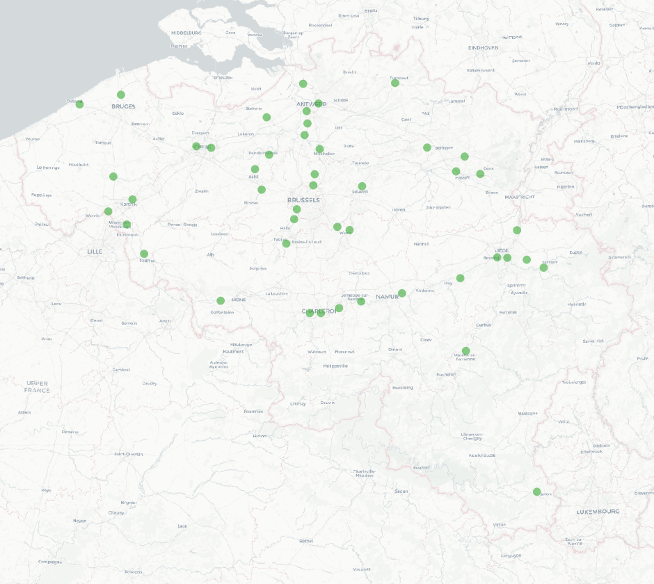
The national wastewater-based epidemiological surveillance of SARS-CoV-2 monitors the SARS-CoV-2 presence in several wastewater treatment plants across Belgium. This dataset contains the results per treatment plant since the beginning of the surveillance in September 2020. The results consist in the SARS-CoV2 concentrations over time as well as other data needed for the interpretations such as the flow rates of the treatment plants and their covering populations.
-
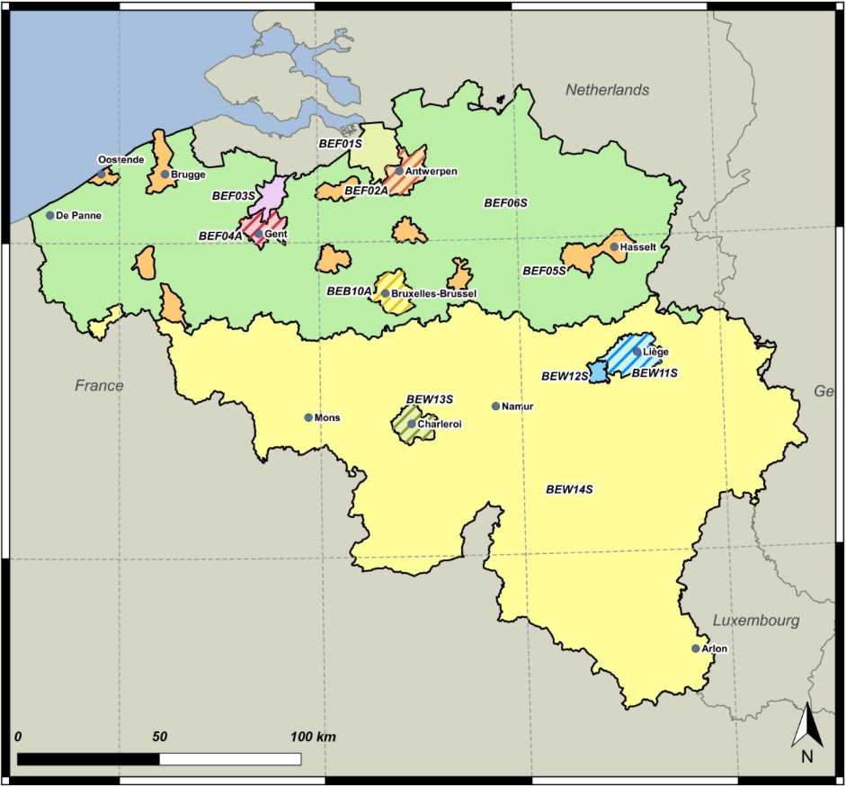
The zones are used as reporting units of the air quality in Belgium. These zones are defined based on Article 3 of the 2004/107/EC Directive and Article 4 of the 2008/50/EC Directive. A zones shall mean a part of the territory of a Member State, as delimited by that Member State for the purposes of air quality assessment and management (source: 2008/50/EC).2008/50/EC Article 4: Establishment of zones and agglomerations: Member States shall establish zones and agglomerations throughout their territory. Air quality assessment and air quality management shall be carried out in all zones and agglomerations.
-
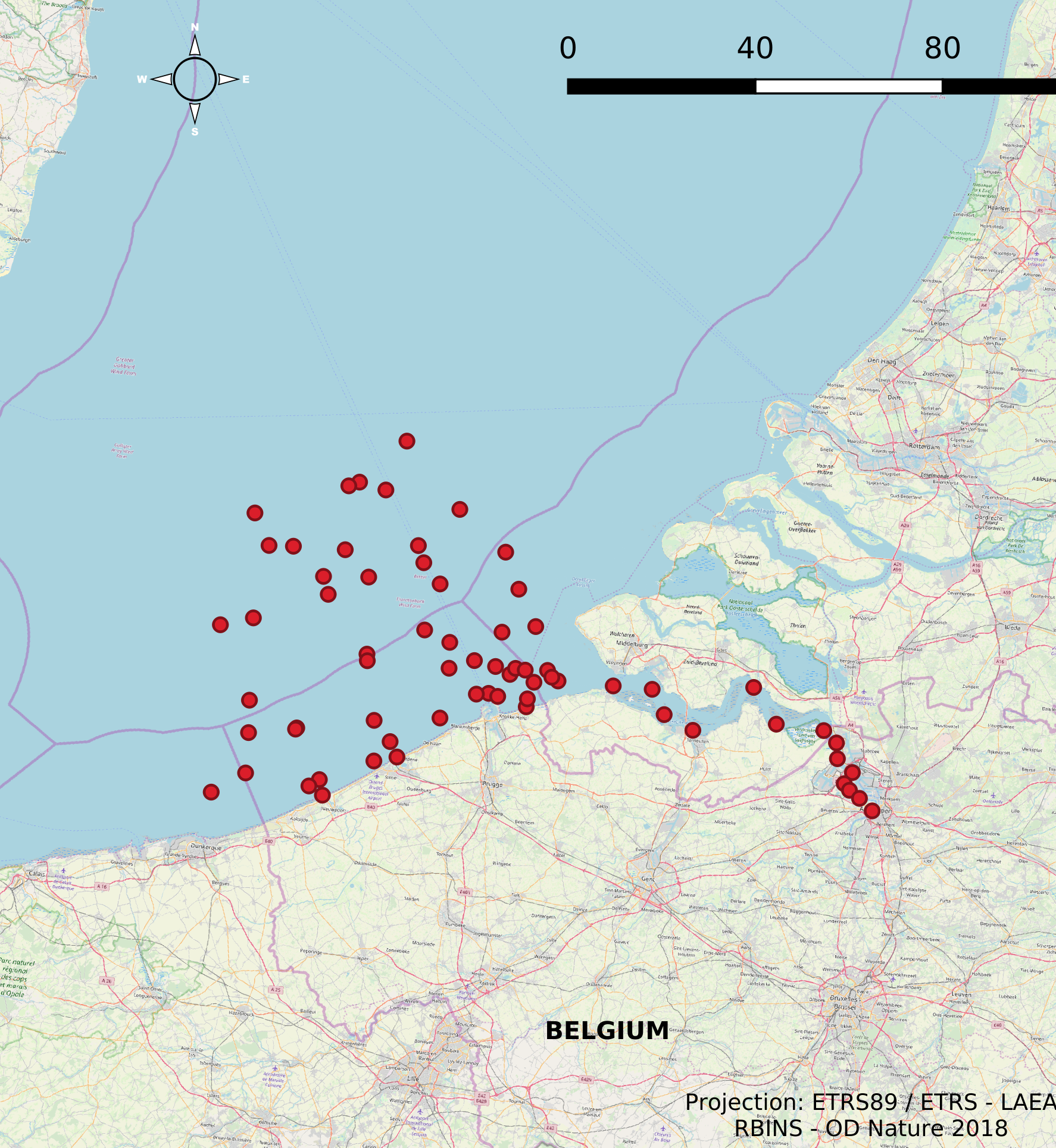
The Scientific Service Management Unit of the Mathematical Model of the North Sea of the Royal Belgian Institute for Natural Sciences has been operating monitoring stations on the Belgian Part of the North Sea since the 1970s. These stations are located in the Scheldt estuary, at open sea and in coastal waters. In 2007, 10 new stations were designated and were placed in the monitoring network needed for the OSPAR convention, the Water Framework Directive and the Marine Strategic Framework Directive. These replaced a series of 54 previous monitoring stations whose data was gathered throughout the years for the Belgian Monitoring Programme and reported according to the recommendations of the OSPAR Convention. This dataset contains information on all monitoring stations ever used by the Scientific Service Management Unit of the Mathematical Model of the North Sea. The dataset provides location, name, operational history and for which reporting obligations they are used.
-
This dataset describes the extents and location of Reefs in the Belgian Part of the North Sea (BPNS) as required for article 17 of the Council Directive 92/43/EEC of 21 May 1992 on the conservation of natural habitats and of wild fauna and flora. The Council Directive seeks to contribute to ensuring biodiversity in the European Union by the conservation of natural habitats and wild fauna and flora species.
-
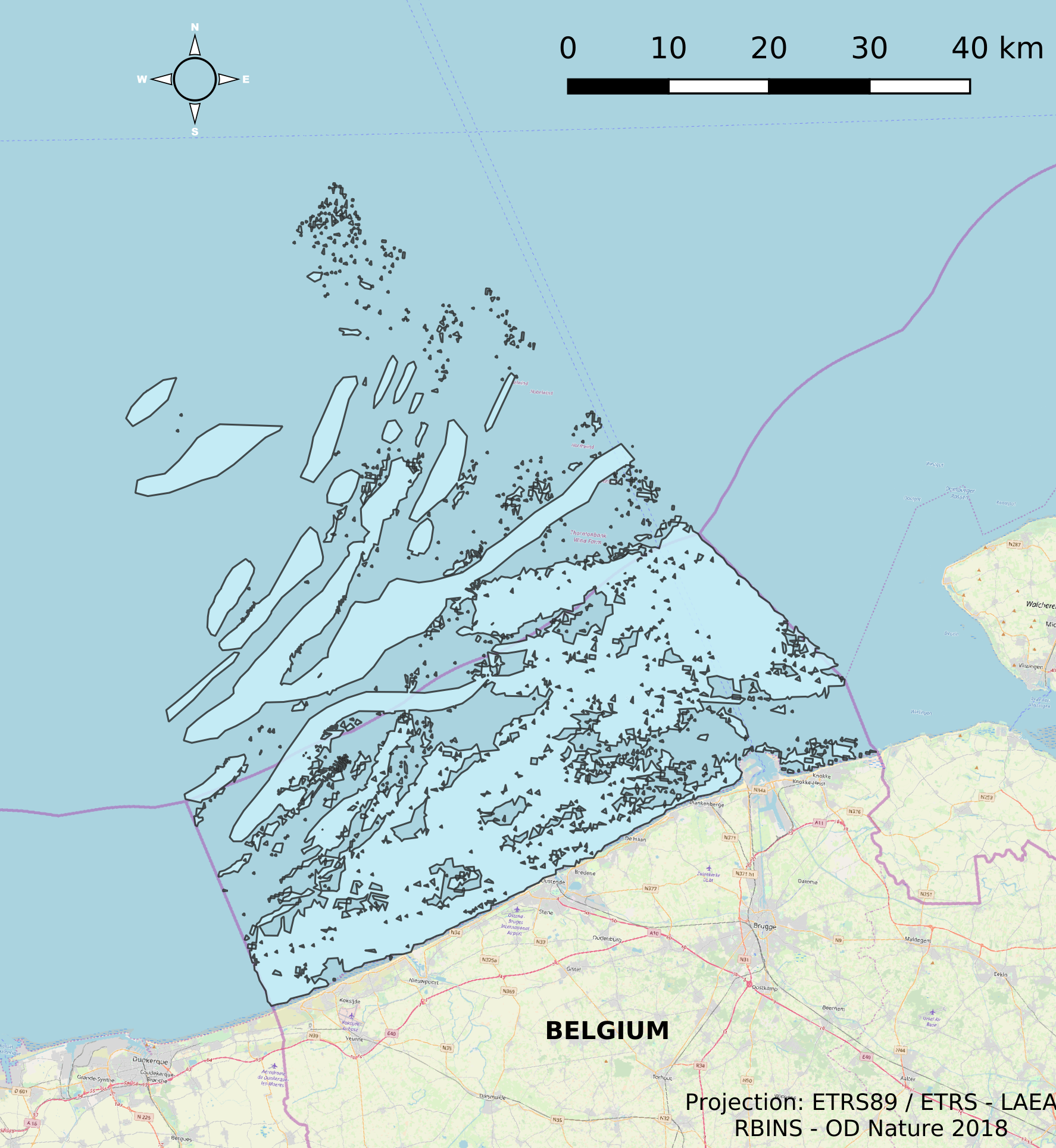
This dataset describes the extents and location of Sandbanks (code 1110) in the Belgian Part of the North Sea (BPNS) as required for article 17 of the Council Directive 92/43/EEC of 21 May 1992 on the conservation of natural habitats and of wild fauna and flora. The Council Directive seeks to contribute to ensuring biodiversity in the European Union by the conservation of natural habitats and wild fauna and flora species.
-
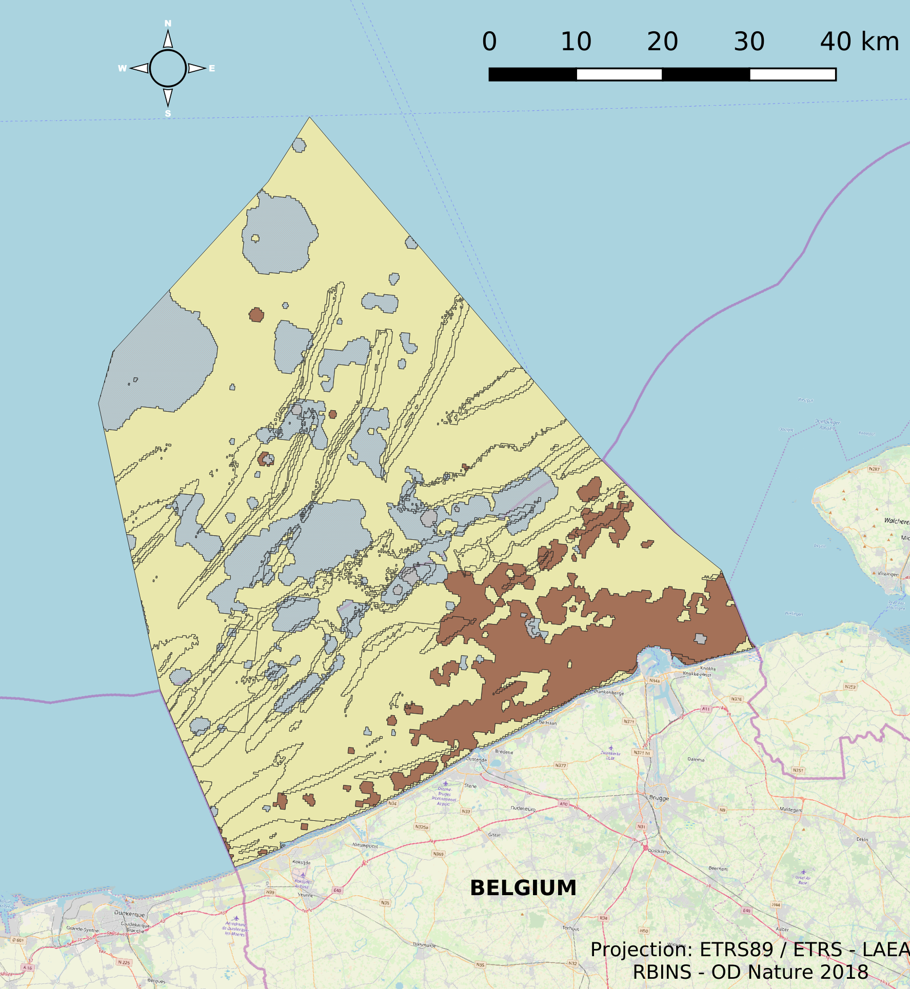
The dataset describes the physical habitats in the Belgian Part of the North Sea. It uses the EUNIS classification system as well as the MSFD Habitat codelist for the description and classification of the BPNS. It provides also information on the energy, biozone and type of substrate for the different areas in the BPNS.
-

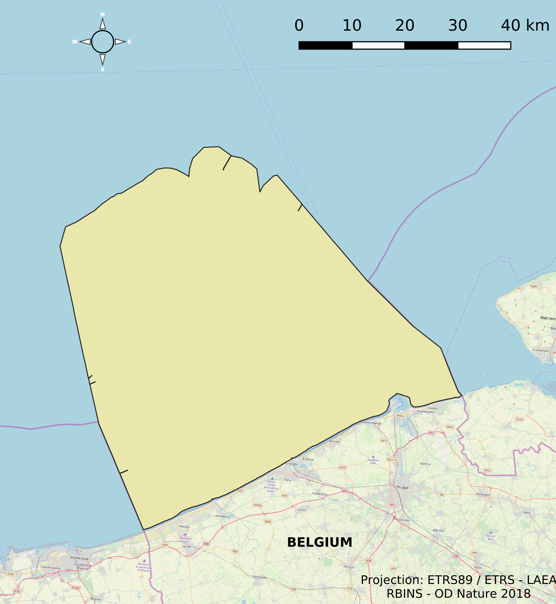
The dataset contains the borders of the Belgian marine waters in the North Sea and the different geographical areas (‘reporting units’) used when reporting in the frame of the the Marine Strategy Framework Directive 2008/56/EC (MSFD) and the Water Framework directive 2000/60/EC (WFD). The ecological status in the frame of WFD is reported for the coastal waters, defined as the one-nautical mile area, while the chemical status needs to be reported for the territorial waters (up to 12 nautical miles). MSFD requires information for the whole area, encompassing the territorial waters and the Belgian Exclusive Economic Zone. For some descriptors, results have been reported separately for the WFD subdivisions during the update of the initial assessment in 2018.
-
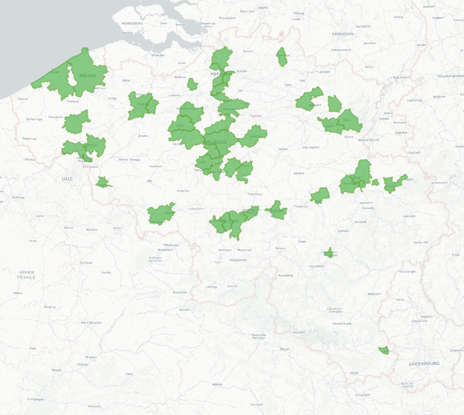
The national wastewater-based epidemiological surveillance of SARS-CoV-2 monitors the SARS-CoV-2 presence in several wastewater treatment plants across Belgium. This dataset contains the catchment areas per wastewater treatment plant since the beginning of the surveillance in September 2020.