 geo.be Metadata Catalog
structure
Type of resources
Available actions
Topics
INSPIRE themes
federalThemes
Keywords
Contact for the resource
Provided by
Years
Formats
Representation types
Update frequencies
status
Scale
Resolution
-

Top10Vector – Constructions is the vector dataset of constructions in Belgium. It includes seven classes. First class: brunnels. Second class: buildings. Third class: particular line constructions. Fourth class: particular polygonal constructions. Fifth class: particular point constructions. Sixth class: towers on buildings. Seventh class: additional polygon geometries. This dataset can be downloaded via the link in 'Access'.
-

Top10Vector – Particular zones is the vector dataset of portions of the Belgian territory having a particular attribution which makes them different from the objects in the other Top10Vector-themes. This dataset includes only one class which can be downloaded via the link in 'Access'.
-
Points Of Interest - Infrastructures interest contains point elements indicating the location of a infrastructure, such as a container depot, incinerator, brunnel (bridges and tunnels), rail traffic, subway access, subway and tram stops, heli- and airport, control tower, light mast, lighthouse, water tower, flashing-lamp, breakwater, harbour area, marina, ship lift, dock, embankment, sluice, stilt structure and water point in Belgium.
-
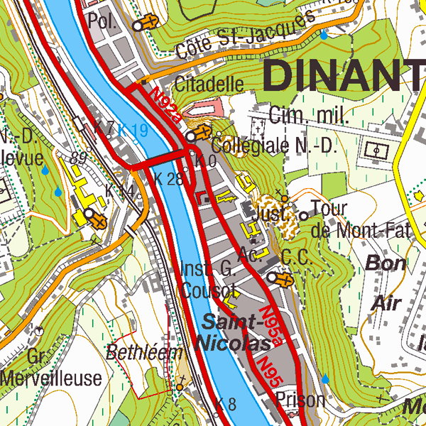
Top50Map is a digital version of the NGI’s topographic cartography on a scale of 1:50 000. The images come from the symbolisation of the objects and the themes in the topo-geographic inventory of the Belgian territory (ITGI), which is built and kept up-to-date by the NGI. It can be used for on-screen viewing or printed on scales between 1:25 000 and 1:50 000 (recommended threshold values). Top50Map is meant for regional use.
-
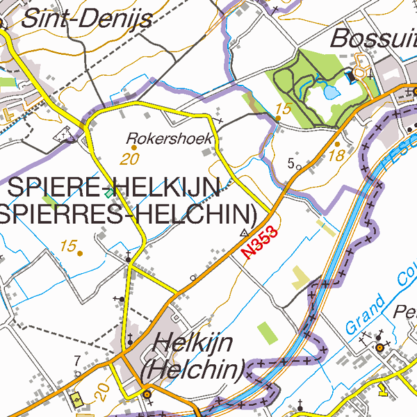
Top25Map is a digital version of the NGI’s topographic cartography on a scale of 1:25 000. These images result from the symbolisation of the objects and themes which are present in the topo-geographic inventory of the Belgian territory (ITGI), which is built and kept up-to-date by the NGI. Top25Map contains all usual themes of the NGI’s cartographic products (land use, transport, hydrography, buildings and constructions, relief,…), as well as the map lettering and the toponyms. The Top25Map cartography is appropriate to hiking.