 geo.be Metadata Catalog
application/xml
Type of resources
Topics
INSPIRE themes
Keywords
Contact for the resource
Provided by
Years
Formats
Representation types
Scale
-
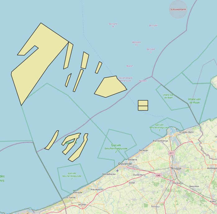
The Royal Decree of 20 March 2026 establishing the marine spatial plan for the period 2026 to 2034 in the Belgian marine areas defines 12 sand and gravel extraction zones: Sand and gravel extraction sector 1a (Thorntonbank) (Art. 19§1.1°), Sand and gravel extraction sector 4d (Art. 19§1.10°), Sand and gravel extraction sector 5 (Blighbank) (Art. 19§1.11°), Sand extraction sector 2kb (Kwintebank) (Art. 19§1.2°), Sand extraction sector 2br (Buiten Ratel) (Art. 19§1.3°), Sand extraction sector 2od (Oostdyck) (Art. 19§1.4°), Sand and gravel extraction sector 3a (Sierra Ventana) (Art. 19§1.5°), Sand and gravel extraction sector 3b (Sierra Ventana) (Art. 19§1.6°), Sand and gravel extraction sector 4a (Noordhinder) (Art. 19§1.7°), Sand and gravel extraction sector 4b (Oosthinder North) (Art. 19§1.8°), Sand and gravel extraction sector 4c (Oosthinder South) (Art. 19§1.9°), Extraction search zone (Art. 19§4). It replaces the 2020 Marine Spatial Plan. Please refer to the Belgian official gazette ("Moniteur belgeBelgisch Staatsblad") for official reference information.
-
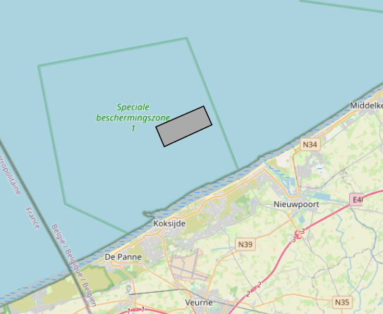
The Royal Decree of 20 March 2026 establishing the marine spatial plan for the period 2026 to 2034 in the Belgian marine areas defines 1 commercial and industrial zones: Zone C for commercial and industrial activities (Art. 27§1). It replaces the 2020 Marine Spatial Plan. Please refer to the Belgian official gazette ("Moniteur belgeBelgisch Staatsblad") for official reference information.
-
This datasets is a compilation of all the campaigns tracks for the two RV Belgica (A962 and 11BU) from 1985 until today. It'll be regularly updated with new data.
-
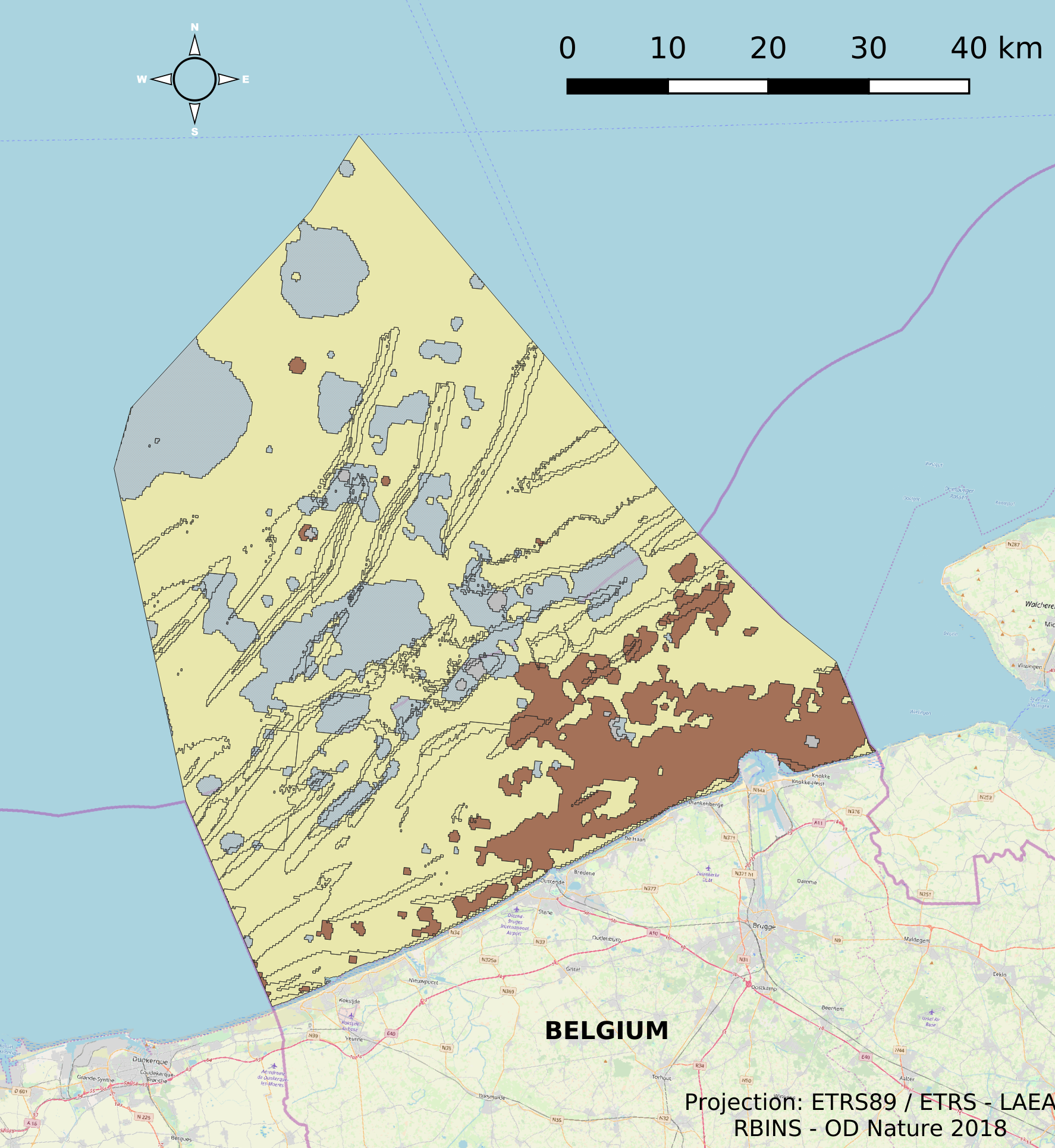
The dataset describes the physical habitats in the Belgian Part of the North Sea. It uses the EUNIS classification system as well as the MSFD Habitat codelist for the description and classification of the BPNS. It provides also information on the energy, biozone and type of substrate for the different areas in the BPNS.
-
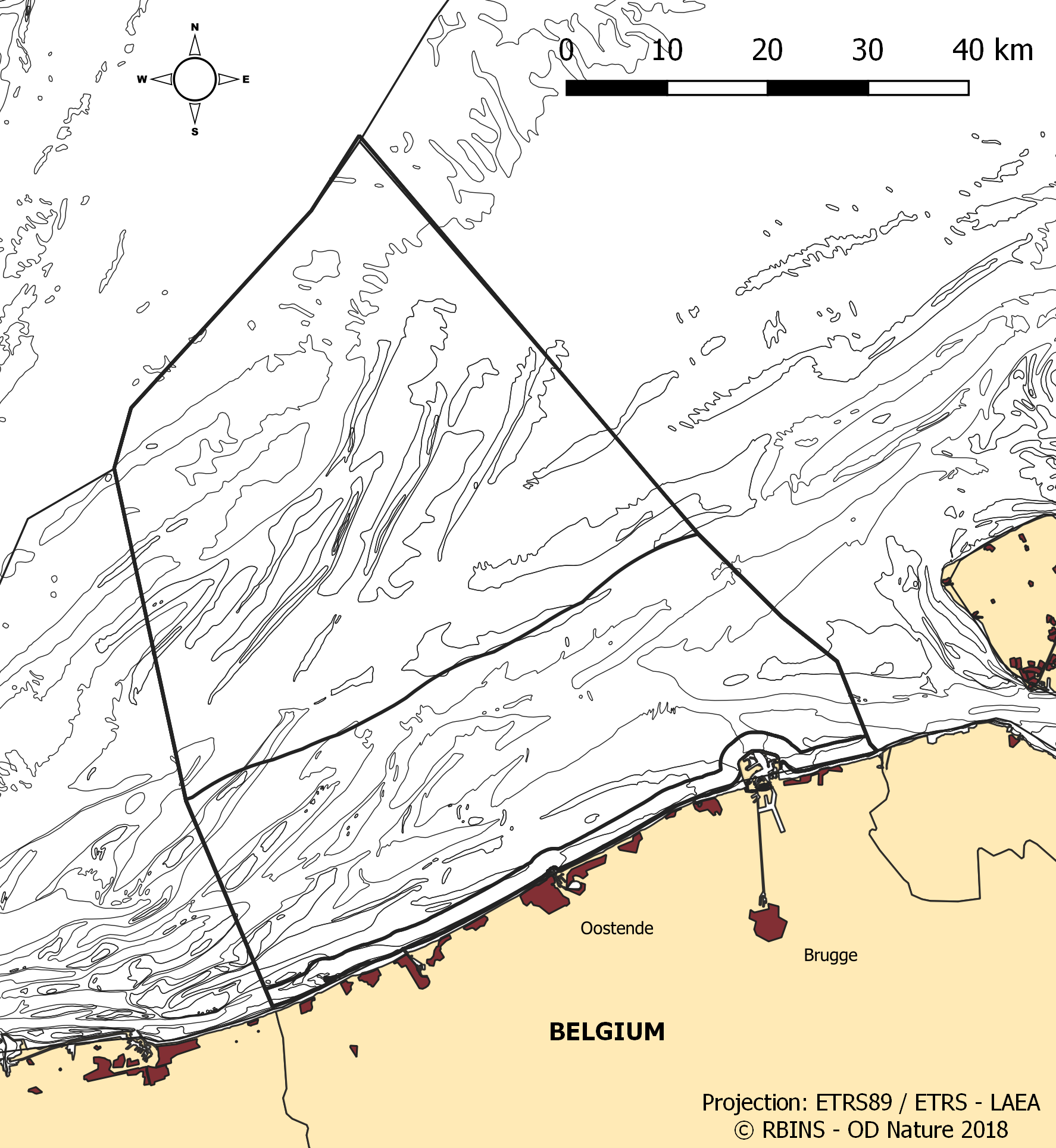
The dataset contains the borders of the Belgian marine waters in the North Sea and the different geographical areas (‘reporting units’) used when reporting in the frame of the the Marine Strategy Framework Directive 2008/56/EC (MSFD) and the Water Framework directive 2000/60/EC (WFD). The ecological status in the frame of WFD is reported for the coastal waters, defined as the one-nautical mile area, while the chemical status needs to be reported for the territorial waters (up to 12 nautical miles). MSFD requires information for the whole area, encompassing the territorial waters and the Belgian Exclusive Economic Zone. For some descriptors, results have been reported separately for the WFD subdivisions during the update of the initial assessment in 2018.
-
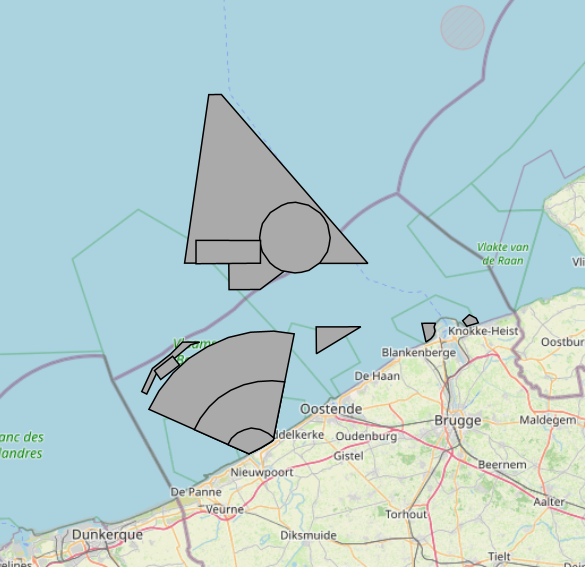
The Royal Decree of 20 March 2026 establishing the marine spatial plan for the period 2026 to 2034 in the Belgian marine areas defines 13 military use zones: Mine warfare exercise zone – QZR 040 (Art. 21§1.1°), Mine warfare exercise zone – NBH-10 (Wenduine) (Art. 21§1.2°), Mine warfare exercise zone – NB-01 (Westhinder) (Art. 21§1.3°), Mine warfare exercise zone (Buiten Ratel) (Art. 21§1.4°), Belgisch Nationaal Oefengebied voor Marineschepen (BNOM) (Art. 21§1.5°), Shallow Water Zone (Art. 21§1.6°), Zone for detonation exercises and operations (Art. 21§2), Lombardsijde firing sector: small sector (Art. 21§3.1°), Lombardsijde firing sector: middle sector (Art. 21§3.2°), Lombardsijde firing sector: large sector (Art. 21§3.3°), Paardenmarkt munitions disposal site (Art. 22§1). It replaces the 2020 Marine Spatial Plan. Please refer to the Belgian official gazette ("Moniteur belgeBelgisch Staatsblad") for official reference information.
-
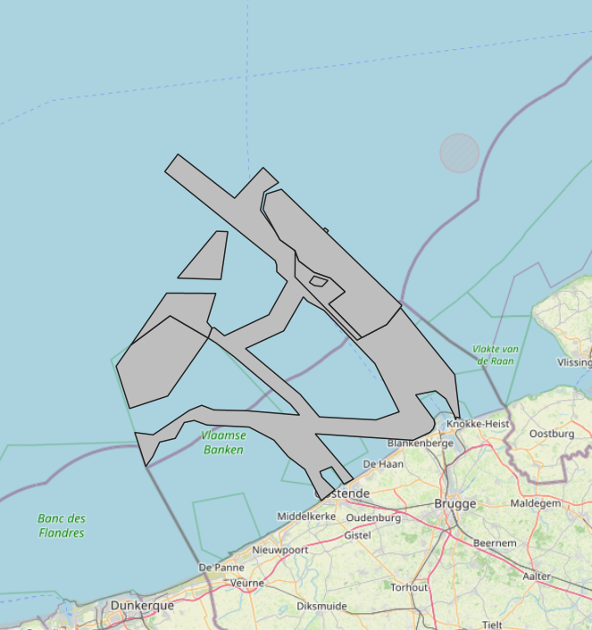
The Royal Decree of 20 March 2026 establishing the marine spatial plan for the period 2026 to 2034 in the Belgian marine areas defines 7 energy, cable and pipeline zones: Renewable energy zone: Zone 1, Eastern Zone (Art. 12§1), Princess Elisabeth renewable energy zone: Zone 2a, Noordhinder North (Art. 12§2.2a°), Princess Elisabeth renewable energy zone: Zone 2b, Noordhinder South (Art. 12§2.2b°), Princess Elisabeth renewable energy zone: Zone 2c, Fairybank (Art. 12§2.3°), Modular offshore grid for electricity transmission (Art. 12§4), Safeguard zone of the Eastern Zone (Art. 12§5), Pipeline and cable corridor (Art. 13§1). It replaces the 2020 Marine Spatial Plan. Please refer to the Belgian official gazette ("Moniteur belgeBelgisch Staatsblad") for official reference information.
-
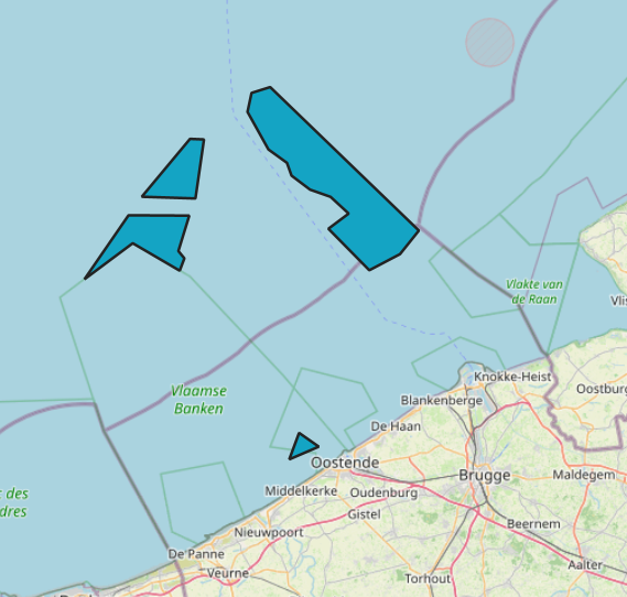
The Royal Decree of 20 March 2026 establishing the marine spatial plan for the period 2026 to 2034 in the Belgian marine areas defines 5 fishery management zones: Zone with prohibition of active bottom-disturbing commercial fishing (Art. 10§2), Zone with prohibition of bottom-disturbing commercial fishing (Art. 10§2), Fisheries research zone (Art. 17§2), Zone accessible to aquaculture and passive fisheries (Art. 18), Zone with prohibition of bottom-disturbing recreational fishing (Art. 24§2). It replaces the 2020 Marine Spatial Plan. Please refer to the Belgian official gazette ("Moniteur belgeBelgisch Staatsblad") for official reference information.
-
2019 Belgian MSP - Princess Elizabeth Zone for renewable Energy in the Belgian Part of the North Sea
This dataset represents the location of the Princess Elizabeth zone in the Belgian Part of the North Sea as described in the Royal Decree of May 22th, 2019, establishing a marine spatial plan for the period 2020-2026. Art. 8. § 3.
-
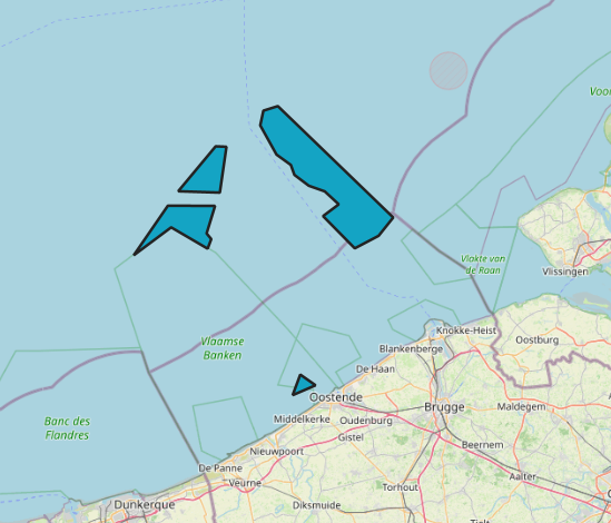
The Royal Decree of 20 March 2026 establishing the marine spatial plan for the period 2026 to 2034 in the Belgian marine areas defines 3 aquaculture zones: Fisheries research zone (Art. 17§2), Zone accessible to aquaculture and passive fisheries (Art. 18), Zone accessible to aquaculture (Art. 18§1). It replaces the 2020 Marine Spatial Plan. Please refer to the Belgian official gazette ("Moniteur belgeBelgisch Staatsblad") for official reference information.