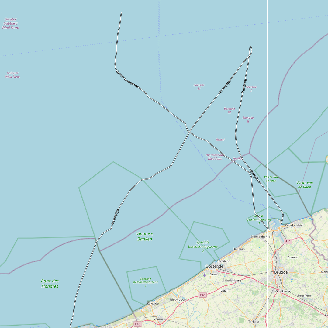
Gas pipelines as built in the Belgian Part of the North Sea
This dataset represents the exact location of gas pipelines installed in the Belgian Part of the North Sea.
Simple
- Date (Creation)
- 2021-11-18
- Date (Revision)
- 2021-11-22
- Date (Publication)
- 2026-02-06
- Date (Creation)
- 2016-05-19
- Unique resource identifier
- https://doi.org/10.24417/f0d44b8c-6d2f-4431-8727-616b119c9ed6
- Identifier
-
http://metadata.naturalsciences.be
/
f0d44b8c-6d2f-4431-8727-616b119c9ed6
- Date
- Other citation details
- This dataset is composed of the following sources: Gas pipelines as built in the Belgian Part of the North Sea.
Author
Royal Belgian Institute for Natural Sciences (RBINS), Directorate Natural Environment (OD Nature)
https://odnature.naturalsciences.be/
https://odnature.naturalsciences.be/
Custodian
Royal Belgian Institute of Natural Sciences (RBINS), Directorate Natural Environment (OD Nature), Belgian Marine Data Centre (BMDC)
https://www.bmdc.be
https://www.bmdc.be
- Keywords
-
- marine spatial planning
- Marine essentials
- Federal government
- Reporting INSPIRE
- Use constraints
- Other restrictions
- Other constraints
- No conditions apply to access and use
- Other constraints
- https://creativecommons.org/licenses/by/4.0/
- Access constraints
- Other restrictions
- Other constraints
- No limitations on public access.
- Use limitation
- No conditions apply to use.
- Classification
- Unclassified
- Spatial representation type
- Vector
- Metadata language
- English
- Topic category
-
- Oceans
- Utilities communication
N
S
E
W
))
- Extent type code
- Yes
- Date
- Unique resource identifier
- North Sea
- gml32:beginPosition
- 2014-01-01
- Reference system identifier
- http://www.opengis.net/def/crs/EPSG/0/4258
- Distribution format
-
-
application/xml
(
Unknown
)
-
application/xml
(
Unknown
)
Distributor
Custodian
Royal Belgian Institute of Natural Sciences (RBINS), Directorate Natural Environment (OD Nature), Belgian Marine Data Centre (BMDC)
https://www.bmdc.be
https://www.bmdc.be
- Name
- application/xml
- Version
- Unknown
- Transfer size
- 0.22797
- OnLine resource
-
od_nature:MUMM_pipelines_ETRS89
(
OGC:WMS
)
A WMS service to view a map
Distributor
Custodian
Royal Belgian Institute of Natural Sciences (RBINS), Directorate Natural Environment (OD Nature), Belgian Marine Data Centre (BMDC)
https://www.bmdc.be
https://www.bmdc.be
- Name
- application/xml
- Version
- Unknown
- Transfer size
- 0.110439
- OnLine resource
-
od_nature:MUMM_pipelines_ETRS89
(
OGC:WFS
)
A WFS service to download
- OnLine resource
- Digital Object Identifier (DOI) ( DOI )
- Hierarchy level
- Dataset
Conformance result
- Date (Publication)
- 2010-12-08
- Explanation
- See the referenced specification
- Pass
- Yes
- Statement
- This dataset represents the location of each gas pipeline, as known from the charts, laid down in the Belgian Part of the North Sea and has not been modified or altered.
- File identifier
- f0d44b8c-6d2f-4431-8727-616b119c9ed6 XML
- Metadata language
- English
- Character set
- UTF8
- Hierarchy level
- Dataset
- Date stamp
- 2026-02-06T16:29:54.100Z
- Metadata standard name
- Geographic information -- Metadata
- Metadata standard version
- ISO 19115:2003/19139
Overviews

large_thumbnail
Spatial extent
N
S
E
W
))
Provided by

Associated resources
Not available
 geo.be Metadata Catalog