gravel extraction
Type of resources
Available actions
Topics
INSPIRE themes
federalThemes
Keywords
Contact for the resource
Provided by
Years
Formats
Representation types
Update frequencies
status
Scale
-

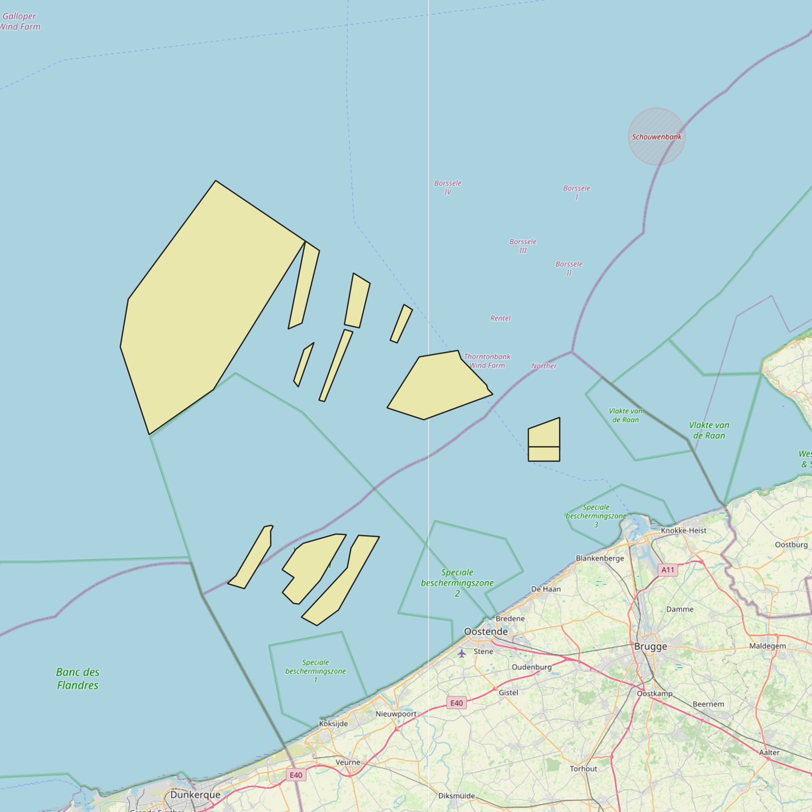
The dataset shows in the form of polygons the sand and gravel extraction sites in the Belgian marine areas as defined by the successive marine spatial plans. A 2014 version illustrates the 2014-2020 plan while the 2020 version illustrates the 2020-2026 plan.
-

The Royal Decree of 22 May 2019 establishing a marine spatial plan defines 12 sand and gravel extraction zones: Sand and gravel exploitation sector 1a (Thorntonbank) (Art. 15§1), Sand and gravel exploitation sector 2br (Buiten Ratel) (Art. 15§1), Sand and gravel exploitation sector 2kb (Kwintebank) (Art. 15§1), Sand and gravel exploitation sector 2od (Oostdyck) (Art. 15§1), Sand and gravel exploitation sector 3a (Sierra Ventana) (Art. 15§1), Sand and gravel exploitation sector 3b (Sierra Ventana) (Art. 15§1), Sand and gravel exploitation sector 4a (Noordhinder) (Art. 15§1), Sand and gravel exploitation sector 4b (Oosthinder-noord) (Art. 15§1), Sand and gravel exploitation sector 4c (Oosthinder-zuid) (Art. 15§1), Sand and gravel exploitation sector 4d (Westhinder) (Art. 15§1), Sand and gravel exploitation sector 5 (Blighbank) (Art. 15§1), Zone for research of the potential of the exploration and exploitation of sand and gravel (Art. 15§4). It replaces the 2014 Marine Spatial Plan, which is included for completeness.. The Royal Decree of 20 March 2014 establishing a marine spatial plan defines in its Art. 11., eleven Management zones with regards to sand and gravel extraction: ten sand and gravel exploitation zones (Thorntonbank, Art. 11 § 1 Sector 1a, Kwintebank, Art. 11 § 1 Sector 2kb, Buiten Ratel, Art. 11 § 1 Sector 2br, Oostdyck, Art. 11 § 1 Sector 2od, Sierra Ventana, Art. 11 § 1 Sector 3a, Sierra Ventana, Art. 11 § 1 Sector 3b, Noord Hinder, Art. 11 § 1 Sector 4a, Oosthinder-noord, Art. 11 § 1 Sector 4b, Oosthinder-zuid, Art. 11 § 1 Sector 4c, Westhinder, Art. 11 § 1 Sector 4d) and one reference zone for monitoring impact of windmills and sand exploitation (Art. 11 § 3). These zones are made available digitally in the resource described by this metadata document. Please refer to the Belgian official gazette (\"Moniteur belge/Belgisch Staatsblad\") for official reference information.
 geo.be Metadata Catalog