 geo.be Metadata Catalog
economic planning
Type of resources
Topics
INSPIRE themes
Keywords
Contact for the resource
Provided by
Years
Formats
Representation types
-
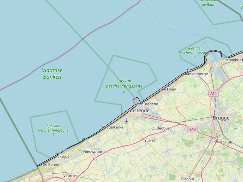
The Royal Decree of 20 March 2026 establishing the marine spatial plan for the period 2026 to 2034 in the Belgian marine areas defines 1 coastal protection experiments zone: Coastal protection belt (Art. 20§2). It replaces the 2020 Marine Spatial Plan. Please refer to the Belgian official gazette ("Moniteur belgeBelgisch Staatsblad") for official reference information.
-
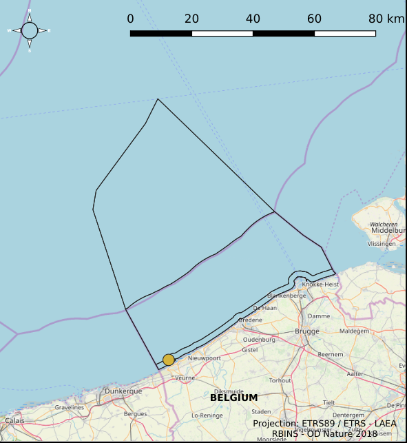
The Royal Decree of 22 May 2019 establishing a marine spatial plan defines 1 coastal protection experiments zone: Zone for coastal protection experiments (Art. 16§2). It replaces the 2014 Marine Spatial Plan, which is included for completeness. The Royal Decree of 20 March 2014 establishing a marine spatial plan defines in its Art. 12. §1 one zone for coastal protection experiments. This zone is made available digitally in the resource described by this metadata document. Please refer to the Belgian official gazette (\"Moniteur belge/Belgisch Staatsblad\") for official reference information.
-
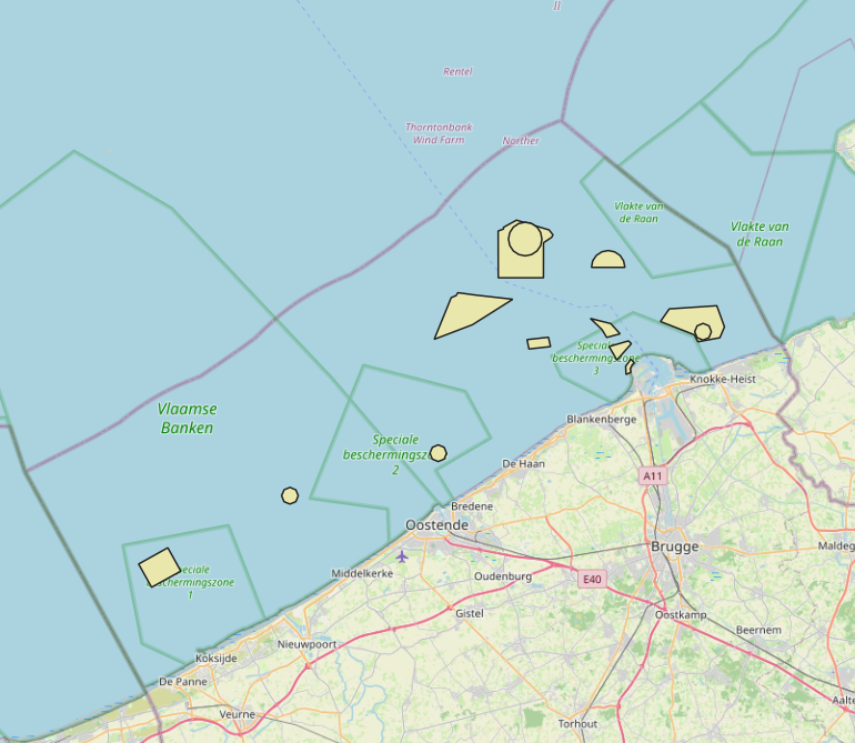
The Royal Decree of 20 March 2026 establishing the marine spatial plan for the period 2026 to 2034 in the Belgian marine areas defines 13 nature conservation areas: Seabed integrity zone: Zone 1, upper (Art. 10§1.1°), Seabed integrity zone: Zone 2, middle (Art. 10§1.2°), Seabed integrity zone: Zone 3, lower (Art. 10§1.3°), Ramsar area (Art. 11), Special Area of Conservation "Vlaamse Banken" (Art. 8§1), Special Area of Conservation "Vlakte van de Raan" (Art. 8§3), Special Protection Area for Birds: SPA 1 (Art. 8§5.1°), Special Protection Area for Birds: SPA 2 (Art. 8§5.2°), Special Protection Area for Birds: SPA 3 (Art. 8§5.3°), Marine reserve: Zone 1, upper (Art. 9§1.1°), Marine reserve: Zone 2a, middle (Art. 9§1.2°), Marine reserve: Zone 2b, middle (Art. 9§2), Marine reserve: Zone 3, lower (Art. 9§3). It replaces the 2020 Marine Spatial Plan. Please refer to the Belgian official gazette ("Moniteur belgeBelgisch Staatsblad") for official reference information.
-
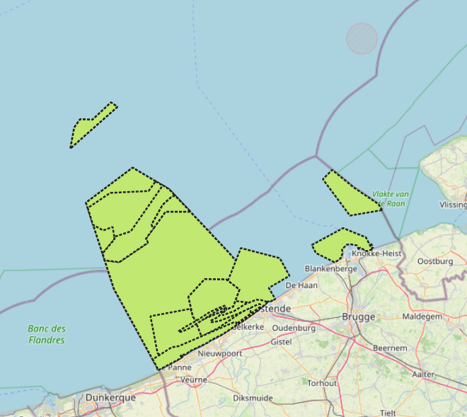
The Royal Decree of 20 March 2026 establishing the marine spatial plan for the period 2026 to 2034 in the Belgian marine areas defines 13 dredging zones: Dredge spoil disposal zone S1 (Art. 15§1.1°), Dredge spoil disposal zone S2 (Art. 15§1.2°), Dredge spoil disposal zone "Public Works Ostend" (Art. 15§1.3°), Dredge spoil disposal zone "Public Works Zeebrugge East" (Art. 15§1.4°), Dredge spoil disposal zone "Public Works Zeebrugge West" (Art. 15§1.5°), Dredge spoil disposal site "Public Works Nieuwpoort" (Art. 15§1.6°), Dredge spoil disposal zone "Zeebrugge Erosion Pit" (Art. 15§1.7°), Zone 1 for future replacement of dredge spoil zone S1 (Art. 15§4.1°), Zone 2 for future replacement of dredge spoil zone S1 (Art. 15§4.2°), Search zone 1 for future replacement of Zeebrugge East and West (Art. 15§6), Search zone 2 for future replacement of Zeebrugge East and West (Art. 15§6), Search zone 3 for future replacement of Zeebrugge East and West (Art. 15§6), Dredge spoil disposal zone for future replacement "Public Works Nieuwpoort" (Art. 15§8). It replaces the 2020 Marine Spatial Plan. Please refer to the Belgian official gazette ("Moniteur belgeBelgisch Staatsblad") for official reference information.
-
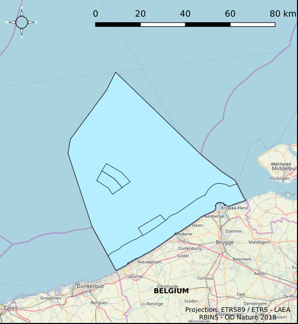
The Royal Decree of 22 May 2019 establishing a marine spatial plan defines 7 fishery management zones: Professional fisheries (Art. 13), Passive fisheries area (Noordhinder Noord) (Art. 14§4), Passive fisheries area (Noordhinder Zuid) (Art. 14§4), Passive fisheries (Fairybank) (Art. 14§4), Search area 1 for fisheries techniques (Art. 6§1), Search area 2 for fisheries techniques (Art. 6§1), Search area 3 for fisheries techniques (Art. 6§1). It replaces the 2014 Marine Spatial Plan, which is included for completeness. The Royal Decree of 20 March 2014 establishing a marine spatial plan defines in its Art. 6, six fisheries management areas: Regular regime, Art. 6 § 1; Fisheries management area 1, Art. 6 § 1.1°; Fisheries management area 2, Art. 6 § 1.2°; Fisheries management area 3, Art. 6 § 1.3°; Fisheries management area 4, Art. 6 § 1.4°; Fisheries management area 5, Art. 6 § 3. These zones are made available digitally in the resource described by this metadata document. Please refer to the Belgian official gazette (\"Moniteur belge/Belgisch Staatsblad\") for official reference information.
-
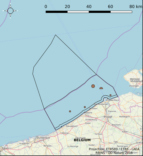
The Royal Decree of 22 May 2019 establishing a marine spatial plan defines in its Art. 11. five dredged material disposal sites (Dredged material disposal site S1, Art. 11 § 1.1°; Dredged material disposal site S2, Art. 11 § 1.2°; Dredged material disposal site Bruggen en Wegen Oostende, Art. 11 § 1.3°; Dredged material disposal site Bruggen en Wegen Zeebrugge Oost, Art. 11 § 1.4°; Dredged material disposal site Bruggen en Wegen Nieuwpoort, Art. 11 § 1.5°). Futhermore, additional zones are defined for the future replacement of dredging areas as defined in Art. 11 §3, §5, §7 and §9. It replaces the 2014 Marine Spatial Plan, which is included for completeness. The Royal Decree of 20 March 2014 establishing a marine spatial plan defines in its Art. 9. five dredged material disposal sites (Dredged material disposal site S1, Art. 9 § 6.1°; Dredged material disposal site S2, Art. 9 § 6.2°; Dredged material disposal site Bruggen en Wegen Oostende, Art. 9 § 6.3°; Dredged material disposal site Bruggen en Wegen Zeebrugge Oost, Art. 9 § 6.4°; Dredged material disposal site Bruggen en Wegen Nieuwpoort, Art. 9 § 6.5°). These zones are made available digitally in the resource described by this metadata document. Please refer to the Belgian official gazette (\"Moniteur belge/Belgisch Staatsblad\") for official reference information.
-
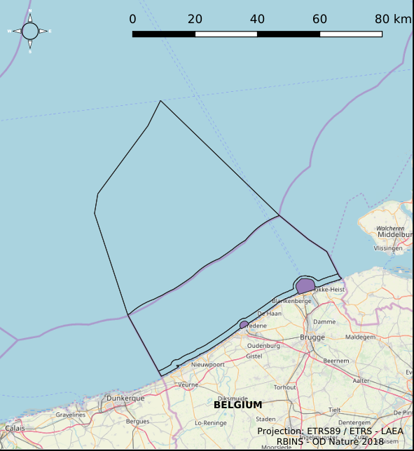
The Royal Decree of 22 May 2019 establishing a marine spatial plan defines 2 potential seaport expansion zones: Potential harbour extension Oostende (Art. 12§2), Potential harbour extension Zeebrugge (Art. 12§3). It replaces the 2014 Marine Spatial Plan, which is included for completeness. The Royal Decree of 20 March 2014 establishing a marine spatial plan defines in its Art. 9. § 10, two zones (Art. 9 §10 zone 1, Ostend, Art. 9 §10 zone 2, Zeebrugge) for the potential extension of the sea ports of Ostend en Zeebrugge. These zones are made available digitally in the resource described by this metadata document. Please refer to the Belgian official gazette (\"Moniteur belge/Belgisch Staatsblad\") for official reference information.
-
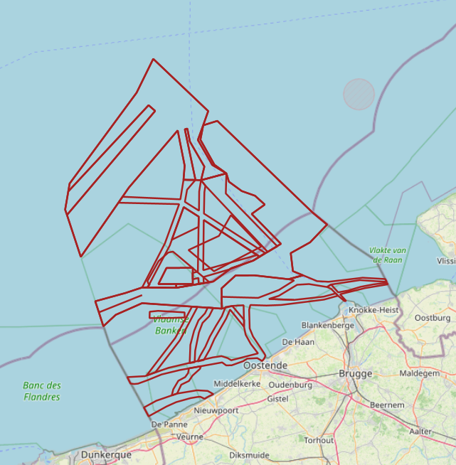
The Royal Decree of 20 March 2026 establishing the marine spatial plan for the period 2026 to 2034 in the Belgian marine areas defines 20 shipping and ports zones: IMO shipping zones (Art. 14§2), Traffic separation schemes (Art. 14§2), IMO traffic separation scheme "Noordhinder South" (Art. 14§2.1°), IMO precautionary area "in the vicinity of Thornton and Blighbank" (Art. 14§2.10°), Other routes and traffic flows (Royal Decree) (Art. 14§2.11°-19°), IMO traffic separation scheme "Off Noordhinder" (Art. 14§2.2°), IMO precautionary area "Noordhinder Junction" (Art. 14§2.3°), IMO traffic separation scheme "At Westhinder" (Art. 14§2.4°), Separation line "At West Hinder" (Art. 14§2.4°), IMO precautionary area "At Westhinder" (Art. 14§2.5°), IMO area to be avoided "At Westhinder" (Art. 14§2.6°), IMO deep-water route "Approach to the Scheldt" (Art. 14§2.7°), IMO two-way route "Westpit" (Art. 14§2.8°), IMO precautionary area "At Gootebank" (Art. 14§2.9°), Anchorage area "Oostdyck" (Art. 14§3.1°), IMO anchorage area "At Westhinder" (Art. 14§3.2°), Maritime safety research zone: Zone 1 (Art. 14§5.1°), Maritime safety research zone: Zone 2 (Art. 14§5.2°), Maritime safety research zone: Zone 3 (Art. 14§5.3°). It replaces the 2020 Marine Spatial Plan. Please refer to the Belgian official gazette ("Moniteur belgeBelgisch Staatsblad") for official reference information.
-
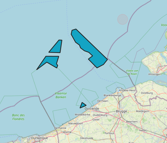
The Royal Decree of 20 March 2026 establishing the marine spatial plan for the period 2026 to 2034 in the Belgian marine areas defines 3 aquaculture zones: Fisheries research zone (Art. 17§2), Zone accessible to aquaculture and passive fisheries (Art. 18), Zone accessible to aquaculture (Art. 18§1). It replaces the 2020 Marine Spatial Plan. Please refer to the Belgian official gazette ("Moniteur belgeBelgisch Staatsblad") for official reference information.
-
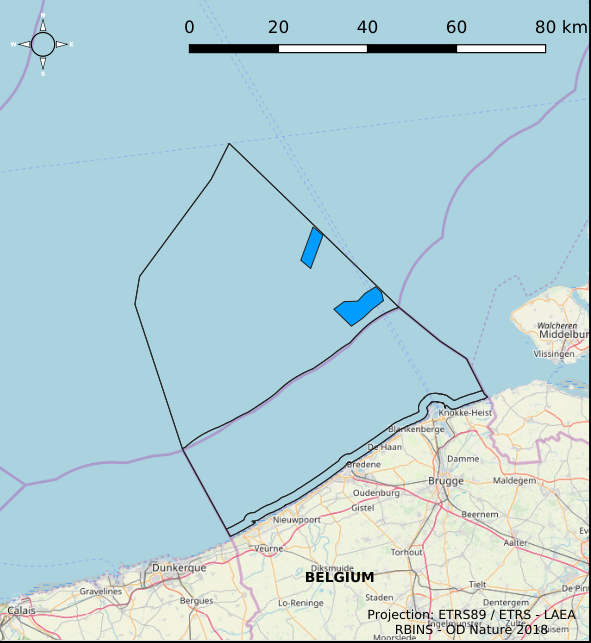
The Royal Decree of 22 May 2019 establishing a marine spatial plan defines 4 aquaculture zones: Zone 1 for aquaculture (Eastern zone) (Art. 14§1), Zone 2 for aquaculture (Noordhinder Noord) (Art. 14§2), Zone 3 for aquaculture (Noordhinder Zuid) (Art. 14§3), Zone 4 for aquaculture (Fairybank) (Art. 14§3). It replaces the 2014 Marine Spatial Plan, which is included for completeness. The Royal Decree of 20 March 2014 establishing a marine spatial plan defines in its Art. 10, two zones for sustainable aquaculture: Zone 1 for sustainable aquaculture, Art. 10 § 2 Zone 1; Zone 2 for sustainable aquaculture, Art. 10 § 2 Zone 2. These zones are made available digitally in the resource described by this metadata document. Please refer to the Belgian official gazette (\"Moniteur belge/Belgisch Staatsblad\") for official reference information.