 geo.be Metadata Catalog
jp2
Type of resources
Available actions
Topics
INSPIRE themes
federalThemes
Keywords
Contact for the resource
Provided by
Years
Formats
Representation types
Update frequencies
status
Resolution
-
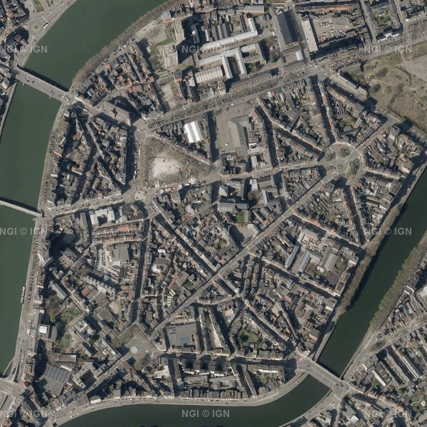
This dataset contains the most recent orthophoto mosaics for the Belgian territory. Orthophotos are aerial photographs that have been geometrically corrected (orthorectification) to eliminate distortions caused, among other things, by terrain, the camera lens and the camera viewing angle. As a result, they have accurate geometry and can be used for cartography, measurements and visual analysis, among other applications. The orthophoto data are provided by the Belgian administrative Regions and integrated by the National Geographic Institute (NGI) into a single national coverage. The transitions between the orthophotos from the different Regions are carefully adjusted to create a seamless and visually homogeneous whole. The dataset is updated annually with the most recent orthophoto data. The aim is to provide complete national orthophoto coverage every year. However, not every year provides complete coverage of Belgium. In such cases, the national coverage is supplemented with orthophotos from previous years. The dataset is updated in phases. For the 2026 edition, orthophoto tiles for Wallonia are currently available. The data for Flanders will be added as soon as they become available. The 2026 data can currently be downloaded, but have not yet been included in the WMS/WMTS web services. All orthophotos are colour images (RGB). The ground sampling distance (GSD) is 25 cm in Wallonia and 12.5 cm in Flanders and the Brussels-Capital Region. Since 2026, the orthophoto mosaics have been divided into tiles according to the NGI 25K grid, a fixed geographical grid covering the Belgian territory. The data can be downloaded as compressed JPEG2000 files (JP2), together with the corresponding world file (.j2w) and metadata describing the extent. The dataset is INSPIRE-compliant.