 geo.be Metadata Catalog
Keyword
Terrain model, DTM, eTOD, ADQ, aviation
Type of resources
Available actions
Topics
INSPIRE themes
federalThemes
Keywords
Contact for the resource
Provided by
Years
Formats
Representation types
Update frequencies
status
Resolution
From
1
-
1
/
1
-
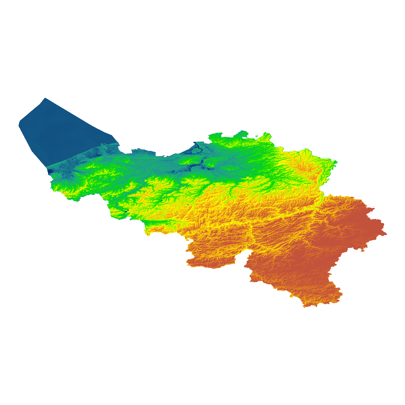
The eTOD digital terrain model (DTM) is a homogeneous and regular point grid that models the height of the ground level for Belgian territory and the height of the sea level in the maritime zone. The primary source is the NGI DTM 5m, which is itself compiled based on the most recent altimetry data of the three Belgian regions and is periodically updated per map sheet at a scale of 1:50,000 using recent stereoscopic aerial images. Where available, updates from the notification platform for aviation obstacles and terrain changes are also integrated. For this DTM, the resolution (1 arcsecond) and the coordinate reference system (WGS84 + EGM2008) are used as defined in the eTOD specifications.