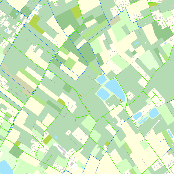
Top10Vector
Simple
- Date (Revision)
- 2026-01-23
- Date (Publication)
- 2013-12-20
- Identifier
- BE.NGI-IGN / e0fdc885-8851-482e-80c9-6a0ba3709761
- Purpose
- Top10Vector contains the data which are used in the first place to make topographic maps at the scales of 1:10 000 and 1:20 000. However, shifting data or other kinds of generalisation for these cartographic applications are avoided during the production of these vector data, as they constitute a geographic reference inventory of the Belgian territory and as such they can be used for a wide range of applications. Whenever it was possible, external thematic identification codes have been linked to Top10Vector in order to facilitate the links with other datasets.
- Status
- Completed
- Maintenance and update frequency
- Quarterly
- Maintenance note
- The update cycle frequency the NGI aims at is 1 year for the road network,3 years for the constructions and 6 for all the other themes.
- Keywords
-
- HVD_cat_hydrography, HVD_cat_land_use, HVD_cat_land_cover, HVD_cat_transport networks, HVD_cat_buildings, HVD_cat_energy_resources
- Use limitation
- https://creativecommons.org/licenses/by/4.0/
- Access constraints
- Other restrictions
- Other constraints
- No limitations on public access
- Use constraints
- Other restrictions
- Other constraints
- https://creativecommons.org/licenses/by/4.0/
- Spatial representation type
- Vector
- Denominator
- 10000
- Metadata language
- English
- Character set
- 8859 Part 15
- Topic category
-
- Imagery base maps earth cover
- Description
- Belgium
))
- Distribution format
-
-
GeoPackage
(
1.3.0
)
-
Esri Shapefile
(
10.2
)
-
GeoPackage
(
1.3.0
)
- OnLine resource
-
View service
(
OGC:WMS
)
View service
- OnLine resource
-
Downloadable data
(
WWW:DOWNLOAD-1.0-http--download
)
Downloadable data
- OnLine resource
-
Downloadable data
(
WWW:DOWNLOAD-1.0-http--download
)
Downloadable data
- OnLine resource
-
Downloadable data
(
WWW:DOWNLOAD-1.0-http--download
)
Downloadable data
- OnLine resource
-
Downloadable data
(
WWW:DOWNLOAD-1.0-http--download
)
Downloadable data
- OnLine resource
-
Federal download service
(
WWW:LINK-1.0-http--link
)
Federal download service
- OnLine resource
-
https://ac.ngi.be/remoteclient-open/ngi-standard-open/Specifications/Vectordata/Top10Vector_ProductSpecification_EN.pdf
(
WWW:LINK-1.0-http--link
)
Technical specifications of the product
- Hierarchy level
- Dataset
- Dataset
- Top10Vector
Domain consistency
- Name of measure
- INSPIRE Conformity
Conformance result
- Date (Publication)
- 2010-12-08
- Explanation
- The dataset’s compliance with the technical requirements as defined by the Commission Regulation (EU) No 1089/2010 of 23 November 2010 has not been checked
- Statement
- For this data set, the NGI aims at an update cycle of 1 year for the road network, 3 years for the constructions and 6 years for all the other themes, The update processes vary according to the theme. The road network and the constructions are updated by means of photogrammetric restitution and field surveys. The geometry of these data is updated in stereoscopy (3D), using recent aerial color photographs. Moreover, some topological rules which apply to this dataset are checked. Next, these data are passed on to the field survey service which will update the attribute data. The update of all the other themes is done by interpretation on orthophotographs and field surveys.First, the geometry and the attribute data are updated in monoscopy (2D), using recent orthophotographs. Next, these data are checked on the field and completed. The NGI collaborates with other organizations for the update of certain themes (re-use of existing data). In order to respect the update cycles whenever it is possible, we sometimes work with subcontractors.
- File identifier
- e0fdc885-8851-482e-80c9-6a0ba3709761 XML
- Metadata language
- English
- Character set
- UTF8
- Hierarchy level
- Dataset
- Date stamp
- 2026-02-19T14:57:35
- Metadata standard name
- ISO 19115:2003/19139
- Metadata standard version
- 1.0
Overviews

Spatial extent
))
Provided by

 geo.be Metadata Catalog