 geo.be Metadata Catalog
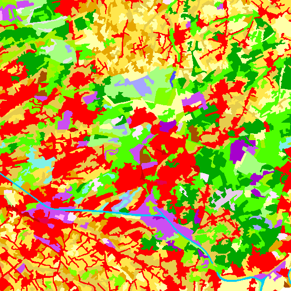
CORINE Land Cover-2012-Belgium
Simple
- Date (Creation)
- 2014-06-23
- Edition
- Version 4.0
Identifier
- Identifier
- BE.NGI-IGN / bcd19aa9-c320-4116-971b-6e4376137f13
- Purpose
-
The CORINE Land Cover 2012 Belgium data set has been produced within the framework of the CORINE Land Cover 2012 project, which is managed by the European Environment Agency. The aim of this agency is to produce a complete soil use cover for 38 European countries. This product is regarded as the third update of the CORINE Land Cover 1995 data set. The previous updates took place in 2000 and 2006. The CORINE Land Cover data set is intended for environment management at European level.
.
- Status
- Completed
- Maintenance and update frequency
- Irregular
- Name
- ESRI Shapefile
- Version
- 1.0
- Use limitation
- https://creativecommons.org/licenses/by/4.0/
- Access constraints
- Other restrictions
- Other constraints
- No limitations on public access
- Use constraints
- Other restrictions
- Other constraints
- https://creativecommons.org/licenses/by/4.0/
- Spatial representation type
- Vector
- Denominator
- 100000
- Metadata language
- Nederlands; Vlaams
- Character set
- 8859 Part 15
- Topic category
-
- Imagery base maps earth cover
- Description
- Belgium
))
- Unique resource identifier
- EPSG:3812
- Codespace
- EPSG
- Distribution format
-
-
Esri Shapefile
(
)
-
Esri Shapefile
(
)
- OnLine resource
-
Service does not display good with Chrome. Use rather Mozilla or Explorer.
(
ATOM
)
Service does not display good with Chrome. Use rather Mozilla or Explorer.
- OnLine resource
-
Federal download service
(
WWW:LINK-1.0-http--link
)
Federal download service
- OnLine resource
-
Downloadable data
(
WWW:DOWNLOAD-1.0-http--download
)
Downloadable data
- OnLine resource
-
View service
(
OGC:WMS
)
View service
- Hierarchy level
- Dataset
- Other
- CORINE Land Cover 2012 Belgium
Domain consistency
- Name of measure
- INSPIRE Conformity
Conformance result
- Date (Publication)
- 2010-12-08
- Explanation
- The dataset described does not fill the technical requirements sustaining the interoperability of data sets and services, as stipulated in the Commission Regulation (EU) No 1089/2010 of 23 November 2010
- Pass
- No
- Statement
-
The data set contains two polygonal layers: CLC2012 and CHA12_BE.
The CLC2012 layer has been produced by making the intersection between the revised CORINE Land Cover 2006 layer and the layer with changes between 2006 and 2012 (CHA12_BE).
The CHA12_BE layer has been produced by a visual comparison of the i2006 and i2012 images, SPOT/IRS and SPOT/IRS images respectively which cover Belgium. The topographic maps at the 1:10 000 and 1:50 000 scales and orthophotographs have been used as additional data.
- Description
- Correction of some flagrant errors in the CORINE Land Cover 2006 data set.
- Date / Time
- 2013-10-01T09:00:00
- Description
- Production of the CHA12_BE layer containing the changes between i2006 and i2012 on the basis of the revised CORINE Land Cover 2006 data set.
- Date / Time
- 2014-01-01T09:00:00
- Description
- Intersection of the changes layer and the revised CORINE Land Cover 2006 data set.
- Date / Time
- 2014-01-01T09:00:00
- Description
- Generalization of the polygons < 25ha resulting from the intersection.
- Date / Time
- 2014-01-01T09:00:00
- Compliance code
- Yes
- Metadata language
- English
- Included with dataset
- Yes
- Feature types
- CHA12_BE
- Feature types
- CLC12_BE
- Feature types
- CLC06rev_BE
- File identifier
- bcd19aa9-c320-4116-971b-6e4376137f13 XML
- Metadata language
- English
- Character set
- UTF8
- Hierarchy level
- Dataset
- Date stamp
- 2026-02-19T14:55:49
- Metadata standard name
- ISO 19115:2003/19139
- Metadata standard version
- 1.0
Overviews
Spatial extent
Provided by
