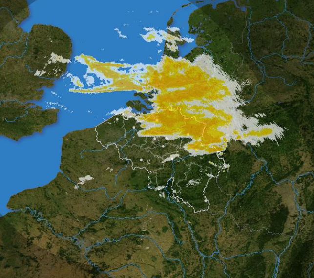
Belgian rainfall composite
The composite is produced every 5 minutes using the reflectivity data from the Wideumont and Jabbeke weather radars.
This product is not publicly available yet.
Simple
- Date (Revision)
- 2025-10-20
- Identifier
- RMI-be / belgian_composite
- Status
- On going
- Maintenance and update frequency
- Continual
- GEMET - INSPIRE themes, version 1.0
-
- Atmospheric conditions
- Keywords
-
- federal government
- radar
- observation
- Spatial scope
- Access constraints
- Other restrictions
- Other constraints
- No limitations on public access
- Use constraints
- Other restrictions
- Classification
- Unclassified
- Spatial representation type
- Grid
- Distance
- 500 http://standards.iso.org/ittf/PubliclyAvailableStandards/ISO_19139_Schemas/resources /uom/ML_gmxUom.xml#m
- Metadata language
- English
- Topic category
-
- Climatology, meteorology, atmosphere
N
S
E
W
))
- Begin date
- 2016-04-01T00:00:00
- Unique resource identifier
- EPSG:4258
- Distribution format
-
-
HDF
(
5
)
-
HDF
(
5
)
- OnLine resource
-
RMI open data portal
(
WWW:LINK-1.0-http--link
)
RMI open data portal
- Hierarchy level
- Dataset
- Other
- dataset
Domain consistency
- Name of measure
- INSPIRE Conformity
Conformance result
- Date (Publication)
- 2010-12-08
- Explanation
- See the referenced specification
- Pass
- No
- Statement
- The rainfall composite combines 2D products from the Wideumont, Jabbeke and Zaventem weather radars. Reflectivity values are converted into rainrates using the Marshall-Palmer relation. For each pixel, the maximum value of the three products is taken. The effective coverage of the composite is smaller than the bounding box. It is determined by the maximum ranges of the three radars, i.e. 250 km for Wideumont, 300 km for Jabbeke, and 250 km for Zaventem.
- File identifier
- RMI_DATASET_BELGIAN_COMPOSITE XML
- Metadata language
- English
- Hierarchy level
- Dataset
- Date stamp
- 2025-10-20
Overviews

Spatial extent
N
S
E
W
))
Provided by

Associated resources
Not available
 geo.be Metadata Catalog