 geo.be Metadata Catalog
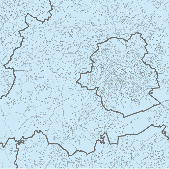
Statistical sectors in Belgium (native version)
Simple
- Date (Creation)
- 2001-10-01
- Date (Revision)
- 2022-01-01
- Identifier
- BE.STATBEL / BE_STATBEL_SH_SU_STATDIS_NAT
- Purpose
- The statistical districts have been made to give a detailed picture of socio-economic conditions and housings in the municipalities.
- Credit
- STATBEL
- Status
- Completed
- Maintenance and update frequency
- Annually
- Use limitation
-
An open data license is available in French an Dutch
- Access constraints
- Other restrictions
- Other constraints
- No limitations on public access
- Use constraints
- Other restrictions
- Other constraints
-
An open data license is available in French an Dutch
- Classification
- Unclassified
- Spatial representation type
- Vector
- Denominator
- 10000
- Metadata language
- English
- Character set
- UTF8
- Topic category
-
- Boundaries
))
- gml32:beginPosition
- 2001-10-01
- Distribution format
-
-
GeoPackage
(
)
-
GeoJSON
(
)
-
Esri Shapefile
(
)
-
GeoPackage
(
)
- OnLine resource
-
Downloadable data
(
WWW:DOWNLOAD-1.0-http--download
)
Downloadable data
- OnLine resource
-
Downloadable data
(
WWW:DOWNLOAD-1.0-http--download
)
Downloadable data
- OnLine resource
-
Downloadable data
(
WWW:DOWNLOAD-1.0-http--download
)
Downloadable data
- OnLine resource
-
https://statbel.fgov.be/sites/default/files/files/opendata/Statistische%20sectoren/Secteurs%20stat-NL_tcm325-174181.pdf
(
WWW:LINK-1.0-http--link
)
Vademecum about statistics sectors
- OnLine resource
-
Downloadable data
(
WWW:DOWNLOAD-1.0-http--download
)
Downloadable data
- OnLine resource
-
Downloadable data
(
WWW:DOWNLOAD-1.0-http--download
)
Downloadable data
- OnLine resource
-
Downloadable data
(
WWW:DOWNLOAD-1.0-http--download
)
Downloadable data
- Hierarchy level
- Dataset
- Name of measure
- INSPIRE Conformity
Domain consistency
- Name of measure
- INSPIRE Conformity
Conformance result
- Date (Publication)
- 2010-12-08
- Explanation
- The dataset described does not fill the technical requirements sustaining the interoperability of data sets and services, as stipulated in the Commission Regulation (EU) No 1089/2010 of 23 November 2010
- Pass
- No
- Statement
-
The statistical sectors were created based on social, economic, urbanistic or morphological characteristics as part of the population and housing census from 1970. They were outlined and represented on analogue topographic 1:10,000 maps.
Since then, they were updated several times:
• the general population and housing census from 1981: to take into account the increase in settlement clusters, new infrastructure works as well as the new administrative borders due to the merger of municipalities carried out since the 1970 census;
• the general population and housing census from 1991: to integrate the new administrative borders from the merger of municipalities in Antwerp;
• the socio-economic survey from 2001: to take into account the exchange of territories among municipalities, the increase in settlement clusters and employment zones as well as the new infrastructure works such as the TGV railway line;
• the population and housing census from 2011: to integrate the new municipal borders from an exchange of territories between two municipalities (Seneffe and Manage in the province of Hainaut) ;
• in 2018: to integrate an exchange of territories between Belgium and the Netherlands and to include the intertidal zone in the territory of the municipalities bordering the North Sea and the new version of the administrative borders published by the General Administration of the Patrimonial Documentation;
• since 2019, the borders of statistical sectors are reviewed annually based on the municipal borders provided by the General Administration of the Patrimonial Documentation in order to take into account their evolutions and geometric corrections.
The digital versions available are derived from the vectorisation of analogue 1:10,000 maps from 1981 referenced in the CRS EPSG 31370 (Belgian Lambert 72) by means of electronic tables to be digitized. The 2001 version is built from a general version (1:10,000) of the administrative borders provided by the National Geographic Institute (NGI), while the following versions are based on more precise versions provided by the General Administration of the Patrimonial Documentation.
- File identifier
- 4d8e0053-fdf5-42e4-a359-1a3386d95899 XML
- Metadata language
- English
- Character set
- UTF8
- Hierarchy level
- Dataset
- Date stamp
- 2024-08-06T11:45:53
- Metadata standard name
- ISO 19115:2003/19139
- Metadata standard version
- 1.0
Overviews
Spatial extent
Provided by
