 geo.be Metadata Catalog
Weather Model Alaro
Weather Model 'Alaro'
A numerical forecast model is a computer program that simulates the evolution of the atmosphere.
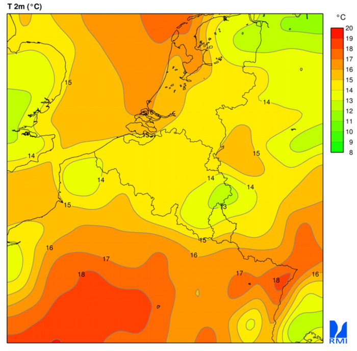
Available parameters : Temperature, Max. temperature, Min. temperature, Dewpoint temperature, Wet-bulb potential temperature, Cloud cover (low, medium, high, tot.), U and V wind component, U, V and vertical velocity, Stationary boundary layer (SBL) Gust, Total precipitation, Large scale rain, Convective rain, Large scale snow, Convective snow, Relative Humidity, Specific humidity, Geopotential, Mean sea level pressure, Orography, freezing level / 0°C isotherm, Convective available potential energy (CAPE)
Simple
- Date (Creation)
- 2010-01-01
- Identifier
- RMI-be / alaro
- Status
- On going
- Maintenance and update frequency
- Continual
- GEMET - INSPIRE themes, version 1.0
-
- Atmospheric conditions
- Keywords
-
- Reporting INSPIRE
- federal government
- forecast
- temperature
- wind
- precipitation
- rain
- snow
- dewpoint temperature
- cloud cover
- relative humidity
- specific humidity
- geopotential
- pressure
- Spatial scope
- Access constraints
- Other restrictions
- Other constraints
- No limitations on public access
- Use constraints
- Other restrictions
- Classification
- Unclassified
- Spatial representation type
- Grid
- Distance
- 4000 http://standards.iso.org/ittf/PubliclyAvailableStandards/ISO_19139_Schemas/resources /uom/ML_gmxUom.xml#m
- Metadata language
- English
- Topic category
-
- Climatology, meteorology, atmosphere
))
- Begin date
- 2010-01-01T12:00:00
- Unique resource identifier
- EPSG:4258
- Distribution format
-
-
Text/plain
(
1.0
)
-
Tiff
(
1.0
)
-
GeoTiff
(
1.0
)
-
Text/plain
(
1.0
)
- OnLine resource
-
RMI open data portal
(
WWW:LINK-1.0-http--link
)
RMI open data portal
- OnLine resource
-
WCS 1.1.0 getCapabilities document
(
OGC:WCS-1.1.0-http-get-capabilities
)
WCS 1.1.0 getCapabilities document
- OnLine resource
-
WMS 1.3.0 getCapabilities document
(
OGC:WMS-1.3.0-http-get-capabilities
)
WMS 1.3.0 getCapabilities document
- OnLine resource
-
FTP directory to download Alaro GRIB files. The latest 4 runs are available
(
WWW:DOWNLOAD-1.0-ftp--download
)
FTP directory to download Alaro GRIB files. The latest 4 runs are available
- OnLine resource
-
Documentation
(
WWW:LINK-1.0-http--link
)
Documentation
- Hierarchy level
- Dataset
- Other
- dataset
Domain consistency
- Name of measure
- INSPIRE Conformity
Conformance result
- Date (Publication)
- 2010-12-08
- Explanation
- See the referenced specification
- Pass
- No
- Statement
-
Most weather forecasts are made by combinating the information from these models with the expertise of the forecaster.
The scientists of the RMI attempt constantly to improve these models on the basis of these newest numerical techniques, the parameterisation of physical processes and the use of meteorological observations.
The results of this research are processed in the operational weather model ALARO. It is used by the weather forecasters of the weather office, and for creating products and services for the general public.
These charts are generated automatically from ALARO every six hours. They aren't corrected or interpreted by the forecasters of the RMI. A correct interpretation of these charts requires some expertise.
- File identifier
- RMI_DATASET_ALARO XML
- Metadata language
- English
- Hierarchy level
- Dataset
- Date stamp
- 2025-09-25
Overviews
Spatial extent
Provided by
