 geo.be Metadata Catalog
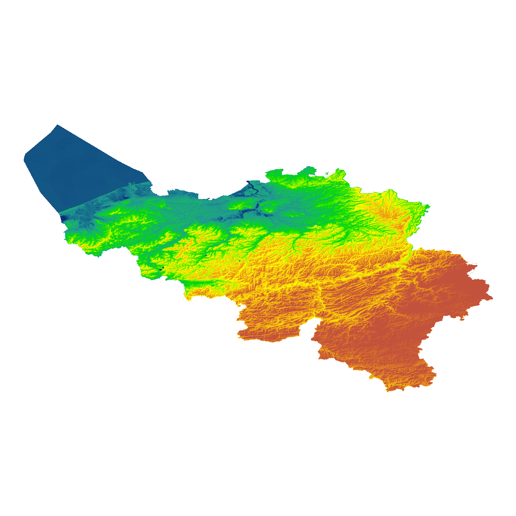
eTOD digital terrain model
Simple
- Date (Creation)
- 2022-07-20
- Date (Revision)
- 2025-12-16
- Identifier
- BE.NGI-IGN / 49c7af1e-0f35-11ed-ac71-186571a04de2
- Status
- Completed
- Maintenance and update frequency
- Irregular
- Keywords
-
- Terrain model, DTM, eTOD, ADQ, aviation
- Use constraints
- Other restrictions
- Other constraints
- https://creativecommons.org/licenses/by/4.0/
- Access constraints
- Other restrictions
- Other constraints
- No limitations on public access
- Use limitation
- https://creativecommons.org/licenses/by/4.0/
- Spatial representation type
- Grid
- Distance
- 30 m
- Metadata language
- Français
- Metadata language
- Nederlands; Vlaams
- Character set
- 8859 Part 15
- Topic category
-
- Transportation
- Description
- Belgium
))
- Distribution format
-
-
TIFF
()
-
Esri Geodatabase
()
-
TIFF
()
- OnLine resource
-
Direct download of resource
(
WWW:DOWNLOAD-1.0-http--download
)
Direct download of resource
- OnLine resource
-
Direct download of resource
(
WWW:DOWNLOAD-1.0-http--download
)
Direct download of resource
- OnLine resource
-
View service
(
OGC:WMS
)
View service
- Hierarchy level
- Dataset
Domain consistency
- Name of measure
- INSPIRE Conformity
Conformance result
- Date (Publication)
- 2010-12-08
- Explanation
- The dataset’s compliance with the technical requirements as defined by the Commission Regulation (EU) No 1089/2010 of 23 November 2010 has not been checked
- Statement
- The primary source is the NGI DTM 5m, which is itself compiled based on the most recent altimetry data of the three Belgian regions and is periodically updated per map sheet at a scale of 1:50,000 using recent stereoscopic aerial images. Where available, updates from the notification platform for aviation obstacles and terrain changes are also integrated.
- File identifier
- 49c7af1e-0f35-11ed-ac71-186571a04de2 XML
- Metadata language
- English
- Character set
- UTF8
- Hierarchy level
- Dataset
- Date stamp
- 2026-05-29T14:24:01
- Metadata standard name
- ISO 19115:2003/19139
- Metadata standard version
- 1.0
Overviews
Spatial extent
Provided by