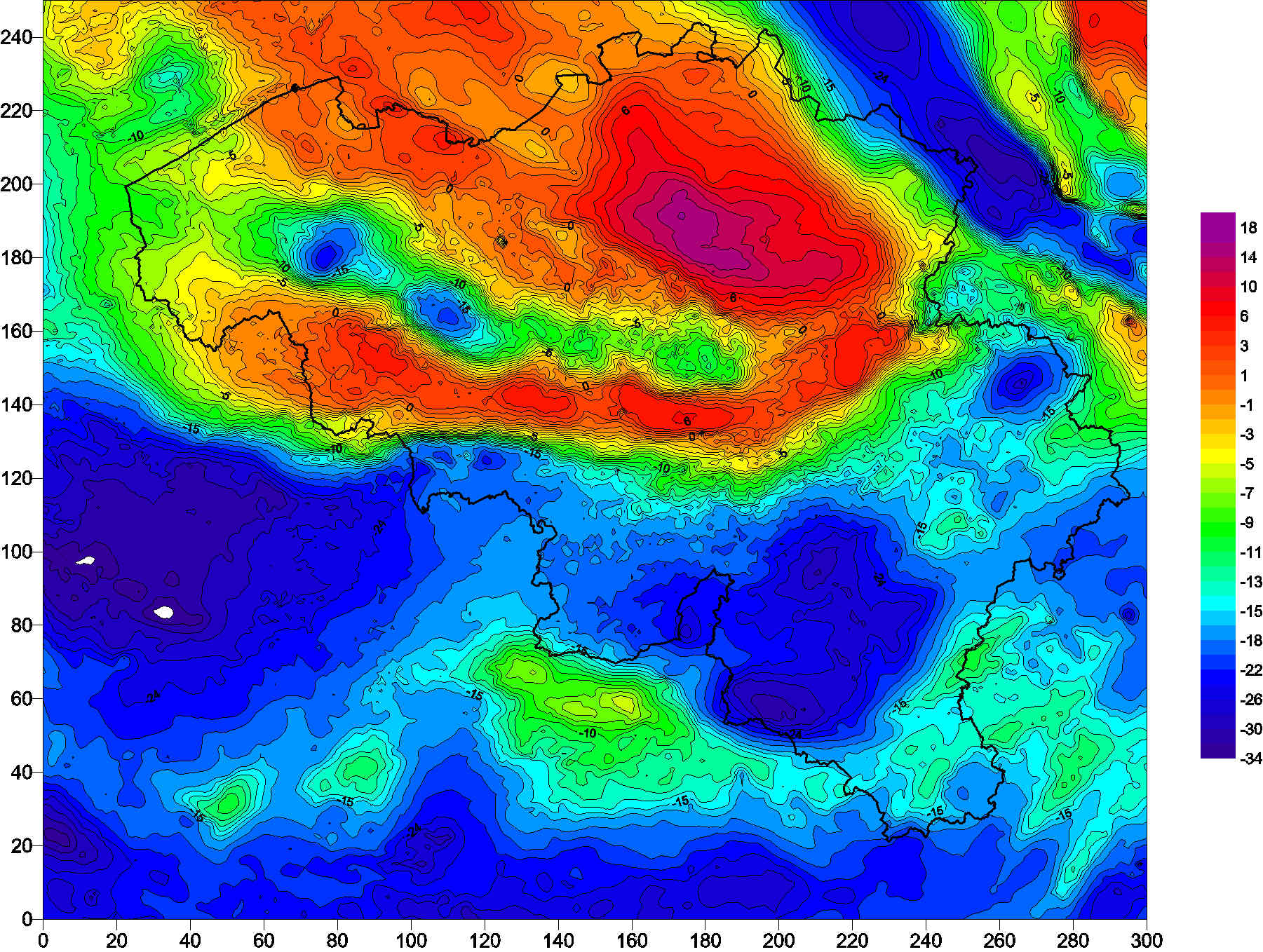
ROB Database of Absolute and Relative Gravity Measurements
The Belgian gravimetric database consists of 69,000 measurements, made using relative spring gravimeters. This database is managed by the Royal Observatory of Belgium since 1925. Two superconducting gravimeters measure elusive gravity variations at the stations of Membach and Rochefort, with a precision better than 1E-10 of gravity at the surface of the Earth (g). Since 1996, an absolute gravimeter performs repeated gravity measurements at selected sites, with an accuracy of 1E-9 g.
Simple
- Date (Creation)
- 2016-10-29T16:00:00
- Identifier
- BE.KSB-ORB / f9d316d7-209a-457f-89e1-35a44ff85f4f
- Status
- On going
- Maintenance and update frequency
- Continual
- Theme
-
- Gravimetry
- Federal government
- Place
-
- Belgium
- GEMET - INSPIRE themes, version 1.0
-
- Natural risk zones
- Statistical units
- Geology
- Use constraints
- Other restrictions
- Other constraints
- Copyright has to be respected. You can find detailed information here: http://seismologie.oma.be/en/legal-notices/data-policy
- Access constraints
- Other restrictions
- Other constraints
- No limitations on public access
- Spatial representation type
- Vector
- Denominator
- 250000
- Metadata language
- English
- Character set
- UTF8
- Topic category
-
- Geoscientific information
- Begin date
- 1350-01-01
N
S
E
W
))
- Unique resource identifier
- EPSG:4326
- Codespace
- EPSG
- Distribution format
-
-
ASCII
()
-
ASCII
()
- OnLine resource
-
Download service
(
OGC:WFS
)
Download service
- OnLine resource
-
View service
(
OGC:WMS
)
View service
- Hierarchy level
- Dataset
- Dataset
- ROB Database of Absolute and Relative Gravity Measurements
Domain consistency
- Name of measure
- INSPIRE Conformity
Conformance result
- Date (Publication)
- 2010-12-08
- Explanation
- This metadata has been successfully validated using the INSPIRE validator at http://inspire-geoportal.ec.europa.eu/validator2/
- Pass
- No
- Statement
- The measurements are performed and processed by the Royal Observatory of Belgium and the National Geographical Institute. The data base is continuously completed with ongoing measurements.
- File identifier
- f9d316d7-209a-457f-89e1-35a44ff85f4f XML
- Metadata language
- English
- Character set
- UTF8
- Hierarchy level
- Dataset
- Date stamp
- 2024-08-12T15:27:03
- Metadata standard name
- ISO 19115:2003/19139
- Metadata standard version
- 1.0
Overviews

Spatial extent
N
S
E
W
))
Provided by

Associated resources
Not available
 geo.be Metadata Catalog