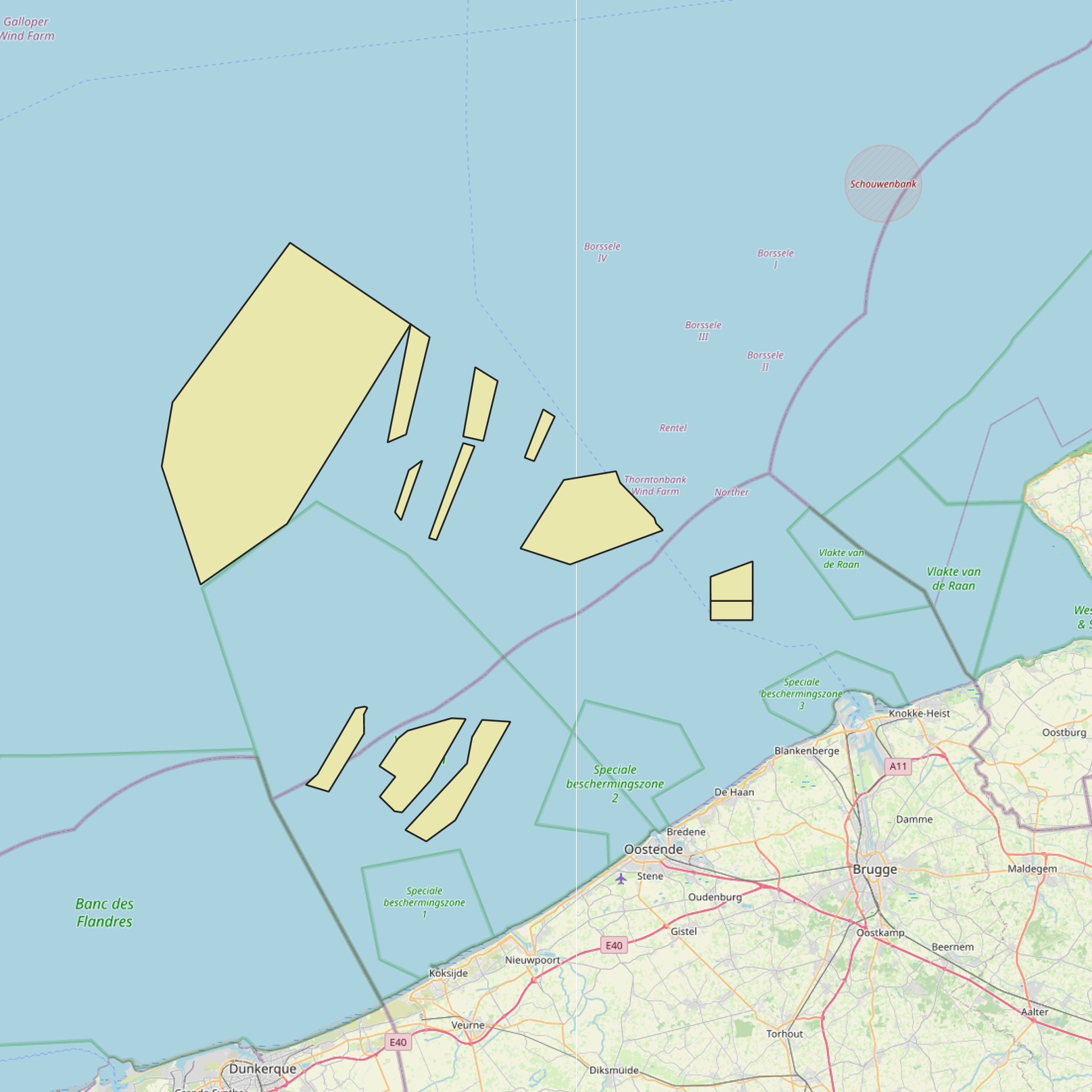
Sand- und Kiesgewinnungszonen im belgischen Teil der Nordsee
Simple
- Datum (Erstellung)
- 2021-11-18
- Datum (Überarbeitung)
- 2021-11-22
- Datum (Publikation)
- 2026-01-28
- Datum (Erstellung)
- 2016-05-19
- Identifikator
-
http://metadata.naturalsciences.be
/
f432b696-ac1a-4971-acc8-184bc79e9b7f
- Datum
- Weitere Informationen
- This dataset is composed of the following sources: (1) MSP 2014-2020 Sand and gravel extraction zones in the Belgian Part of the North Sea. (2) MSP 2020-2026 Sand and gravel extraction zones in the Belgian Part of the North Sea. (3) SWAP (n.d.). MarineAtlas website.MarineAtlas website. (4) Sand and gravel extraction zones in the Belgian Part of the North Sea.
https://www.naturalsciences.be
https://www.bmdc.be
https://www.naturalsciences.be
https://odnature.naturalsciences.be/
- Thema
-
- Marine Spatial Plan
- Land use
- Reporting INSPIRE
- Bundesregierung
- Nutzungseinschränkungen
- Benutzerdeifinierte Einschränkungen
- Andere Einschränkungen
- No conditions apply to access and use
- Andere Einschränkungen
- https://creativecommons.org/licenses/by/4.0/
- Zugriffseinschränkungen
- Benutzerdeifinierte Einschränkungen
- Andere Einschränkungen
- Öffentliche Zugang nicht beschränkt.
- Anwendungseinschränkungen
- Es gelten keine Bedingungen zum Nutzung.
- Sicherheitseinstufung
- Unbeschränkt
- Räumliche Darstellungsart
- Vektor
- Sprache
- English
- Thematik
-
- Wirtschaft
- Meere
- Planungsunterlagen, Kataster
))
- Art der Ausdehnungsangabe
- Ja
- Datum
- Code
- North Sea
- gml32:beginPosition
- 2014-01-01
- Identifikator des Referenzsystems
- http://www.opengis.net/def/crs/EPSG/0/4258
- Abgabeformat
-
-
application/xml
(
Unknown
)
-
text/html
(
Unknown
)
-
application/xml
(
Unknown
)
Vertriebsstelle
https://www.bmdc.be
- Bezeichnung
- application/xml
- Version
- Unknown
- Transfergrösse
- 0.218439
- Online
-
imsp:bmsp_extraction_zone
(
OGC:WMS
)
A WMS service to view a map
Vertriebsstelle
https://www.bmdc.be
- Bezeichnung
- application/xml
- Version
- Unknown
- Transfergrösse
- 0.111594
- Online
-
imsp:bmsp_extraction_zone
(
OGC:WFS
)
A WFS service to download
Vertriebsstelle
https://www.bmdc.be
- Bezeichnung
- application/xml
- Version
- Unknown
- Transfergrösse
- 0.225898
- Online
-
imsp19:bmsp_extraction_zone
(
OGC:WMS
)
A WMS service to view a map
Vertriebsstelle
https://www.bmdc.be
- Bezeichnung
- application/xml
- Version
- Unknown
- Transfergrösse
- 0.116278
- Online
-
imsp19:bmsp_extraction_zone
(
OGC:WFS
)
A WFS service to download
Vertriebsstelle
https://www.bmdc.be
- Bezeichnung
- text/html
- Version
- Unknown
- Transfergrösse
- 0.008877
- Online
-
MarineAtlas website. SWAP
(
WWW:LINK-1.0-http--link
)
An HTTP link to view information
- Online
- Digital Object Identifier (DOI) ( DOI )
- Bezugsebene
- Datenbestand
Konformitätsergebnis
- Datum (Publikation)
- 2010-12-08
- Erklärung
- Siehe die angegebene Spezifikation
- Bestanden
- Ja
- Erläuterung
- Der Datensatz ist qualitätsgesichert. Der Datensatz entspricht einer digitalisierten Version der im belgischen Amtsblatt ("Belgisch staatsblad/Moniteur belge") veröffentlichten Informationen. Nur die im Amtsblatt veröffentlichten Informationen haben Rechtsgültigkeit.
- Metadatensatzidentifikator
- f432b696-ac1a-4971-acc8-184bc79e9b7f XML
- Sprache
- English
- Zeichensatz
- Utf8
- Hierarchieebene
- Datenbestand
- Datum
- 2026-01-28T16:29:48.573Z
- Bezeichnung des Metadatenstandards
- Geographic information -- Metadata
- Version des Metadatenstandards
- ISO 19115:2003/19139
 geo.be Metadata Catalog

