geo.be Metadata Catalog
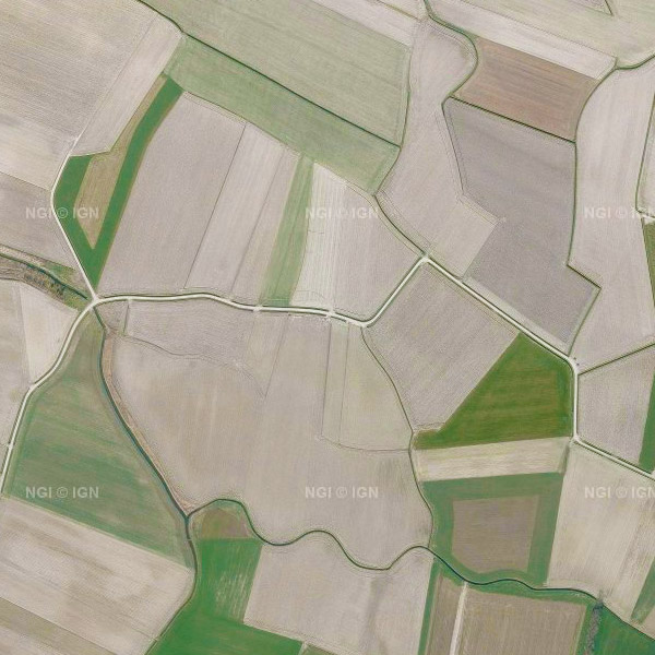
Orthophoto INSPIRE (WMS)
This service allows the visualization of the national orthophoto mosaics covering the entire territory of Belgium. The data is accessible via a Web Map Service (WMS).
Orthophotos are aerial photographs that have been geometrically corrected (orthorectified) to eliminate distortions caused by terrain relief, lens distortion, and camera tilt. Unlike raw aerial imagery, orthophotos have a uniform scale and accurate geometry, making them suitable for cartography, measurements, and visual analysis.
This specific service includes orthophotos from 2016 up to and including 2023, derived from aerial surveys carried out by the Belgian administrative Regions. A separate layer is published for each available year, with 2023 being the most recent orthophoto coverage in this service. The national orthophoto coverage is renewed annually. The orthophoto datasets of the Regions are integrated by the National Geographic Institute (NGI) into a single national coverage. Where possible, radiometric corrections are applied to ensure smooth transitions between the data of the Regions. The resulting orthophoto mosaics are georeferenced in the Lambert 2008 coordinate system.
All orthophotos are in colour (RGB). For the 2016–2021 campaigns, the ground resolution (GSD) is 25 cm throughout Belgium. From the 2022 campaign onwards, the GSD is 25 cm in Wallonia and 15 cm in Flanders and the Brussels-Capital Region. The spatial coverage of this service is the entire Belgian territory.
For downloading the most recent orthophoto mosaics, reference is made to the associated dataset "Orthofoto INSPIRE".
Simple
Identification info
- Date (Creation)
- 2017-03-15
- Date (Revision)
- 2024-04-15
- Identifier
- BE.NGI-IGN / 29238f19-ac79-4a4a-a797-5490226381ec
- Annex D4 of the European Commission Regulation 1205/2008
- Use limitation
- https://creativecommons.org/licenses/by/4.0/
- Access constraints
- Other restrictions
- Other constraints
- No limitations on public access
- Use constraints
- Other restrictions
- Other constraints
- https://creativecommons.org/licenses/by/4.0/
- Service Type
- view
- Description
- Belgium
))
Coupled Resource
- Operation Name
- GetCapabilities
- Identifier
- e59181f0-8469-44c6-8f6c-a5e1a4af15d5
- Coupling Type
- Tight
Contains Operations
- Operation Name
- GetCapabilities
- Distributed Computing Platforms
- Web services
- Connect Point
- https://wms.ngi.be/inspire/ortho/service ( OGC:WMS )
- Operates On
- Reference system identifier
- EPSG:3035
- Reference system identifier
- EPSG:4258
- Reference system identifier
- EPSG:3857
- Reference system identifier
- EPSG:4326
- Reference system identifier
- EPSG:3812
- OnLine resource
-
View service
(
OGC:WMS
)
View service
- OnLine resource
-
View service
(
OGC:WMTS
)
View service
- Hierarchy level
- Service
- Other
- Webmap Service
Domain consistency
- Name of measure
- INSPIRE Conformity
Conformance result
- Date (Publication)
- 2009-08-19
- Explanation
- The service described meets the technical requirements as defined by the Commission Regulation (EC) No 976/2009 of 19 October 2009
- Pass
- Yes
- File identifier
- 29238f19-ac79-4a4a-a797-5490226381ec XML
- Metadata language
- English
- Character set
- UTF8
- Hierarchy level
- Service
- Hierarchy level name
- Webmap Service
- Date stamp
- 2026-06-10T13:46:54
- Metadata standard name
- ISO 19115:2003/19139
- Metadata standard version
- 1.0
Overviews
Spatial extent
Provided by