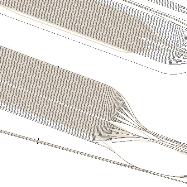
Top10Vector - Railway network
Simple
- Date (Revision)
- 2026-01-23
- Date (Creation)
- 2017-03-16
- Identifier
- BE.NGI-IGN / a9ab14e0-adbc-452e-9042-3614a123c97c
- Purpose
- Top10Vector is a vector dataset containing the NGI's geometrically most accurate and semantically most detailed topo-geographic vector data. The data originate from the topo-geographic inventory of the Belgian territory (ITGI) which was build and is maintained by the National Geographic Institute. The dataset contains 35 feature classes, which are grouped in eight themes: road network, railway network, hydrography, high-tension network, constructions, land cover and vegetation, local relief and particular zones. The geometry of the data of all these themes is described by x, y, z-coordinates. Top10Vector is available for the entire Belgian territory and can be supplied in the form of GeoPackage or Shapefile.
- Status
- Completed
- Maintenance and update frequency
- Quarterly
- Maintenance note
- The update cycle frequency the NGI aims at for the railroad network is 6 years.
- Name
- GeoPackage
- Version
- 1.3.0
- Keywords
-
- HVD_cat_transport networks
- Use limitation
- https://creativecommons.org/licenses/by/4.0/
- Access constraints
- Other restrictions
- Other constraints
- No limitations on public access
- Use constraints
- Other restrictions
- Other constraints
- https://creativecommons.org/licenses/by/4.0/
- Spatial representation type
- Vector
- Denominator
- 10000
- Metadata language
- Nederlands; Vlaams
- Metadata language
- Français
- Character set
- 8859 Part 15
- Topic category
-
- Transportation
- Description
- Belgium
))
- Distribution format
-
-
GeoPackage
(
1.3.0
)
-
Esri Shapefile
(
10.2
)
-
GeoPackage
(
1.3.0
)
- OnLine resource
-
View service
(
OGC:WMS
)
View service
- OnLine resource
-
Downloadable data
(
WWW:DOWNLOAD-1.0-http--download
)
Downloadable data
- OnLine resource
-
Downloadable data
(
WWW:DOWNLOAD-1.0-http--download
)
Downloadable data
- OnLine resource
-
Downloadable data
(
WWW:DOWNLOAD-1.0-http--download
)
Downloadable data
- OnLine resource
-
Downloadable data
(
WWW:DOWNLOAD-1.0-http--download
)
Downloadable data
- OnLine resource
-
Federal download service
(
WWW:LINK-1.0-http--link
)
Federal download service
- OnLine resource
-
https://ac.ngi.be/remoteclient-open/ngi-standard-open/Specifications/Vectordata/Top10Vector_ProductSpecification_EN.pdf
(
WWW:LINK-1.0-http--link
)
Technical specifications of the product
- OnLine resource
-
Federal download service
(
WWW:LINK-1.0-http--link
)
Federal download service
- Hierarchy level
- Dataset
- Dataset
- Top10Vector- Railroad network
Domain consistency
- Name of measure
- INSPIRE Conformity
Conformance result
- Date (Publication)
- 2010-12-08
- Explanation
- The dataset’s compliance with the technical requirements as defined by the Commission Regulation (EU) No 1089/2010 of 23 November 2010 has not been checked
- Statement
- The data have been collected in two different ways: on the one hand, by field survey, writing down the attribute data on mat-pale photographs, followed by the photogrammetric stereo restitution of the geometry in a CAD-file (with Lambert72 xyz-coordinates) and finally the topological cleaning up and the import of the attribute data in a 2D-database. On the other hand, by photogrammetric stereo restitution of the geometry in a CAD-file (with Lambert72 xyz-coordinates), followed by the import (on-site) of the attribute data in the CAD-files and finally the topological cleaning up in a 2D-database.During the dataloading into the new ITGI-model, the contents of the 2D-database have been mapped and converted into a database with Lambert2008-coordinates. The z-coordinate was recovered from the photogrammetric restitution's CAD-files or calculated on the basis of the DTM.
- Compliance code
- Yes
- Metadata language
- English
- Included with dataset
- Yes
- Feature types
- RA_RailwaySurface
- Feature types
- RA_RailwayTrackSegment
- File identifier
- a9ab14e0-adbc-452e-9042-3614a123c97c XML
- Metadata language
- English
- Character set
- UTF8
- Parent identifier
- Top10Vector e0fdc885-8851-482e-80c9-6a0ba3709761
- Hierarchy level
- Dataset
- Hierarchy level name
- Top10Vector
- Date stamp
- 2026-02-19T14:57:03
- Metadata standard name
- ISO 19115:2003/19139
- Metadata standard version
- 1.0
Overviews

Spatial extent
))
Provided by

 geo.be Metadata Catalog