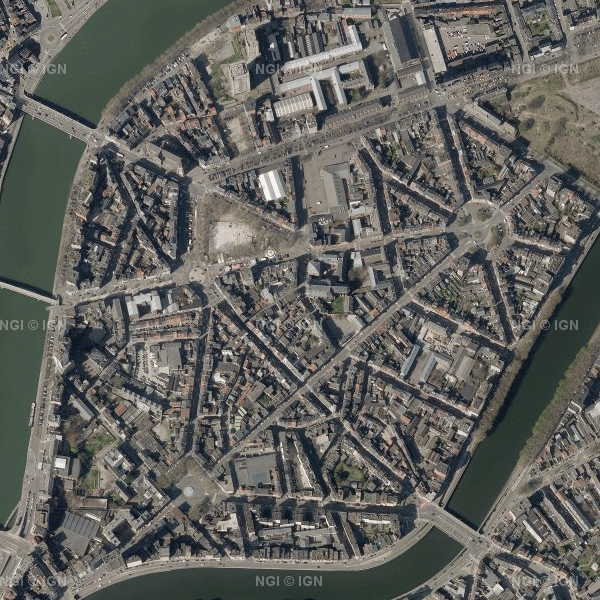
Orthophoto
Orthophotographs are digital aerial photographs that have been adjusted for lens distortion, topographic relief and camera tilt. The orthophotographs are metrically more accurate than common aerial photographs. They are very valuable as reference information and also, for instance, for surveying parcels. This cover is renewed every year by the regions. The orthophotographs are produced on the basis of digital colour aerial photography. The orthophotographs have a minimal resolution of 25 cm. A mosaic of the orthophotos can be consulted on the map viewer or via the viewservices.
Simple
- Date (Publication)
- 2015-01-01
- Edition
- Version 1.0
- Identifier
- BE.NGI-IGN / 0F4693B0-61DF-4900-B4BB-FFBFFF441167
- Purpose
- Orthophotographs are used internally and externally as background information for a wide range of applications.
- Status
- Completed
Custodian
National Geographic Institute
-
Steven Roovers
Kortenberglaan 115
,
Brussels
,
1000
,
Belgium
http://www.ngi.be
- Name
- TIFF
- Keywords
-
- Keywords
-
- Orthophotograph
- Use limitation
- https://creativecommons.org/licenses/by/4.0/
- Access constraints
- Other restrictions
- Other constraints
- No limitations on public access
- Use constraints
- Other restrictions
- Other constraints
- https://creativecommons.org/licenses/by/4.0/
- Spatial representation type
- Grid
- Distance
- 0.25 m
- Metadata language
- English
- Character set
- 8859 Part 15
- Topic category
-
- Imagery base maps earth cover
- Description
- Belgium
N
S
E
W
))
- Unique resource identifier
- EPSG:3812
- Codespace
- EPSG
- Distribution format
-
-
TIFF
(
)
-
TIFF
(
)
- OnLine resource
-
https://www.ngi.be/website/aanbod/kaarten-en-fotos/luchtfotos-orthofotos
(
WWW:LINK-1.0-http--link
)
Direct access to the webshop
- Hierarchy level
- Dataset
- Dataset
- Orthophoto
Domain consistency
- Name of measure
- INSPIRE Conformity
Conformance result
- Date (Publication)
- 2010-12-08
- Explanation
- The dataset described does not fill the technical requirements sustaining the interoperability of data sets and services, as stipulated in the Commission Regulation (EU) No 1089/2010 of 23 November 2010
- Pass
- No
- Statement
- Orthofotophotographs are produced on the basis of the NGI's standard aerial photography or aerial photography by third parties. They can also be obtained via third parties. From 2013 on, orthophotographs are produced on the basis of the regional aerial photography.
- Description
- Aerotriangulation of the aerial photography.Step2: orthorectification of each individual aerial photograph on the basis of orientation data originating from the aerotriangulation and the DTM10k. Step3: combining all individual orthorectified photographs into one large mosaic. Step 4: Manual control of the geometry and control on artefacts. Step 5: Cutting into convenient tiles of 2X2 km.
- Description
- Digital aerial colour photographs of the zone concerned with a maximum pixel of 30 cm and an overlap of 60/25 or better. The aerial photographs are the same as those which are being used in the photogrammetric stero restitution.
- File identifier
- 434c9672-4fb8-4a99-93bc-cc8b3b988700 XML
- Metadata language
- English
- Character set
- UTF8
- Hierarchy level
- Dataset
- Date stamp
- 2024-06-06T08:46:23
- Metadata standard name
- ISO 19115:2003/19139
- Metadata standard version
- 1.0
Point of contact
National Geographic Institute
-
Floor Van Damme
Kortenberglaan 115
,
Brussels
,
1000
,
Belgium
http://www.ngi.be
Overviews

Spatial extent
N
S
E
W
))
Provided by

Associated resources
Not available
 geo.be Metadata Catalog