 geo.be Metadata Catalog
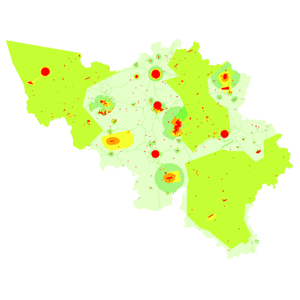
Aeronautical Obstacle Evaluation Map for Belgium (WMS)
The "Aeronautical Obstacle Evaluation Map for Belgium" allows to know whether advice is required for a construction or structure that, due to its height, may have an influence on aviation: if the planned construction or structure exceeds the height indicated on the map, the Civil Aviation Authority of the Federal Public Service Mobility and Transport should be requested for advice, according to the procedure on https://mobilit.belgium.be/nl/luchtvaart/veiligheid/hindernissen-en-bebakening.
The height indicated on the map is determined by the federal ministers responsible for Civil Aviation and Defence. This height is determined in order to protect the civil and military aerodromes, the visual aviation routes, the military aviation areas and the civil and military aeronautical installations for communication, navigation and surveillance (CNS).
Consequently, the use of this map allows the application of the following Regulation :
Regulation (EC) N° 1108/2009 of the European Parliament and of the Council of 21 October 2009 amending Regulation (EC) No 216/2008 in the field of aerodromes, air traffic management and air navigation services and repealing Directive 2006/23/EC.
In the Flemish Region the use of this chart allows the application of the article 35 §16 of “het besluit van de Vlaamse Regering van 27 november 2015 tot uitvoering van het decreet van 25 april 2014 betreffende de omgevingsvergunning”. The same data limited to the flemish Region are available on the Digitaal Vlaanderen website.
Simple
Identification info
- Date (Revision)
- 2026-01-12
- Date (Creation)
- 2018-04-05
- Identifier
- BE.DGLV-DGTA / 07142d02-4a96-4373-9bec-92ed20984964
- Keywords
-
- AOEM
- AOEMaps
- DGLV
- DGTA
- Federal viewer
- Annex D4 of the European Commission Regulation 1205/2008
- Use limitation
- https://creativecommons.org/licenses/by/4.0/
- Access constraints
- Other restrictions
- Other constraints
- No limitations on public access
- Use constraints
- Other restrictions
- Other constraints
- https://creativecommons.org/licenses/by/4.0/
- Service Type
- view
- Description
- Belgium (including the territorial waters and territorial airspace)
))
Coupled Resource
- Operation Name
- GetCapabilities
- Identifier
- 8c545664-cbbe-4d71-9181-69f53aa8bbca
- Coupling Type
- Tight
Contains Operations
- Operation Name
- GetCapabilities
- Distributed Computing Platforms
- Web services
- Connect Point
- https://wms.ngi.be/inspire/dgta_dglv/service ( OGC:WMS )
- Operates On
- Reference system identifier
- EPSG:3035
- Reference system identifier
- EPSG:4258
- Reference system identifier
- EPSG:3857
- Reference system identifier
- EPSG:4326
- Reference system identifier
- EPSG:3812
- OnLine resource
-
View service
(
OGC:WMS
)
View service
- Hierarchy level
- Service
- Other
- Webmap Service
Domain consistency
- Name of measure
- INSPIRE Conformity
Conformance result
- Date (Publication)
- 2009-08-19
- Explanation
- The service described meets the technical requirements as defined by the Commission Regulation (EC) No 976/2009 of 19 October 2009
- Pass
- Yes
- Statement
-
The Aeronautical Obstacle Evaluation Map for Belgium is composed of various datasets:
- Digital Terrain Model Belgium of the NGI (DTM5m)
- Visual roads in Belgium: derived from the ITGI dataset of the NGI
- Civil Aviation Authority (CAA): Heliports, ULModromes, model aviation, paramotors and aerodromes in Belgium
- Belgocontrol: PAN-OPS, ILS, radar, DVOR and NDB for the certified Belgian airports and for the smaller Area Control Centers (ACC) for en-route air traffic control
- Defense: full coverage of the Belgian territory, including the territorial waters and territorial airspace, for the aeronautical aspects (military airspace and military airports) as well as for the radar and communication systems.
- Data about the certified airports in Belgium is provided by the airports themselves
- File identifier
- 07142d02-4a96-4373-9bec-92ed20984964 XML
- Metadata language
- English
- Character set
- UTF8
- Hierarchy level
- Service
- Hierarchy level name
- Webmap Service
- Date stamp
- 2026-05-12T15:10:30
- Metadata standard name
- ISO 19115:2003/19139
- Metadata standard version
- 1.0
Overviews
Spatial extent
Provided by