Top250Map
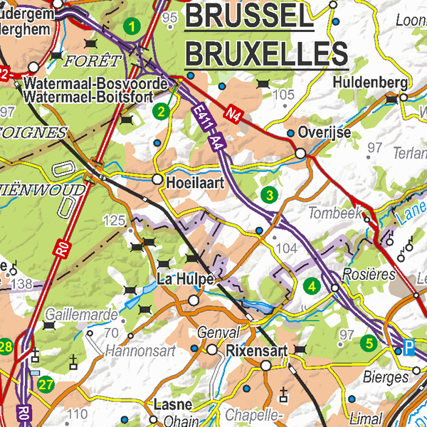
Top250Map is a digital version of the NGI’s  topographic  cartography on a scale of 1:250  000. It is the smallest scale used by the NGI  to  produce a cartographic representation of Belgium. It focuses mainly on inhabited places and transport networks. The whole territory is available in one single file. This map is characterized  by the great number of toponyms of inhabited  places.
                  
                  Simple
- Date (Creation)
- 2019-03-29
- Date (Revision)
- 2019-03-29
- Identifier
- BE.NGI-IGN / 94fa1700-808e-11e9-93f3-482ae30f98d9
- Status
- Completed
                          
                            
                            Custodian


                                National Geographic  Institute
                              
                              -
                              
                                
                                Frédérique Spitaels


                                Kortenberglaan 115
                              
                              ,
                              
                                
                                Brussels
                              
                              ,
                              
                                
                                1000
                              
                              ,
                              
                                
                                Belgium


                            http://www.ngi.be
                          
                        - Maintenance and update frequency
- Irregular
- Use limitation
- https://creativecommons.org/licenses/by/4.0/
- Access constraints
- Other restrictions
- Other constraints
- No limitations on public access
- Use constraints
- Other restrictions
- Other constraints
- https://creativecommons.org/licenses/by/4.0/
- Spatial representation type
- Grid
- Distance
- 16 m
- Metadata language
- Deutsch
- Metadata language
- Nederlands; Vlaams
- Metadata language
- Français
- Character set
- 8859 Part 15
- Description
- Belgium
                            
                            N


                            S


                            E


                            W
                          
                          )) 
                        - Unique resource identifier
- EPSG:3812
- Codespace
- EPSG
- Distribution format
- 
                            - 
                                TIFF
                                (


                                )
                                
 
- 
                                TIFF
                                (


                                )
                                
- OnLine resource
- 


                                View service
                              
                            
                            (


                                OGC:WMS
                              
                            
                            )
                            View service 
- OnLine resource
- 


                                https://ngi.be/wp-content/uploads/2025/09/Top250Map_ProductSpecification_FR.pdf
                              
                            
                            (


                                WWW:LINK-1.0-http--link
                              
                            
                            )
                            Technical specifications of the product 
- OnLine resource
- 


                                Downloadable data
                              
                            
                            (


                                WWW:DOWNLOAD-1.0-http--download
                              
                            
                            )
                            Downloadable data 
- Hierarchy level
- Dataset
Domain consistency
- Name of measure
- INSPIRE Conformity
Conformance result
- Date (Publication)
- 2010-12-08
- Explanation
- The dataset’s compliance with the technical requirements as defined by the Commission Regulation (EU) No 1089/2010 of 23 November 2010 has not been checked
- Statement
- Top250Map is made by the symbolisation of the objects and themes in the topo-geographic inventory of the Belgian territory (ITGI). Many themes are generalized on a scale of 1:250 000 from data on the scale of 1:50 000.
- File identifier
- 94f81b30-808e-11e9-b09a-482ae30f98d9 XML
- Metadata language
- English
- Character set
- UTF8
- Hierarchy level
- Static map
- Hierarchy level name
- staticMap
- Date stamp
- 2025-09-24T09:44:39
- Metadata standard name
- ISO 19115:2003/19139
- Metadata standard version
- 1.0
                          
                            
                            Point of contact


                                National Geographic  Institute
                              
                              -
                              
                                
                                Floor Van Damme


                                Kortenberglaan 115
                              
                              ,
                              
                                
                                Brussels
                              
                              ,
                              
                                
                                1000
                              
                              ,
                              
                                
                                Belgium


                            http://www.ngi.be
                          
                        Overviews
 
                Spatial extent
                      
                      N


                      S


                      E


                      W
                    
                    )) 
                  Provided by
 
                Associated resources
Not available
                 geo.be Metadata Catalog
                  geo.be Metadata Catalog