geo.be Metadata Catalog
CORINE High Resolution Layers-Belgium 2015
CORINE High Resolution Layers-Belgium 2015
CORINE High Resolution Layers-Belgium 2015
CORINE High Resolution Layers-Belgium 2015
The product is made of 5 "high resolution layers" covering all the Belgian territory as part of a European-wide coverage for the reference year 2015. The 5 layers concern 4 distinct themes: Imperviousness, Forest, Grasslands, Wetness and Water. The 5 layers were produced by an automatic classification based on satellite images and collateral data and achieved by private companies (EEA service providers), and they were verified by Belgium. At the Belgian level, verification and enhancements were made by IV for the northern part and SPW for the outhern part. The NGI coordinated the project.
Data was produced with funding by the European Union. Copyright Copernicus Programme
DISCLAIMER: National Geographic Institute has undertaken to distribute the data on behalf of EEA under Specific Contract No 3436/R0-Copernicus/EEA.57005 implementing Framework service contract No EEA/IDM/R0/16/009/Belgium. National Geographic Institute accepts no responsibility or liability whatsoever with regard to the content and use of these data.”
The European Environment Agency accepts no responsibility or liability whatsoever with regard to the information on this site and the information does not necessarily reflect the official opinion of the EEA or other European Communities bodies and institutions.
Le produit est composé de 5 "high resolution layers" couvrant le territoire belge dans le cadre d'une couverture pan-Européenne pour l'année de référence 2015. Les 5 couchent concernent 4 thèmes différents: Surfaces imperméables, Forestière, Hydrographie Zones humides, Prairies permanentes. Les 5 couches ont été produites par classification automatique à partir d'images satellites et de données collatérales par des sociétés privées (Service providers de l'EEA) et ont été vérifiées par la Belgique. Au niveau belge, les vérifications ont été réalisées par l'IV pour le nord et le SPW pour le sud. L'IGN a coordonné le projet.
Les données ont été produites grâce à un financement de l'Union européenne.
DISCLAIMER : L’Institut géographique national s'est engagé à diffuser les données au nom de l'AEE en vertu du contrat spécifique no 3436/R0-Copernicus/EEA.57005 portant exécution du contrat-cadre de services no EEA/IDM/R0/16/009/Belgium. L’Institut géographique national décline toute responsabilité quant au contenu et à l’utilisation de ces données.
L'Institut National Géographique décline toute responsabilité en ce qui concerne le contenu et l'utilisation de ces données." L'Agence européenne pour l'environnement décline toute responsabilité en ce qui concerne les informations présentes sur ce site et ces informations ne reflètent pas l'opinion officielle de l'AEE ou d'autres organes et institutions des Communautés européennes.
Het product bestaat uit 5 "high resolution layers", die het Belgische grondgebied overdekken in het kader van een pan-Europese overdekking voor het referentiejaar 2015. De 5 lagen (Imperviousness density, Tree Cover Density, Dominant Leaf Type, Grassland, Wetness and Water) hebben betrekking op 4 verschillende thema's: Ondoordringbare oppervlakken, Bosbedekking, Permanente hydrografie en Vochtige zones, Permanente weiden. De 5 lagen werden geproduceerd via automatische classificatie op basis van satellietbeelden en aanvullende gegevens van privéfirma's (Service providers van het EEA). Ze werden nagezien door België. Op Belgisch niveau gebeurden het nazicht door IV voor het Noorden en door de SPW voor het zuiden. Het NGI heeft het project gecoördineerd.
Gegevens werden geproduceerd met financiering door de Europese Unie. Copyright Copernicus-programma
DISCLAIMER: Het Nationaal Geografisch Instituut heeft zich ertoe verbonden de gegevens namens de EEA te verspreiden onder specifiek contract nr. 3436/R0-Copernicus/EEA.57005 tot uitvoering van raamcontract voor dienstverlening nr. EEA/IDM/R0/16/009/Belgium. Het Nationaal Geografisch Instituut aanvaardt geen enkele verantwoordelijkheid of aansprakelijkheid met betrekking tot de inhoud en het gebruik van deze gegevens. "
Het Europees Milieuagentschap aanvaardt geen enkele verantwoordelijkheid of aansprakelijkheid met betrekking tot de informatie op deze site en de informatie komt niet noodzakelijk overeen met de officiële mening van de EEA of andere instellingen en instellingen van de Europese Gemeenschap.
Simple
-
Date (Création)Datum (creatie)Datum (Erstellung)Date (Creation)
- 2017-03-15
-
IdentificateurIdentifierIdentifikatorIdentifier
- EEA / 8aa0a821-22f4-11e9-b82f-acb57d9e6f5a
-
EtatStatusBearbeitungsstatusStatus
-
FinalisécompleetAbgeschlossenCompleted
-
Fréquence de mise à jourHerzieningsfrequentieÜberarbeitungsintervallMaintenance and update frequency
-
InconnueonbekendUnbekanntUnknown
- Keywords
-
-
CopernicusCopernicusCopernicusCopernicus
-
HVD_cat_land coverHVD_cat_land coverHVD_cat_land coverHVD_cat_land cover
-
-
Use limitationLimitation d'utilisationGebruiksbeperkingenAnwendungseinschränkungen
-
https://creativecommons.org/licenses/by/4.0/https://creativecommons.org/licenses/by/4.0/deed.frhttps://creativecommons.org/licenses/by/4.0/deed.nlhttps://creativecommons.org/licenses/by/4.0/deed.de
-
Contraintes d'accès(Juridische) toegangsrestrictieZugriffseinschränkungenAccess constraints
-
Autres restrictionsandersBenutzerdeifinierte EinschränkungenOther restrictions
-
Other constraintsAutres contraintesOverige beperkingenAndere Einschränkungen
-
No limitations on public accessPas de restrictions concernant l'accès publicGeen beperkingen op openbare toegangÖffentliche Zugang nicht beschränkt
-
Contraintes d'utilisation(Juridische) gebruiksbeperkingNutzungseinschränkungenUse constraints
-
Autres restrictionsandersBenutzerdeifinierte EinschränkungenOther restrictions
-
Other constraintsAutres contraintesOverige beperkingenAndere Einschränkungen
-
https://creativecommons.org/licenses/by/4.0/https://creativecommons.org/licenses/by/4.0/deed.frhttps://creativecommons.org/licenses/by/4.0/deed.nlhttps://creativecommons.org/licenses/by/4.0/deed.de
-
Type de représentation spatialeRuimtelijk schemaRäumliche DarstellungsartSpatial representation type
-
RastergridRaster, GitterGrid
-
LangueTaalSpracheMetadata language
- English
-
DescriptionDescriptionOmschrijvingBeschreibung
-
BelgiumBelgiqueBelgiëBelgien
))
-
Unique resource identifier
-
EPSG:3812
- Codespace
- EPSG
-
Format (encodage)Distributie formaatAbgabeformatDistribution format
-
-
TIFF( )
-
-
Ressource en ligneOnLine bronnenOnlineOnLine resource
-
View service Service de visualisation Raadpleegdienst Darstellungsdienste
(
OGC:WMS
)
View serviceService de visualisationRaadpleegdienstDarstellungsdienste
-
Ressource en ligneOnLine bronnenOnlineOnLine resource
-
Downloadable data Données téléchargeables Downloadable data Downloadable Data
(
WWW:DOWNLOAD-1.0-http--download
)
Downloadable dataDonnées téléchargeablesDownloadable dataDownloadable Data
-
NiveauNiveau kwaliteitsbeschrijvingBezugsebeneHierarchy level
-
Jeu de donnéesdatasetDatenbestandDataset
Cohérence du domaine de valeurs
Domain consistentie
Konsistenz des Wertebereichs
Domain consistency
-
Name of measureNom du testName of measureTestverfahren
-
INSPIRE ConformityConformité INSPIREINSPIRE ConformiteitINSPIRE Konformität
Résultat de conformité
Resultaat conformiteit met de specificatie
Konformitätsergebnis
Conformance result
-
Date (Publication)Datum (publicatie)Datum (Publikation)Date (Publication)
- 2010-12-08
-
ExplanationExplicationUitlegErklärung
-
The dataset’s compliance with the technical requirements as defined by the Commission Regulation (EU) No 1089/2010 of 23 November 2010 has not been checkedLa conformité du jeu de donnée aux exigences techniques telles qu’elles sont définies par le Règlement (UE) n° 1089/2010 de la Commission du 23 novembre 2010 n'a pas été testéeDe overeenstemming van de dataset met de technische vereisten zoals bepaald in de Verordening (EU) nr 1089/2010 van de Commissie van 23 november 2010 werd niet gecontroleerdDie Kongruenz des Datensatzes mit den technischen Anforderungen wie bestimmt in der Verordnung (EG) Nr. 1089/2010 der Kommission vom 23. November 2010 wurde nicht geprüft
-
StatementGénéralités sur la provenanceAlgemene beschrijving herkomstErläuterung
-
The layer was completed by the automatic classification achieved by an EEA service provider. Belgium achieved a classification verification on the basis of their own thematic data and aerial photographs.La couche a été réalisée par classification automatique par un service provider de l'EEA. La Belgique a réalisé une vérification de la classification sur base de ses données thématiques propres et de photos aériennes.De laag werd gemaakt door automatische classificatie door een service provider van het EEA. België heeft de classificatie nagezien op basis van zijn eigen thematische gegevens en van luchtfoto's.Die Schicht wurde durch automatische Klassifizierung von einem Service-Provider der EUA produziert. Belgien hat die Klassifizierung nachgeprüft auf basis seiner eigenen thematischen Daten und Luftbilder.
-
Identifiant de la ficheMetadata IDMetadatensatzidentifikatorFile identifier
- 8aa0a821-22f4-11e9-b82f-acb57d9e6f5a XML
-
LangueTaalSpracheMetadata language
- English
-
Jeu de caractèresKaraktersetZeichensatzCharacter set
-
Utf8utf8Utf8UTF8
-
Type de ressourceHierarchisch niveauHierarchieebeneHierarchy level
-
Jeu de donnéesdatasetDatenbestandDataset
-
Date des métadonnéesMetadata datumDatumDate stamp
- 2026-02-03T11:17:14
-
Metadata standard name
-
ISO 19115:2003/19139
- Metadata standard version
- 1.0
Overviews
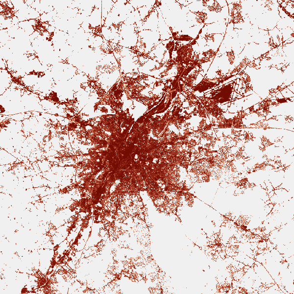
Spatial extent
Provided by