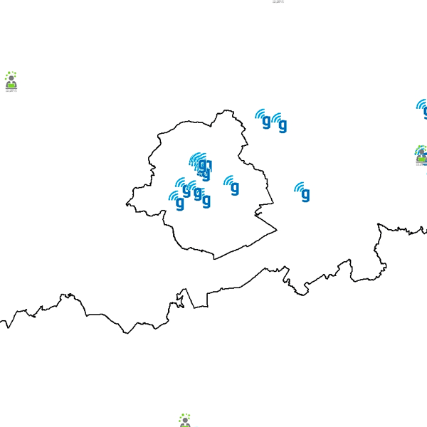
Govroam access points localization
Govroam is a " wifi roaming " solution. This service offers to the users a simple and secure access to the wireless network of their institution, but also to networks of other participating institutions. A user from an organization that participates in govroam will be able to connect to any wireless access point broadcasting govroam. The data provided here makes it possible to locate these access points.
Simple
Identification info
- Date (Creation)
- 2018-06-01
- Identifier
- BE.BELNET / ff158bb1-81af-49e2-a0fc-219403e49041
- Maintenance and update frequency
- As needed
- Commission Regulation (EC) No 1205/2008
-
- infoMapAccessService
- Keywords
-
- Federal viewer
- Federal Viewer
- Use limitation
- •The custodian of the resource holds the rights of property (including the rights of intellectual property) to the geographic files •The custodian grants the user the right to use the data for his internal use. •Commercial use of the data under any form is strictly forbidden •Custodian’s name must be mentioned each time the data are being used publically.
- Access constraints
- Other restrictions
- Other constraints
- No limitations on public access
- Use constraints
- Other restrictions
- Other constraints
- •The custodian of the resource holds the rights of property (including the rights of intellectual property) to the geographic files •The custodian grants the user the right to use the data for his internal use. •Commercial use of the data under any form is strictly forbidden •Custodian’s name must be mentioned each time the data are being used publically.
- Service Type
- view
- Description
- Belgium
N
S
E
W
))
Coupled Resource
- Operation Name
- GetCapabilities
- Identifier
- d63b72da-6e7f-4981-b6fe-04133a127041
- Coupling Type
- Tight
Contains Operations
- Operation Name
- GetCapabilities
- Distributed Computing Platforms
- Web services
- Connect Point
- https://data.geo.be/ws/govroam/wms?request=getcapabilities&service=wms ( OGC:WMS )
- Operates On
- Reference system identifier
- EPSG:3035
- Reference system identifier
- EPSG:4258
- Reference system identifier
- EPSG:3857
- Reference system identifier
- EPSG:4326
- Reference system identifier
- EPSG:3812
- OnLine resource
-
View service
(
OGC:WMS
)
View service
- Hierarchy level
- Service
- Other
- Webmap Service
Domain consistency
- Name of measure
- INSPIRE Conformity
Conformance result
- Date (Publication)
- 2009-08-19
- Explanation
- The service described meets the technical requirements as defined by the Commission Regulation (EC) No 976/2009 of 19 October 2009
- Pass
- Yes
- Statement
- The map shows the location of Wi-Fi access points that broadcast govroam. This list is established on the basis of the information provided by the administrators of these access points (address of the building, local, ...). It is subject to change depending on the installation / uninstallation of new access points.
- File identifier
- 89c94ede-2e76-468d-9234-e37b51ae92ee XML
- Metadata language
- English
- Character set
- UTF8
- Hierarchy level
- Service
- Hierarchy level name
- Webmap Service
- Date stamp
- 2025-06-05T16:22:47
- Metadata standard name
- ISO 19115:2003/19139
- Metadata standard version
- 1.0
Point of contact
National Geographic Institute
-
Floor Van Damme
Kortenberglaan 115
,
Brussels
,
1000
,
Belgium
http://www.ngi.be
Overviews

Spatial extent
N
S
E
W
))
Provided by

Associated resources
Not available
 geo.be Metadata Catalog