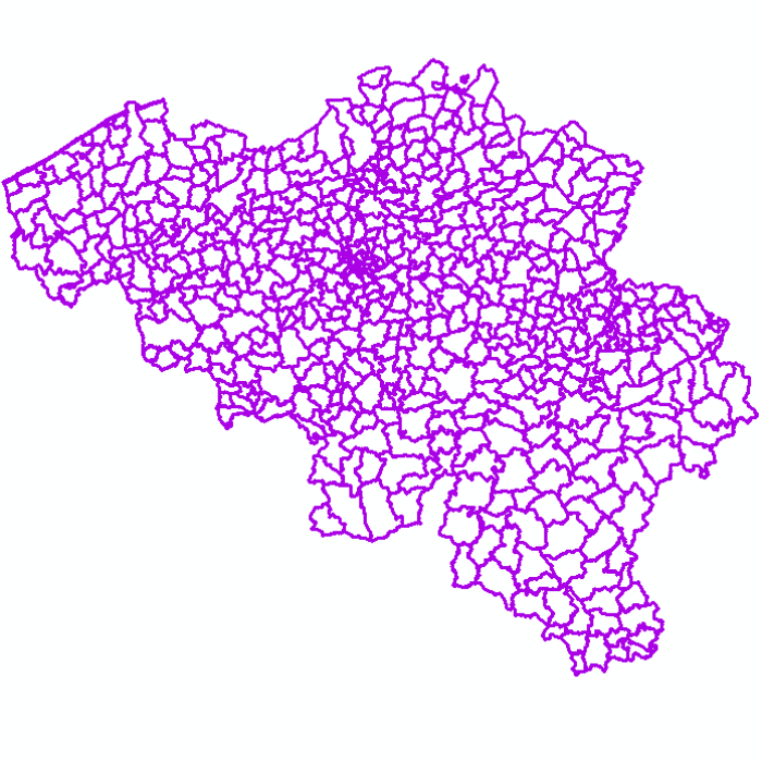
Administrative units
Administrative units corresponds to the dataset of administrative units from the reference database for the land register data. Administrative limits are legally defined by an administrative entity or between two administrative entities. In Belgium, administrative limits as legally defined are fixed and can only be changed by a law, ordinance or decree. The General Administration of Patrimonial Documentation of the FPS Finance is named by the federal authorities as the authentic source of Belgian administrative limits.
This dataset corresponds to the legal situation as defined on January 1st of the reference year or to the situation at the specified date. It is composed of seven geometric classes (polygons and lines) and one class without geometry. The first class corresponds to the whole national territory. The second corresponds to the territory of the three regions, the third to the territory of the provinces, the fourth to the territory of the administrative districts, the fifth to the territory of the municipalities, the sixth to the territory of the Antwerp city districts and the seventh to the administrative boundaries in the form of lines. The class without geometry corresponds to the table of tax situations. The dataset can be freely downloaded as a zipped shapefiles.
Simple
- Date (Creation)
- 2020-12-15
- Date (Revision)
- 2025-06-20
- Identifier
- GAPD / 629ad470-71dc-11eb-af47-3448ed25ad7c
- Identifier
- GAPD / AU-FiscSit
- Status
- Completed
- Maintenance and update frequency
- Annually
- Use constraints
- Other restrictions
- Other constraints
- The licence is fully available in French (https://finances.belgium.be/sites/default/files/Licence_plan_opendata_FR.PDF) or in Dutch (https://financien.belgium.be/sites/default/files/Licentie_plan_opendata_NL.PDF).
- Access constraints
- Other restrictions
- Other constraints
- No limitations on public access
- Spatial representation type
- Vector
- Denominator
- 10000
- Metadata language
- English
- Metadata language
- Deutsch
- Metadata language
- Français
- Metadata language
- Nederlands; Vlaams
- Character set
- UTF-8
- Topic category
-
- Planning cadastre
- Description
- Belgium
))
- Reference system identifier
- 31370
- Reference system identifier
- 3812
- Distribution format
-
-
Esri Shapefile
(
10.2
)
-
Esri Shapefile
(
10.2
)
- OnLine resource
-
https://opendata.fin.belgium.be/download/TechnicalSpecifications/AU-RefSit_20250521_TechSpec_NL.pdf
(
WWW:LINK-1.0-http--link
)
Technical documentation of the product
- OnLine resource
-
Download service non-INSPIRE datasets
(
WWW:LINK-1.0-http--link
)
Download service non-INSPIRE datasets
- OnLine resource
-
Application CadGIS Viewer
(
WWW:LINK-1.0-http--link
)
Application CadGIS Viewer
- OnLine resource
-
Direct download of resource (version : 20250521 - ESPG : 3812)
(
WWW:DOWNLOAD-1.0-http--download
)
Direct download of resource (version : 20250521 - ESPG : 3812)
- OnLine resource
-
Direct download of resource (version : 20250521 - ESPG : 31370)
(
WWW:DOWNLOAD-1.0-http--download
)
Direct download of resource (version : 20250521 - ESPG : 31370)
- OnLine resource
-
Direct download of all the versions of the resource
(
WWW:DOWNLOAD-1.0-http--download
)
Direct download of all the versions of the resource
- Hierarchy level
- Dataset
Domain consistency
- Name of measure
- INSPIRE Conformity
Conformance result
- Date (Publication)
- 2010-12-08
- Explanation
- The dataset’s compliance with the technical requirements as defined by the Commission Regulation (EU) No 1089/2010 of 23 November 2010 has not been checked
- Statement
- Administrative Units - situation on January 1st is extracted from the reference database for the land register data, CadGIS, whose situation is fixed on January 1st of the reference year. The geometric representation of administrative limits published in CadGIS is made up of a set of sections whose layout (X and Y coordinates) corresponds to the situation of an administrative limits at a given moment. Sometimes the coordinates are legally recorded, but often they are coming from an analysis and interpretation of legal documents, and/or field data or any other relevant information such as regional reference frames, aerial photographs or original plans. Therefore, this layout does not possess the same quality everywhere. Especially in places that have not been subject to recent measurements, (carto)graphic coordinates can be proposed and can therefore change over time if new information of better quality is provided in compliance with the update rules currently being developed. In the CadGIS database, the administrative limits are the delimitations of Belgian administrative entities at different hierarchical levels, i.e. municipalities, administrative arrondissements, provinces, regions and finally the country. Polygons (corresponding to the territories of the different hierarchical levels from the municipality to the country) are generated on the basis of the layout of these limits.
- File identifier
- 629ad470-71dc-11eb-af47-3448ed25ad7c XML
- Metadata language
- English
- Character set
- UTF8
- Hierarchy level
- Dataset
- Date stamp
- 2026-02-03T13:29:54
- Metadata standard name
- ISO 19115:2003/19139
- Metadata standard version
- 1.0
Overviews

Spatial extent
))
Provided by

 geo.be Metadata Catalog